Pierce Wanderings
Texas Hiking (and elsewhere)
Balconies Cave and Cliffs Trail – Pinnacles NP 8/28/20
Friday, August 28, 2020
Balconies Cave and Cliffs Trail – Pinnacles National Park, California
HOT, sunny, mid 90s
Ian, Court, Greg, Cat
3.1 miles
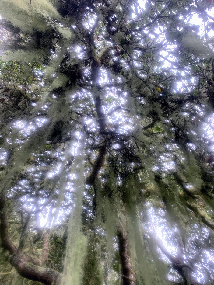
Warning: the pics on this post kind of suck. It was a bit smoky and I think there was also something off with my camera, so apologies in advance.
The four of us took a drive out to our newest National Park: Pinnacles. It’s about an hour and a half east of Carmel and Monterey and is quite spectacular.

I knew it had a reputation for being hot and it lived up to that reputation, especially when we had just come from 60 degrees in Carmel for 4 days. There are also zero natural water sources in the park during the summer, but we all had a good amount, so no problems there.
Pinnacles is also known for being a breeding ground and home base for endangered California Condors. We scanned the sky for condors as we hiked, but the birds of prey we saw were too far away to positively identify.
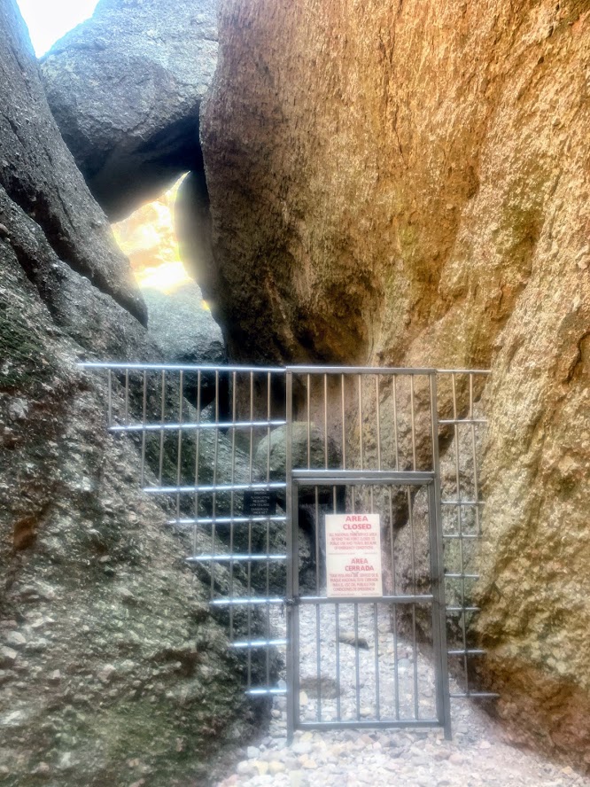
There are some long and tough trails that lead up into the High Peaks area, which I would love to do one day, but seeing as how we were limited on time and got there in the heat of the day, we decided to try out the shorter trail to the Balconies Caves and Cliffs. The caves were closed due to Covid (no staff at the park), but it was a nice trail anyway.

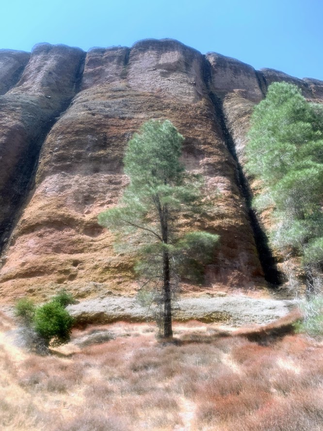
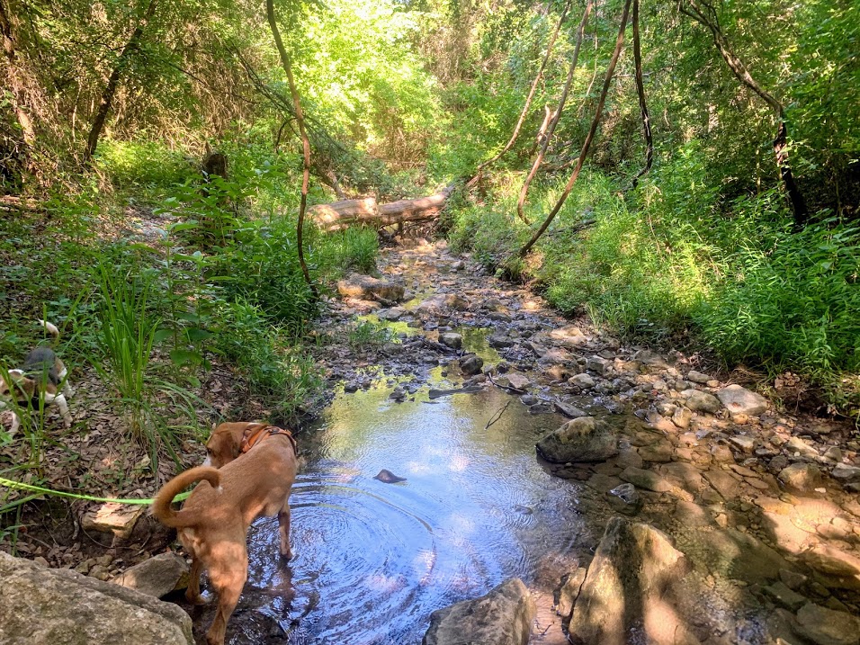
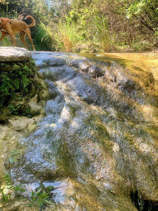
The rock formations were spectacular and the trails well marked. We crossed several dry creek beds that I think would be flowing well during the spring.

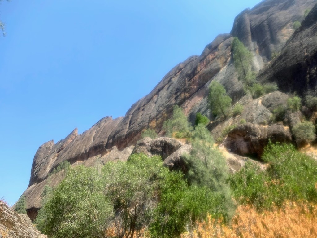
After we got to the closed cave entrance, we double backed and took the fork for the Cliffs. We switchbacked up above the caves and got some nice views as we battled the sun. One of the main rock formations on this trail is called Elephant Rock, which looms over you for most of the trail and can’t really be seen in full until you get up above on the cliffs. Looks like an elephant laying down and sleeping, in my opinion.

Greg also pointed out one that looked like a human skull in profile.

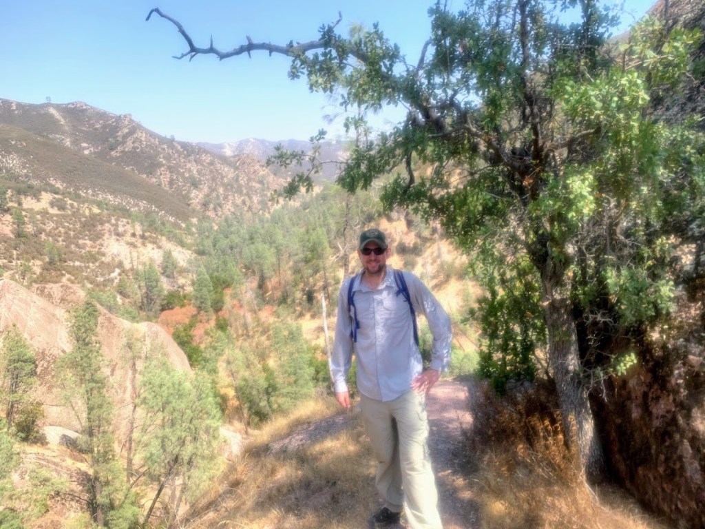
The views back down the valley were great and after we reached what we determined to be the high point of the trail, we turned back to retrace our steps. If the caves were open we could have made this a loop, but twas not to be. I hope to make it back out here one day, probably during the spring, and get deeper into the High Peaks and maybe even make a backpacking trip out of it.


Jack’s Peak Trail – Monterey, CA 8/26/20

Wednesday, August 26, 2020
Jack’s Peak Trail – Monterey, CA
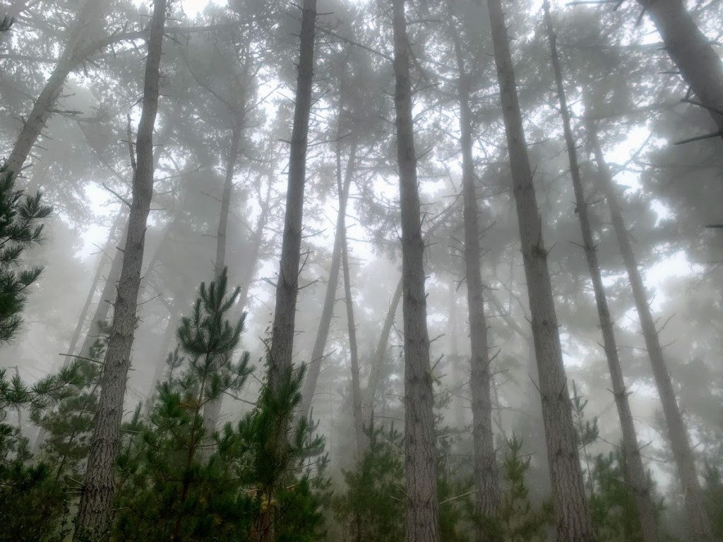
Foggy, cool, mid 60s
Ian, Greg
5.9 miles
After braving an airplane during a pandemic (good work all around Southwest Airlines), we got out to California to visit our good friends Greg and Cat in the Bay Area, who moved there just before Covid hit. We hit up the smoky wine country (wildfires) for a few days and then headed down to Carmel and Monterey. Greg and I got out on a hike one morning at Jack’s Peak Park, just east of the two towns.
We parked at a trail head that was actually outside of the park and walked uphill about a mile to the park boundary. The trail was a bit overgrown and I’m glad we both had long pants on. The foggy morning led to some really cool pics. There was moss hanging from the trees and it was very serene.


Once we got to the park boundary, the trails were much wider and in better shape and there was a parking lot and restrooms. There was a sign warning of a black bear in the area, but we never came across any sign of him/her. We combined a couple of trail loops, hit Jack’s Peak, which was a bit underwhelming, and then headed back down the way we came.

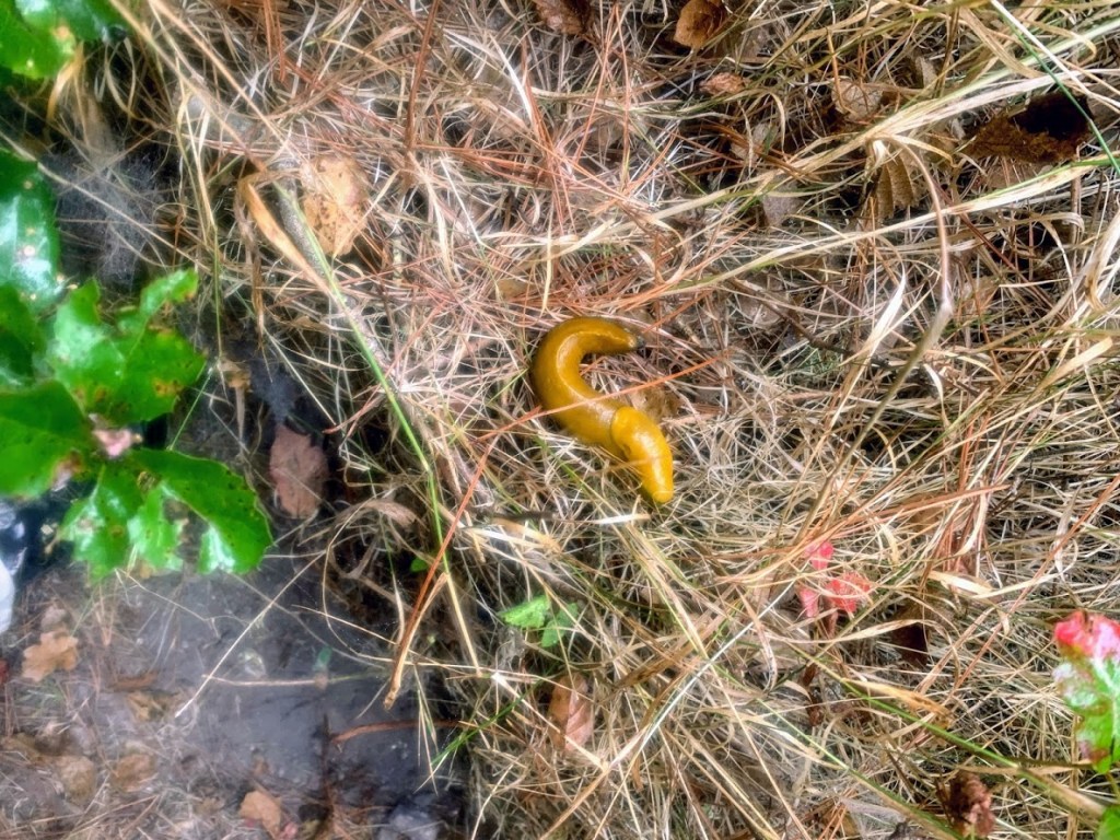
On the way back down the overgrown section, I looked down at one point and saw a yellow jacket nest in the ground right on the trail. I pointed it out to Greg and we quickly kept moving to avoid upsetting them. Just after that, we ran into a hiker and her three dogs. She was heading back uphill on the trail and we warned her about the nest. She said she had just been stung 3 times and was trying to get back to her car. She described where she had parked and we realized it was probably right next to us and she was heading the wrong direction. She had gotten disoriented trying to get away from the yellow jackets, so she and her dogs followed us back down the car.
We all safely arrived back and neither Greg nor I received any stings. That would have been a bummer of a way to end the hike. All in all it was a very pretty and quiet hike with a lot of solitude on a Wednesday morning.


Blue Lake via Bridal Veil Falls Trail – Telluride, Co 7/29/20
Wednesday, July 29, 2020
Blue Lake Via Bridal Veil Falls Trail – Telluride, Colorado
Sunny, pleasant, mid 70s
Ian, Court, Biff, Finn
11.3 miles
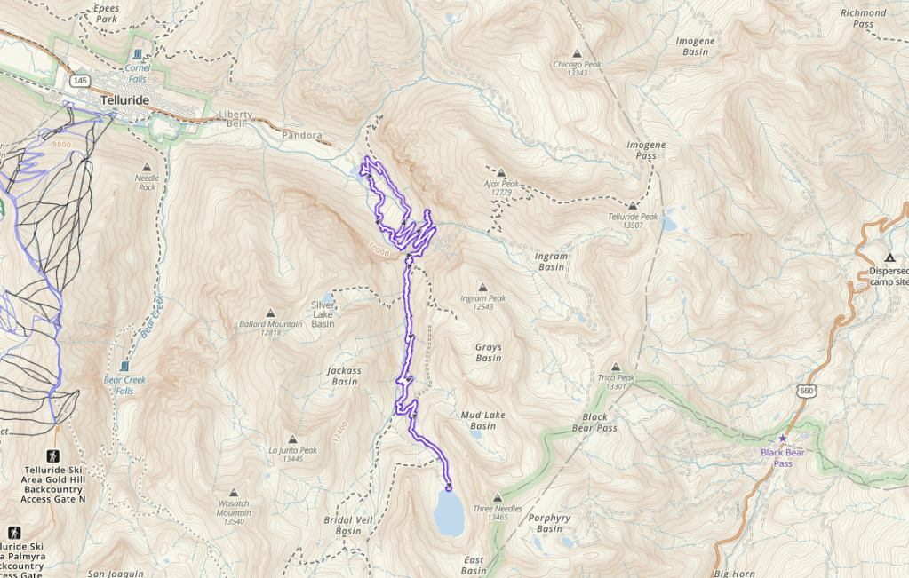
This was the biggest hike of the trip and one of the biggest we’ve ever done, especially the elevation. We got up to over 12,000 feet and man, I felt it. A bit of a long post coming.
Our original intention was to hike the other Blue Lake trail on the north side of Telluride near Mt. Sneffels, but it was an hour and a half drive to the trail head and I wasn’t sure if my non-4WD SUV would make it. Instead, we drove to the end of the road in Telluride and parked at the trail head for Bridal Veil Falls.

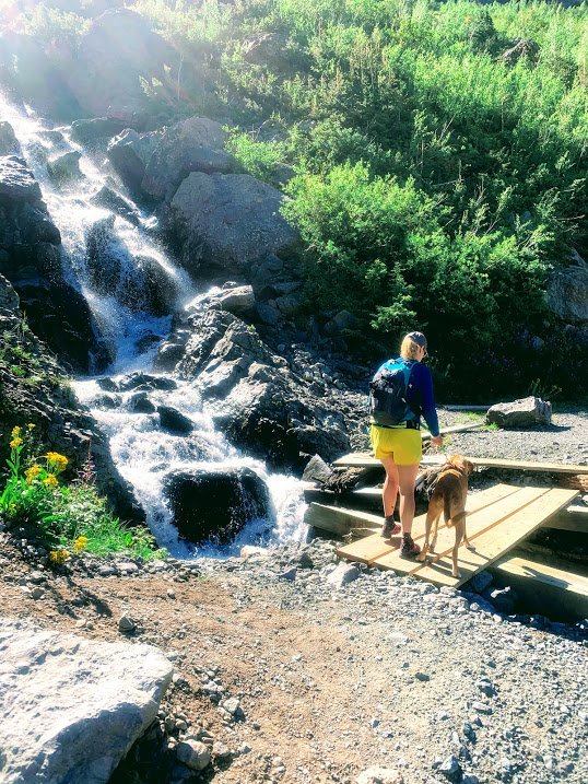
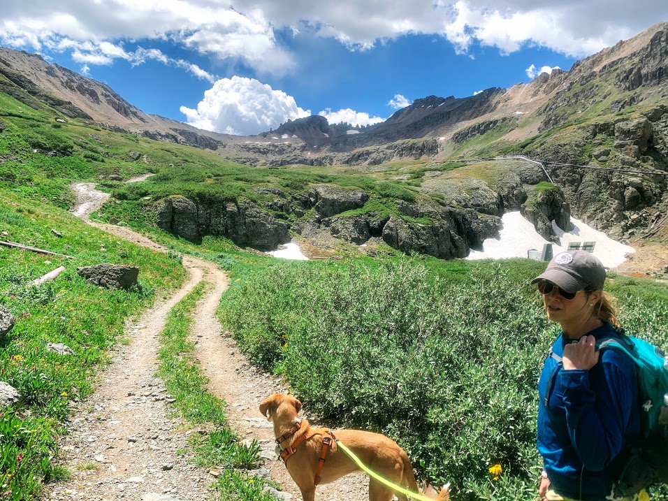
A lot of people take a jeep trail up to the base of the falls and start the hike from there, but we decided to add on the additional 1.2 mile trail from the very bottom to lengthen the hike. Hiking with dogs, especially on tough trail, is a mental exercise as much as it is physical. I didn’t start off in a great mental spot. Finnigan gets a head of steam and loves to pull on new trails, so it’s a challenge to keep your balance while clambering over rocks. However, there were so many waterfalls and general beauty on this trail that it was well worth it.
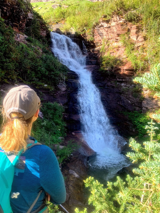
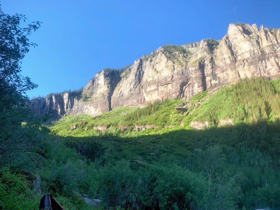
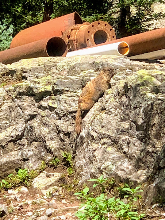
We reached Bridal Veil Falls and also the remains of some mining equipment, which I found really cool. We had a great view down into the valley and Telluride as well. There’s also an old power plant at the top of the falls, which is actually back in use after being originally decommissioned in 1953. According to wiki, it supplies about 25% of the power to Telluride down below.


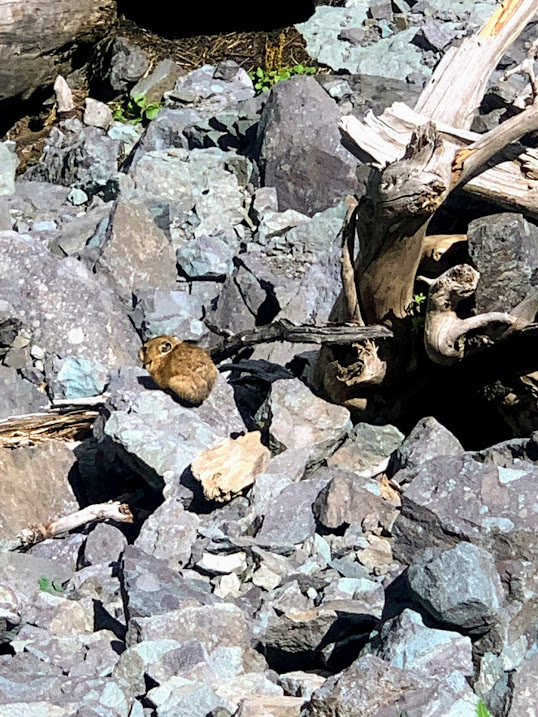
From here the trail kept going up and eventually started to switchback as we gained elevation to over 12,000 feet at the lake. The wildflowers were gorgeous and we saw pikas and marmots as we ascended. In multiple places the ice cold water streamed over the trail from small waterfalls and rivulets originating from places unknown.
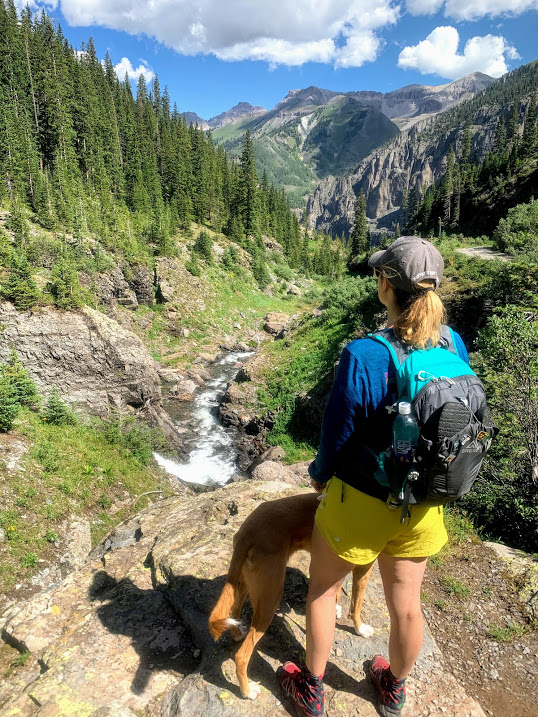


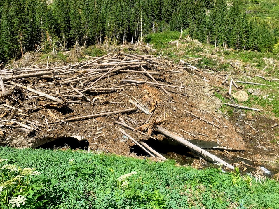
There was also a section where there had been either an avalanche over the winter or a landslide (pretty sure it was an avalanche) and there was a huge debris pile going over the creek with snow still melting underneath it. It was like a giant snow bridge covered in destroyed trees and looked like it might collapse at any moment.

Once we got over 11,000 I had to stop and catch my breath multiple times. I was determined to make it though and I struggled through to the end. There was more old mining equipment and shelters way up here. I can’t imagine how they got it all up here.


We ate lunch and filtered water before starting the long descent back down. Another downside of hiking with the pups is not having our trekking poles, but they had a blast and it was well worth it. Around mile 10, little Biff’s legs weren’t having anymore, so we switched off carrying him down the last mile or so. He’s such a trooper.
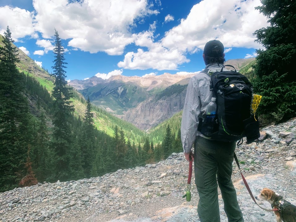
What an amazing hike this was. I probably had the hardest time of all four of us, but it was stunningly beautiful and absolutely lived up to my expectations for Telluride and the Rockies in general. We went home, picked up dinner, and the pups passed out.

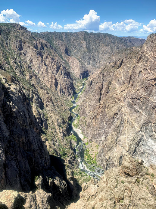
Black Canyon of the Gunnison National Park – Colorado 7/28/20

Tuesday, July 28, 2020
Black Canyon of the Gunnison National Park – Colorado
Sunny, WARM, low 90s
Ian, Court, Biff, Finn
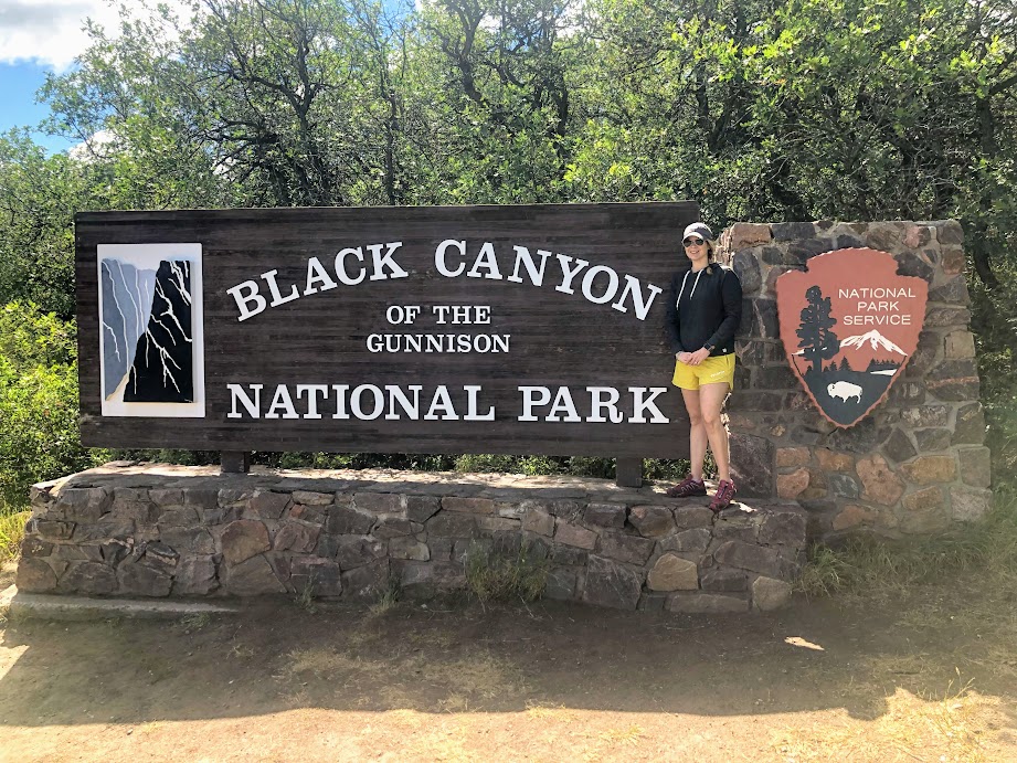
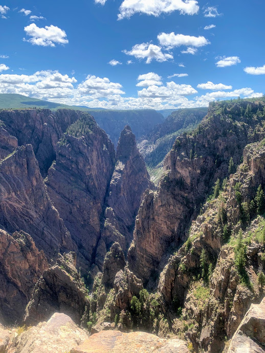
Black Canyon of the Gunnison is about an hour and a half drive north of Telluride, near the town of Montrose. I had always heard this was one of the more underrated National Parks and it was pretty spectacular. I would have liked to have been able to hike down into the canyon, but with the dogs, our options were basically limited to the overlooks. We probably walked at least a couple of miles overall anyway, as there were paths to the overlooks of varying lengths, usually a quarter mile or so. Each overlook gave a different perspective of the canyon.


The visitor’s center was set up on tables outside and they had the stamps for our National Parks Passports, which was awesome. I was worried they might not. The park was fairly crowded for a weekday during a pandemic, but again, people in Colorado were very good about distancing and mask usage.

We got to the end of the road that followed the south rim of the canyon and had a picnic lunch in the shade. It was quite warm today at the park, which is at a similar elevation to Telluride, but in a much more exposed and less mountainous area. Highly recommend if you’re ever in the neighborhood.

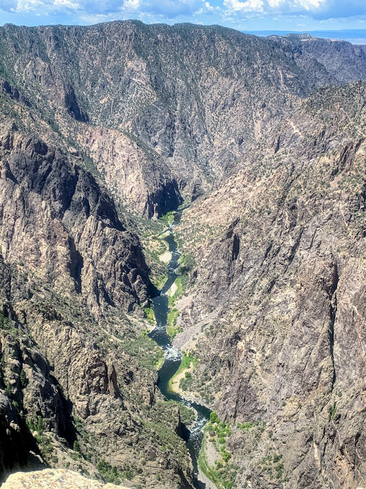
From the NPS site:
The story of Black Canyon can be summed up in three words: grow, blow, and flow. About 60 million years ago, a small area of land uplifted (grow), bringing 1.8 billion year old metamorphic rock to high elevations. This is called the Gunnison Uplift. About 30 million years ago, large volcanoes erupted on either side of this uplift, burying it in volcanic rock (blow). Then, as early as 2 million years ago, the Gunnison River began flowing in force (flow). The river and time eroded all of the volcanic rock and cut a deep canyon in the metamorphic rock below. What you see today is a deep, steep, and narrow canyon: the Black Canyon of the Gunnison.
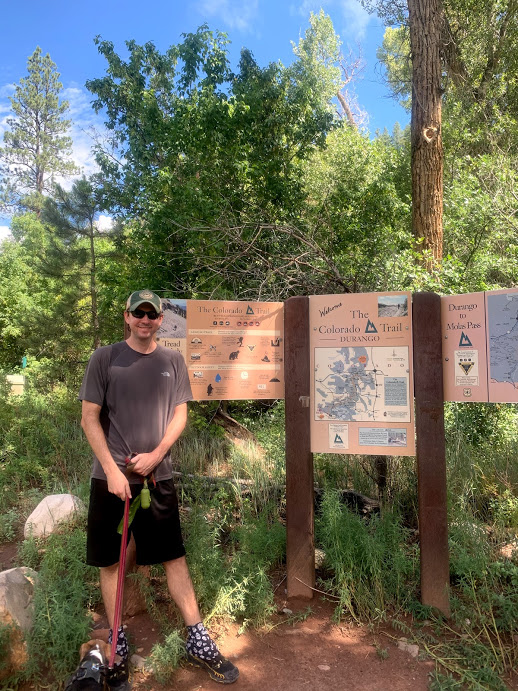
Colorado Trail Southern Terminus – Junction Creek 7/27/20

Monday, July 27, 2020
Colorado Trail Southern Terminus – Junction Creek Campground
Ian, Court, Biff, Finn
Cool, partly cloudy, mid 50s
6 miles
We took a road trip to Colorado with the dogs to escape the monotony of Covid life. What a strange time we are living through.
After driving to Santa Fe the first night (that’s a long drive) we drove up through Pagosa Springs to a campround at Junction Creek, just outside of Durango.
Here’s my Australian nature show video as we unpack the car.
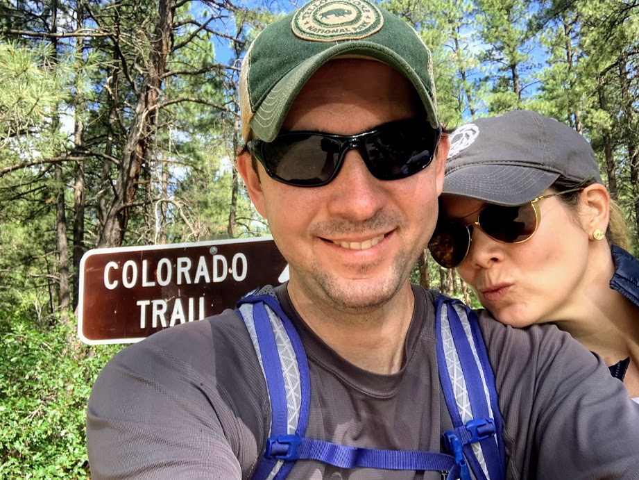
This also happens to be where the southern terminus of the Colorado Trail is located. I made reservations at the campground a few months back without knowing this is where the 486 mile trail from Denver ends. This is now the 3rd southern terminus I have visited of the longer trails. PCT, AT, and now CT.
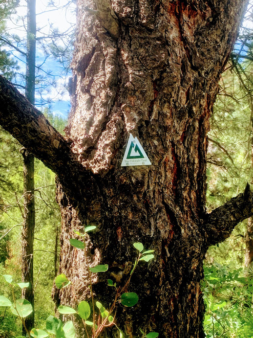
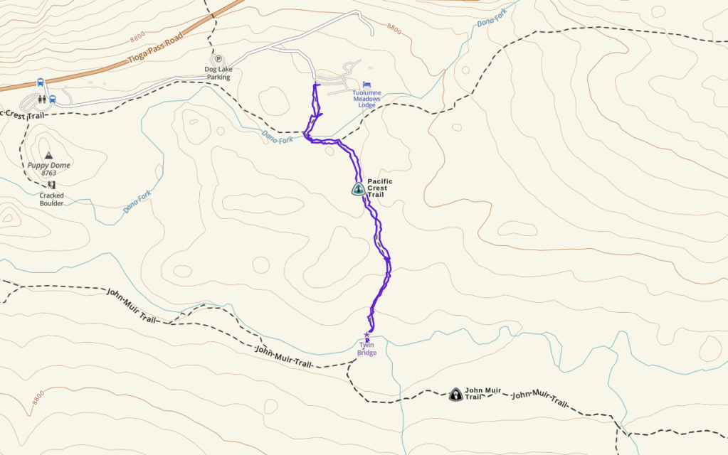
After breaking camp and loading up the car, we drove the few hundred yards down to the trail head. We actually started about half a mile in on the trail, but went to visit the actual terminus at the end of the hike. The crisp morning mountain air was such a nice contrast to the heat of Texas that is in the annual blast furnace phase back home.


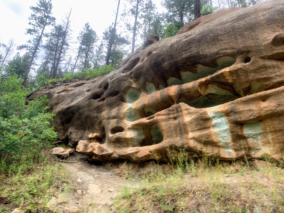
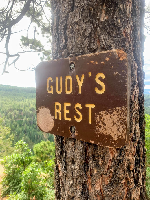
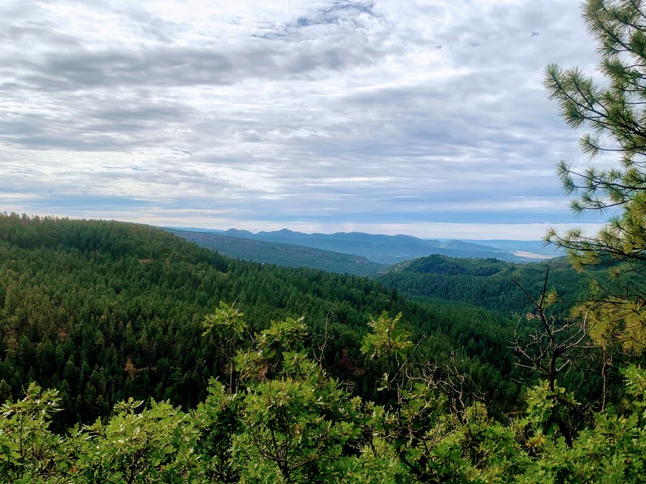
The trail followed the north side of the valley formed by Junction Creek and then dipped down to cross it on a wooden bridge. After crossing to the other side, we were confronted by a series of switchbacks that brought us up to the top of the south side and a spectacular view at Gudy’s Rest.


On the way up, we came across two sets of thru hikers that were about to finish their long journey that started all the way back in Denver several weeks earlier! I got all jazzed about thru hiking again after seeing how dirty, tired, and yet supremely happy and satisfied these trekkers were. Such an accomplishment.
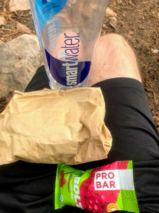
At Gudy’s Rest we sat on a log and ate a late breakfast that Court had packed of sandwiches and trail mix while we enjoyed the view down the valley back towards Durango.
After getting back to the trail head, we drove down to the actual terminus and got a quick photo before hitting Starbucks and driving through the mountains to Telluride, via Silverton and Ouray.

Tuolumne meadows – pct 11/1/19
November 1, 2019
Tuolumne Meadows – Pacific Crest Trail
Yosemite National Park
1.5 miles
Not sure why I didn’t include this in my original Yosemite postings from last fall, but hey, better late than never.
Court and I were in Yosemite for Greg and Cat’s wedding (awesome venue guys!) and we took a day trip up Tioga Road to Tuolumne Meadows to get a quick hike in on the PCT. Tuolumne Meadows is at roughly mile 941 on the PCT and is a resupply point for hikers during the season. During the fall, however, all of the accommodations and stores are shut down and it is deserted. It was kind of an eerie feeling, but the silence and stillness was nice.
We just did a quick jaunt on the trail of about 1.5 miles from the Tuolumne Meadows lodge parking lot to Twin Bridge and back, but hey, chalk up another 1.5 miles on the PCT for me!

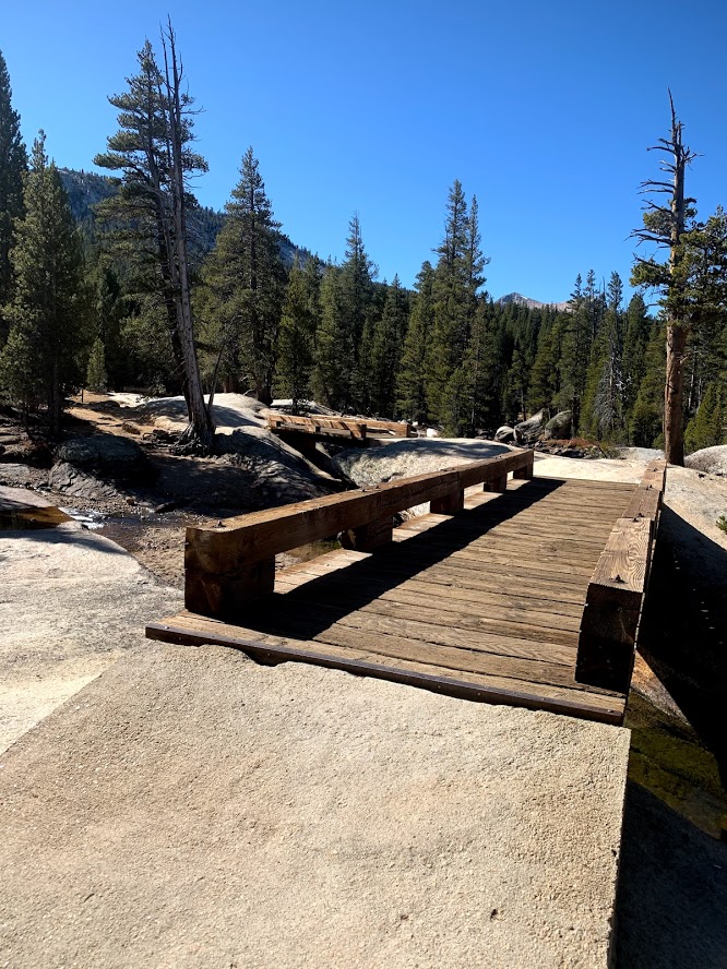

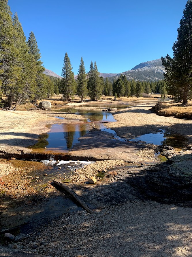

The Tuolumne River was already icing over in the early fall.
Steiner ranch nature trail system 6/13/20
Saturday, June 13, 2020
We were actually supposed to be camping up at Possum Kingdom with our friends Ryan and Kelly this weekend, but they ended up having to come to Austin instead, so we got a quick morning hike in with them out at Steiner Ranch. With the pandemic still in full force (and growing now, good work Texas), Steiner is a decent place to keep away from crowds and still get some good hiking in. Reservations for the state parks are impossible to get and are required for dayhiking also. The greenbelt in Austin is just packed, so we are avoiding that for a while too.
I’ve blogged parts of this trail system multiple times, so this isn’t anything really new, but the May rains are still running off and the water is flowing fairly well in the ravines and kloofs (look it up). The pups made a new friend in Darcy, Ryan and Kelly’s giant schnauzer.

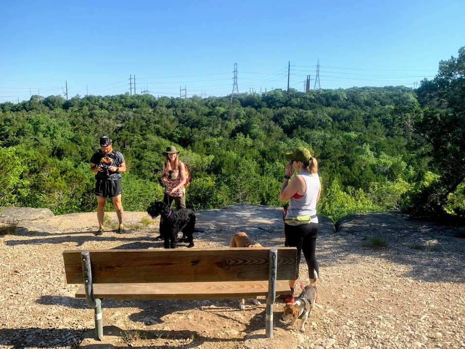


We got out to the trail early enough that the heat wasn’t bad yet and there was a lot of shade, so the pups did fine. We also managed to get a little lost, like we do about half of the time we come out to these trails, so had to road walk the end back to the car, but good times were had by all.
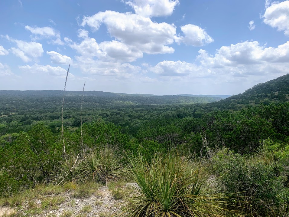
Hill Country State Natural Area 5/23/20

Saturday, May 23, 2020
Hike: Hill Country State Natural Area near Bandera, TX – Wilderness and Spring Branch Trails
Weather: Partly cloudy, breezy, HOT, mid 90s
Hikers: Ian, Court, Biff, Finn
Length: 4 miles
First hike of the Covid Era! We finally broke out of our quarantine and got out to some trails this past weekend. We drove out to Hill Country State Natural Area, one of the few places in Central Texas that we hadn’t experienced, near Bandera, just west of San Antonio.
The State Parks are allowing a limited amount of day passes right now that you have to reserve online in advance. As Texas starts to open up, people are flocking to outdoor areas. We got the last available pass for Saturday afternoon at HCSNA, but I think a lot of passes went unused, as there were still a dozen or so waiting to be picked up when we left the park to come back home.
The good old Texas heat is starting to hit and the dogs (and humans) haven’t acclimated yet, so this hike got cut a little bit shorter than originally intended. I did bring a ton of water, so the pups were well hydrated, but tired.

We started off on the Wilderness Trail, which was marked as “moderate”, but was really a pretty flat jeep trail for most of the way. This is prime snake country, but we didn’t see any on this day. HCSNA has a lot of trails that we need to explore, but we only did parts of two. We cut the Wilderness loop short and hopped onto the Spring Branch trail, which was more challenging, but also prettier.

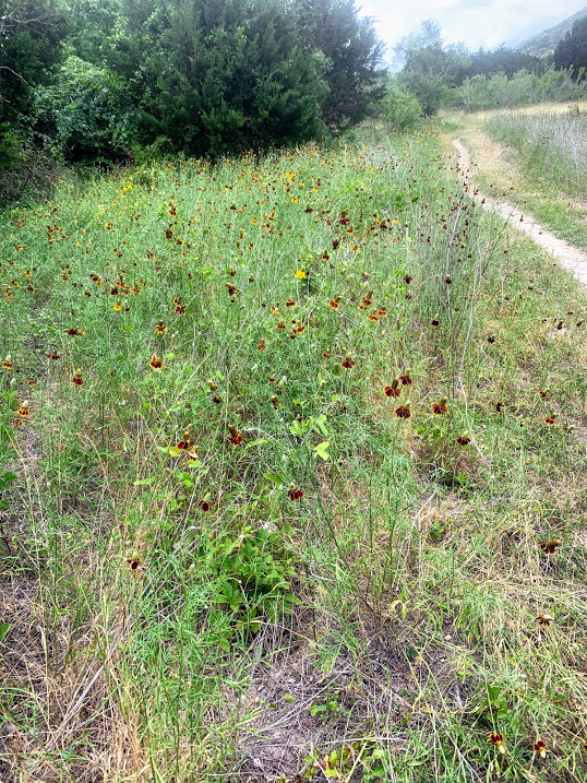
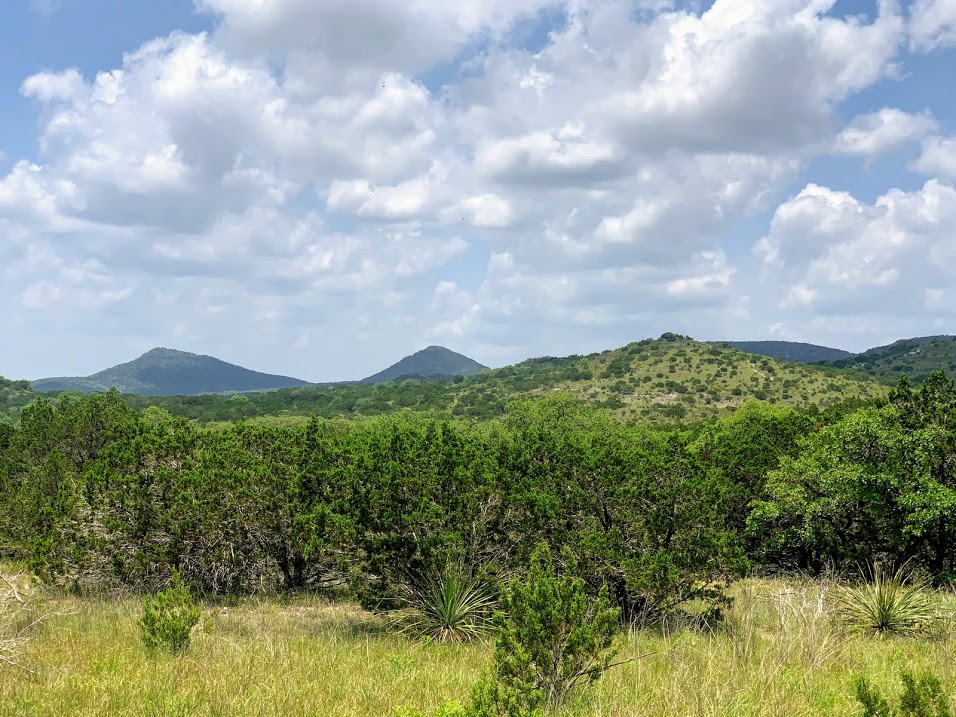
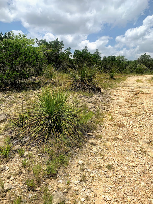

There were plenty of lizards scurrying about, much to Finn’s excited delight. We had to stop and take a few breaks in the shade and drink plenty of water. The views were nice and the breeze coming down the hills was a welcome respite from the heat.

After a 4 mile loop, we were back at the car and cranked the AC for the 2 hour drive home. It’s now what I call “sunrise hiking” time in Texas, where you have to start early in order to avoid the heat. Hoping to add more hikes to the blog soon as we start up a delayed hiking season.

COVID – 19

As some may know, my PCT hike for 2020 was postponed. I actually made the call before the COVID outbreak, but this definitely would have sealed the deal.
One of the bloggers I follow who is also a doctor posted the following and I feel it’s good to pass the info along. I’ll be back to updating this blog for the spring hiking season in Texas. At least my favorite hobby isn’t impacted (much) by these weird times we are living in.
As a physician (Internal Medicine and Ophthalmology), I try to separate my work from this blog, but at a time like this, I feel the need to spread the message to as many people as possible.
Although it is still very early in the COVID-19 pandemic, it is clear that the world will never be the same. As the SARS-CoV-2 makes it way around the world, we will all experience our version of the pandemic at different times. Healthcare workers scramble around the world to contain the virus and minimize casualties. The battle against this virus will not be won in the hospital wards and in the clinics, it is fought in our homes and neighborhoods with prevention. The soldiers in this battle are the people who live in this country. by staying home, you are contributing more than you will ever realize. That is our main weapon. With such…
View original post 202 more words
Hiatus – NEW SITE!
A quick note to the tens of followers on this blog, I am going to stop posting new content for the next few months here, as I am documenting my PCT thru hike on my new blog:
http://www.mexicotocanada2020.com
I’m starting from the southern terminus on March 23! Holy crap!


Recent Comments