Pierce Wanderings
Texas Hiking (and elsewhere)
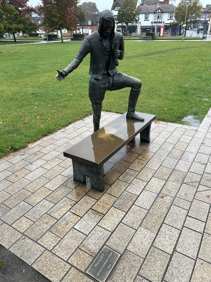
Cotswolds Day 4 – Rain Day! Stratford-Upon-Avon 9/23/24
Monday, September 24, 2024
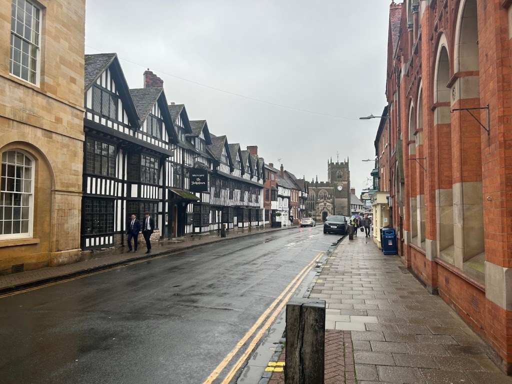
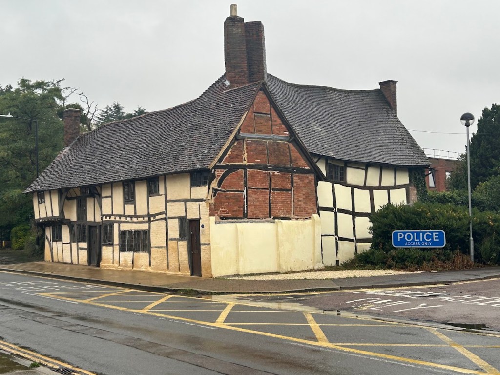
Today was rainy all day long, so we all decided to skip the hiking section from Chipping Campden to Moreton-in-Marsh (7.75 miles) and instead drive a half hour up to Stratford-Upon-Avon, the birth and death-place of William Shakespeare. The town is beautiful, if a bit touristy, but my favorite part was the Holy Trinity Church where he is buried.

We walked around town in the rain, but it wasn’t too heavy most of the time.


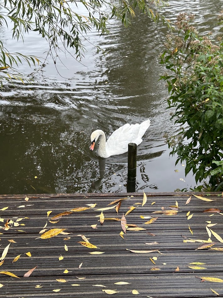
The Avon River runs through town and we walked along it until we got to the church.


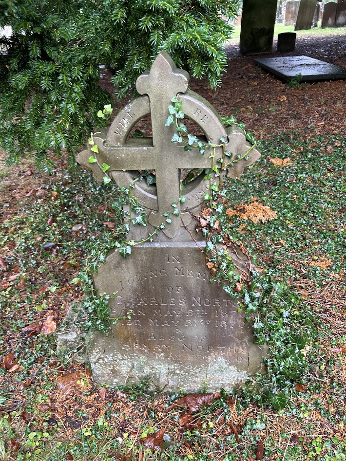
The church had a great graveyard and we looked for the oldest headstone for a bit. I think the oldest we found was around 1780.
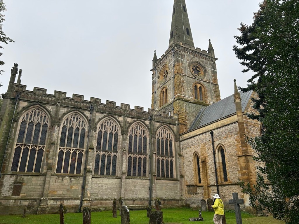


Shakespeare is interred inside. There were several people explaining the history and points of interest. One man had memorized a newly discovered Tolkien poem about Christmas and recited it to us. Random, but I’m always down for anything Tolkien related.


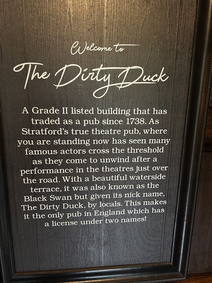
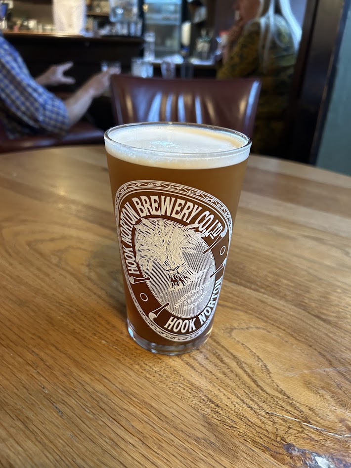
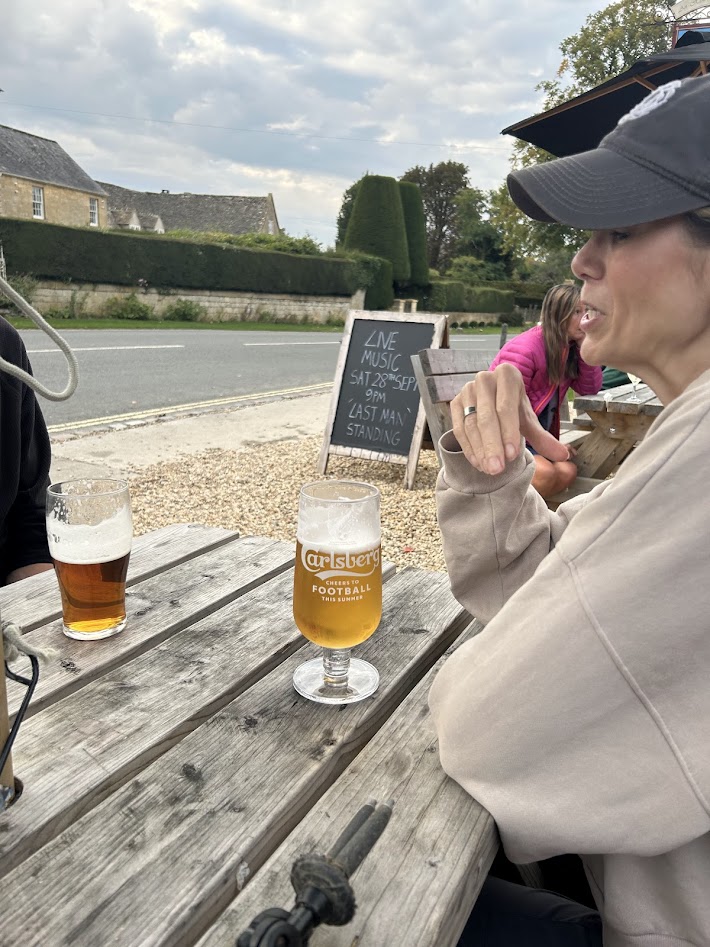
After the church, we went to eat lunch at the Black Swan Pub, which also is called The Dirty Duck by the locals. It’s a place where the Shakespearean actors in the town gather to imbibe and there’s a separate wing of the bar where they hang out. It was a cool vibe.


We then walked back through town to our car and headed to Moreton-in-Marsh, where we would stay for the night and get ready to hike again the next day, when the weather was supposed to clear up a bit.
Cotswolds Day 3 – Broadway to Chipping Campden 9/22/24
Sunday, September 22, 2024
6 miles
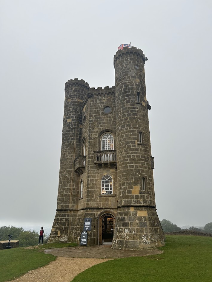
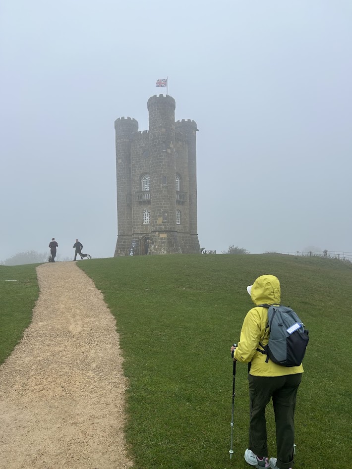
The rain and fog moved in today. We donned our rain gear and Court and I started out with a steep uphill climb from the town of Broadway to the top of a hill where Broadway Tower overlooks the landscape. Mom would join us at the cafe by the tower and hike with us the rest of the day to Chipping Campden.


The Broadway Tower was also a nuclear fallout shelter in the Cold War and they play up that angle quite a bit. It was touristy, but fun.


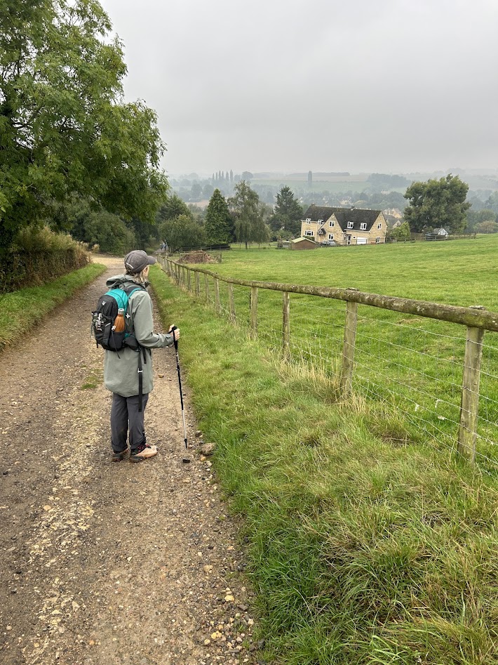
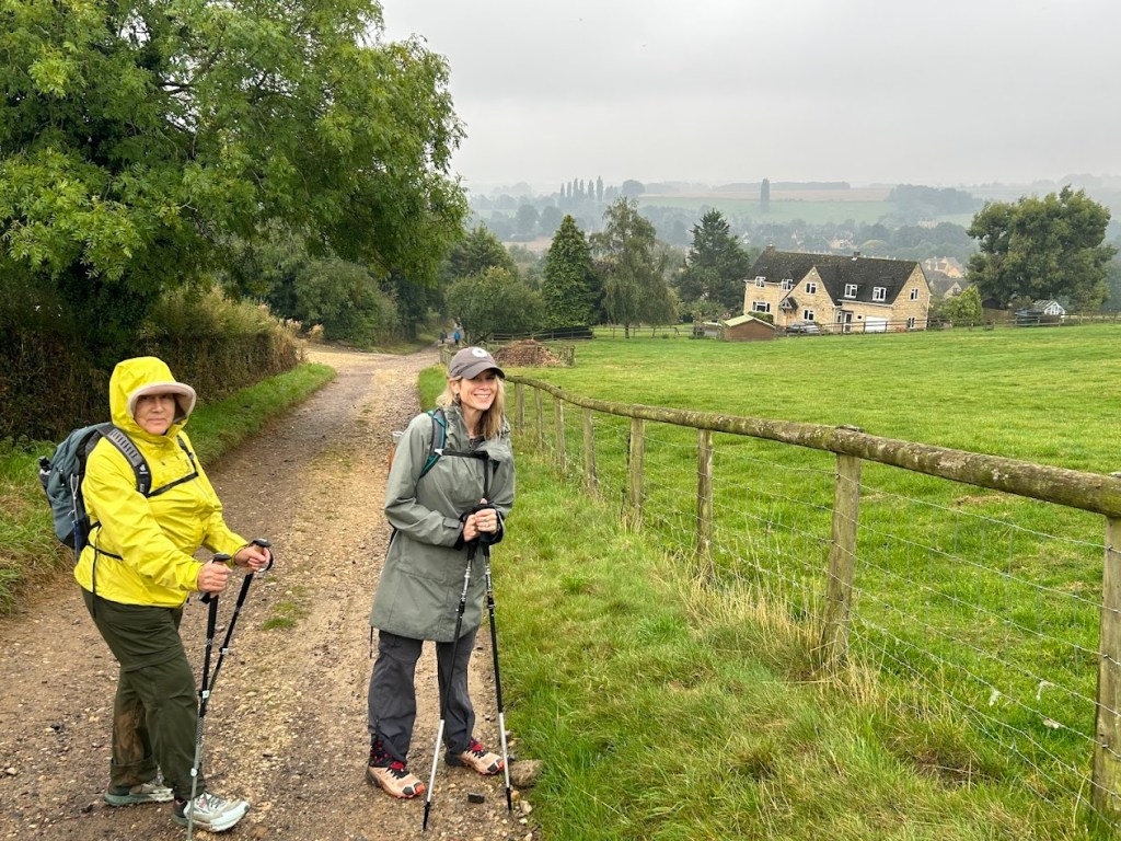
Mom joined us at the tower and hiked the rest of the day with us, about 4.5 more miles through the rain and fog to Chipping Campden.
The trail led us through the woods and then across a couple of mucky fields that made our shoes heavy with mud.


After scraping the mud cakes off our shoes and losing about 10 pounds in weight, we reached Dover Hill and the Vale of Evesham. I loved that name. It felt very Tolkien-esque.

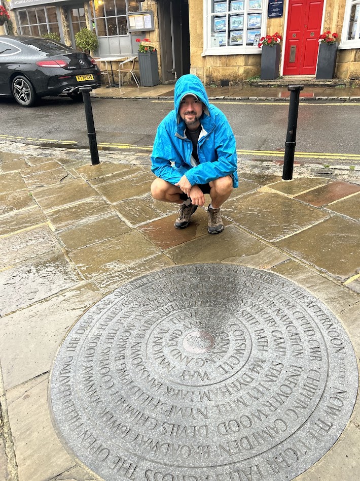
Coming down off the hill, we descended into Chipping Campden, which felt like one of the oldest towns we would stay in. Very medieval feeling. This is also the official northern terminus of the Cotswold Way. I nerd out about long trail termini.
We checked into our hotel and hung out in the bar for our post-hike pint. A great deluge would await us tomorrow.
Cotswolds Day 2 – Winchcombe to Broadway 9/21/24
Saturday, September 21, 2024
9 miles
We took a taxi back to Winchcombe the next morning and met up with our guide for the day, Robert. We had booked one day with a guide, simply to tell us about the history of the area and it was nice to not have to worry about staying on the path, as he knew the track from memory. Mom and Dad stayed behind to explore and let Mom rest up from the first day’s hike. The weather today was probably the best we had the whole trip. Sunny and cool for most of the day, with only a slight shower in the afternoon for 10 minutes or so.


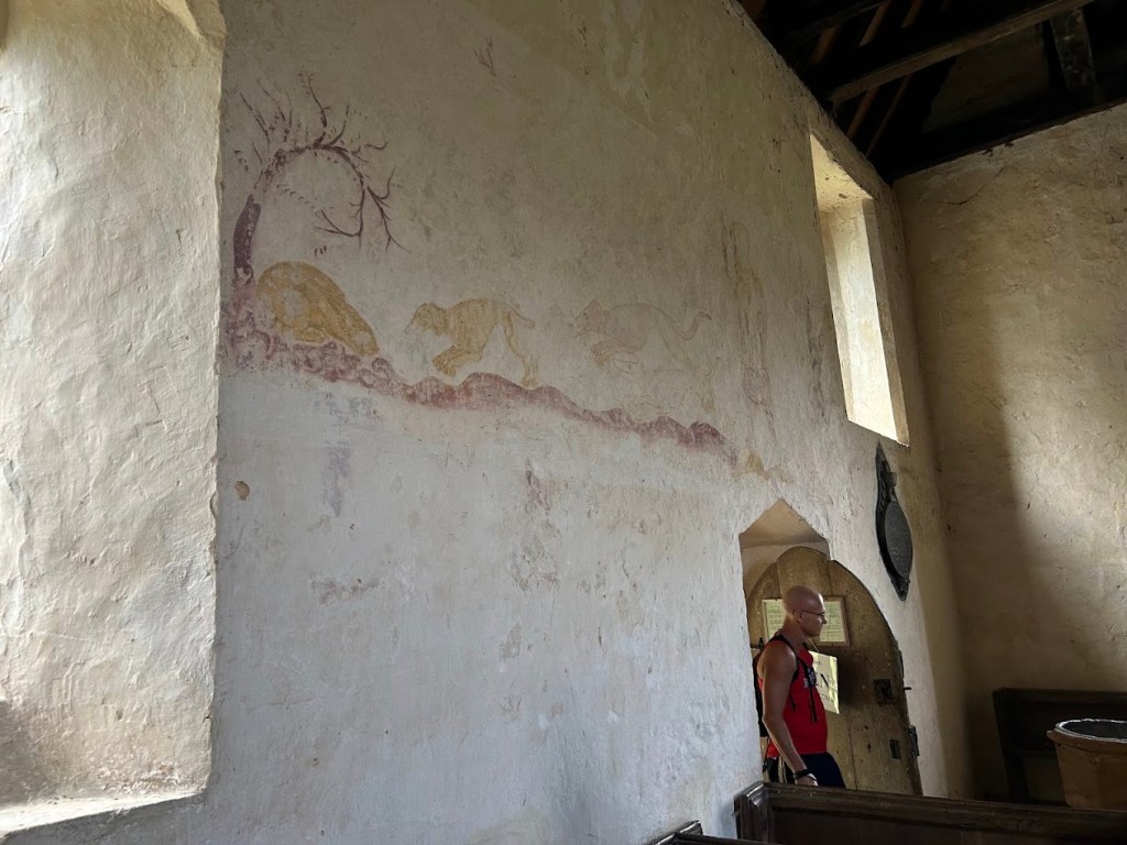
We came to one of the older churches we would see on this trip. This one, Hailes Church next to the remains of Hailes Abbey, dates back to I believe the 13th century at least (the Abbey is from 1246 and the church is said to pre-date the Abbey) and still has some original frescoes still visible on the walls. Super cool.


We stopped for lunch just after at Hayle’s (different spelling) Fruit Farm, which was a nice place to grab a juice, coffee, and a pastry to fuel up for more hiking.


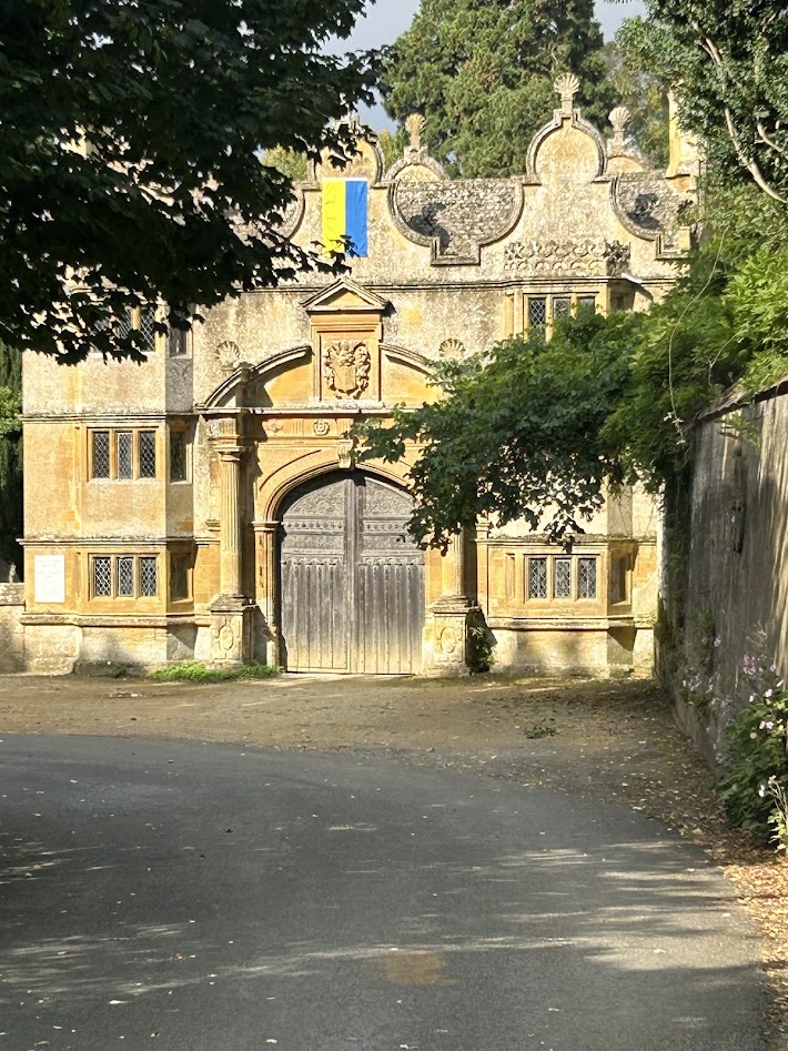
We hiked on to the village of Stanway and the house of the “His Lordship”, which Robert mockingly called the Earl (?) who technically lorded over the lands we were walking. He explained to us how the Earl lived in the house by himself and how the old medieval peasant fields were still visible in the earth, creating a rolling landscape of mounds, which I have heard by others referred to as the “Cotswold Wave”.


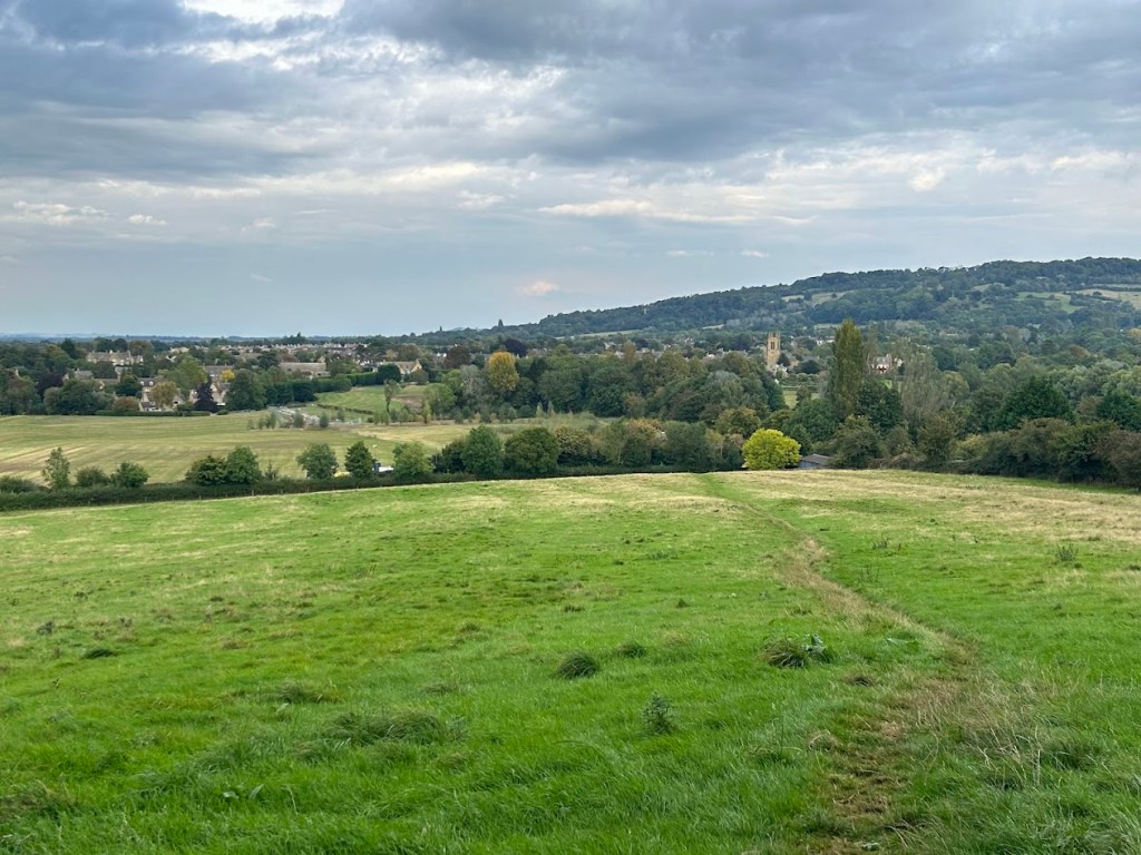
We hiked on to the next town of Stanton, which was quintessential Cotswold cottages with the yellow limestone. We would love to have a home here, but they were all well over a million pounds to buy.


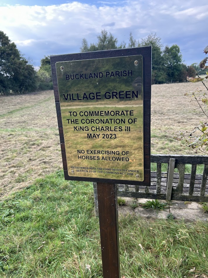
Moving on through the pastures, we came to our last town of the day in Buckland, though it was really just a few nice homes here and there. We chuckled at this sign, as Robert really doesn’t think much of the Royals apparently.
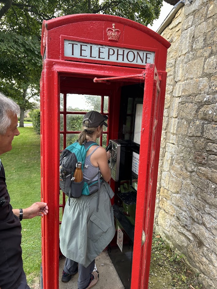
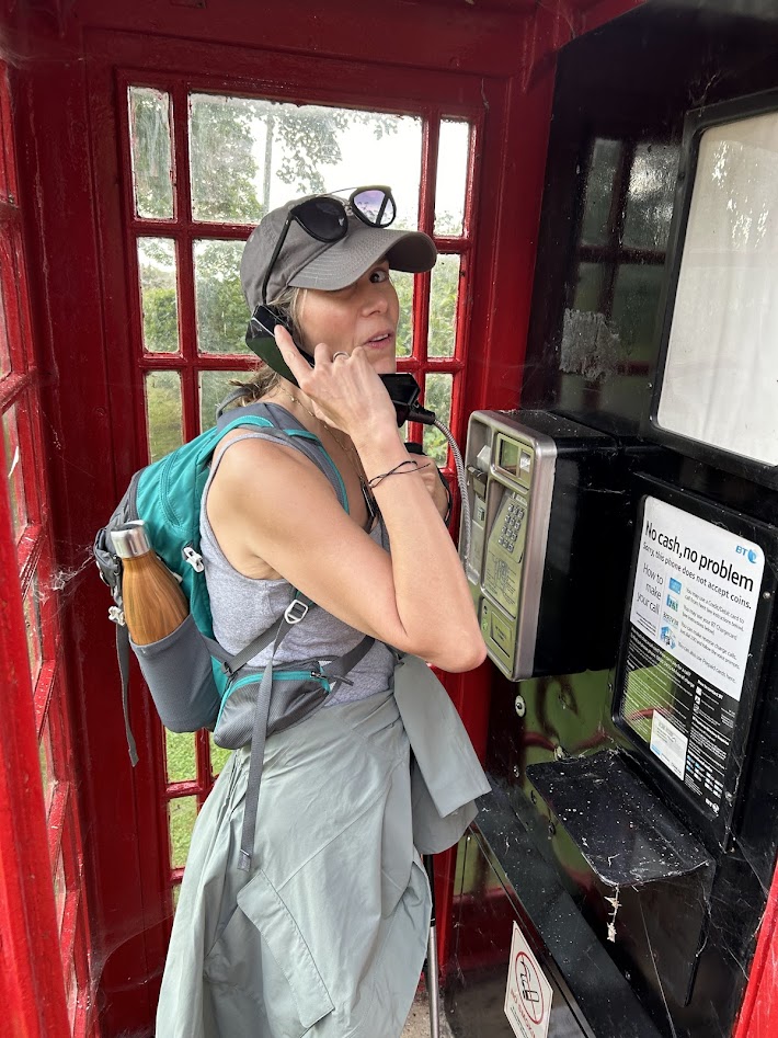
We also found one of the few functioning pay phone booths still around.
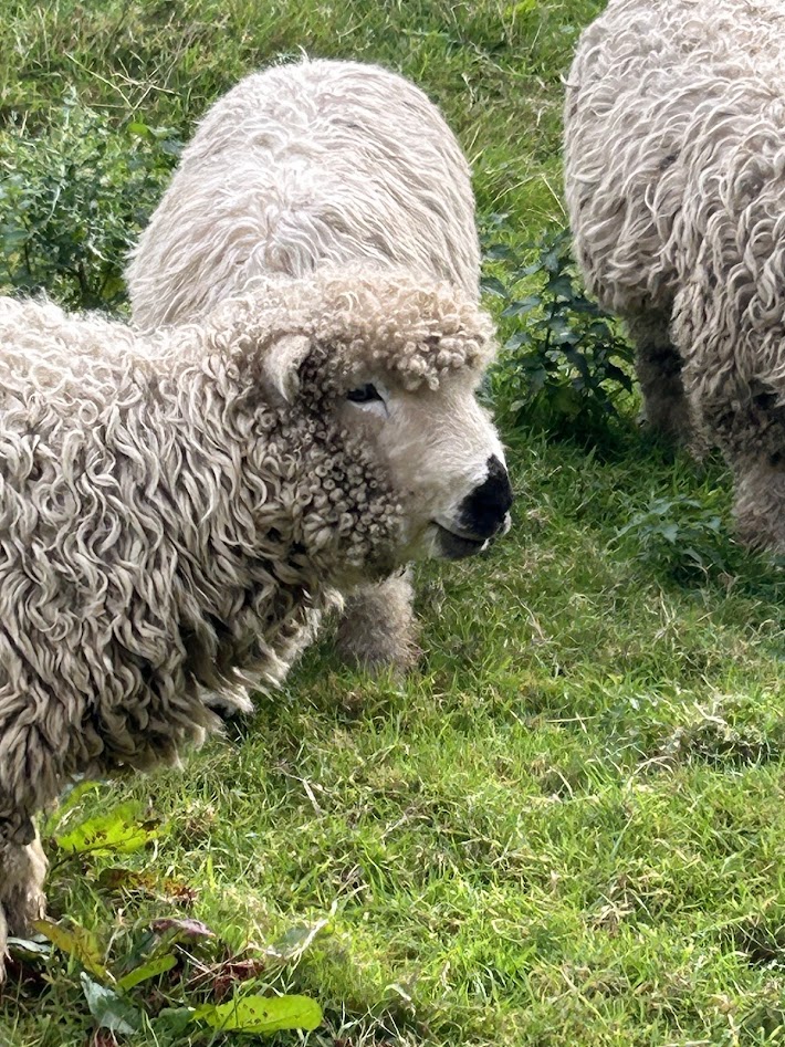
And Courtney got to pet a sheep. These sheep were specially bred by this family and Robert thinks they are kept as pets, which is why they are much less timid than most we had encountered.

We finished up the hike into Broadway and stopped at Robert’s favorite pub, The Crown & Trumpet, for a pint with him to end the day. Mom would rejoin us tomorrow, as would the rain.


Cotswolds Day 1 – Cheltenham to Winchcombe 9/20/24
Friday, September 20, 2024
8 miles
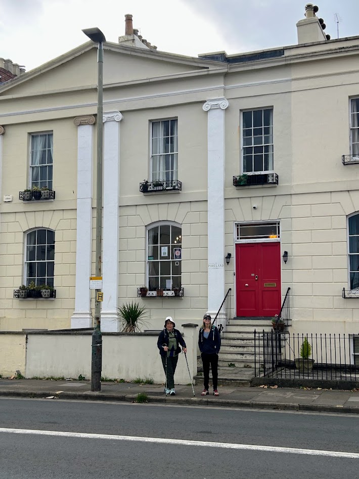
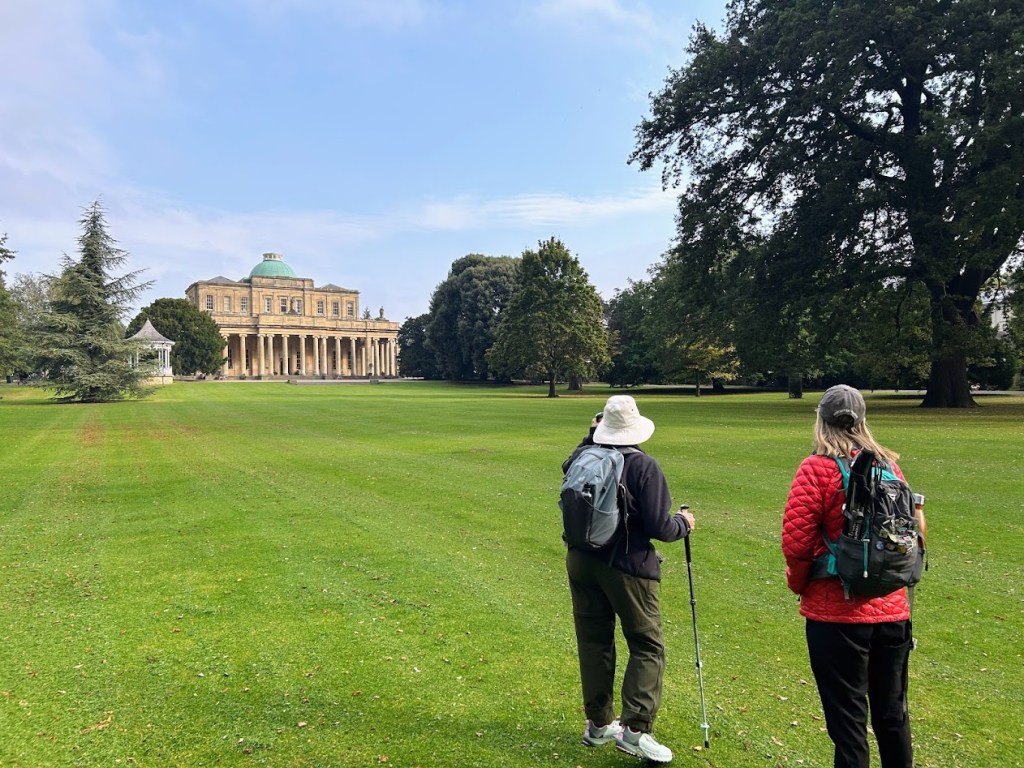
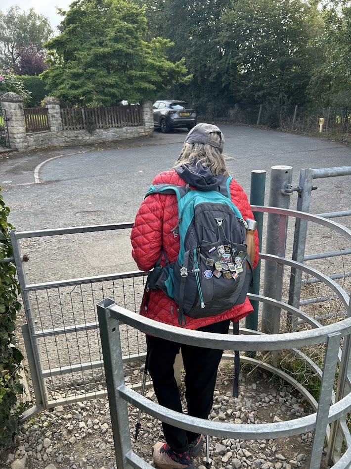
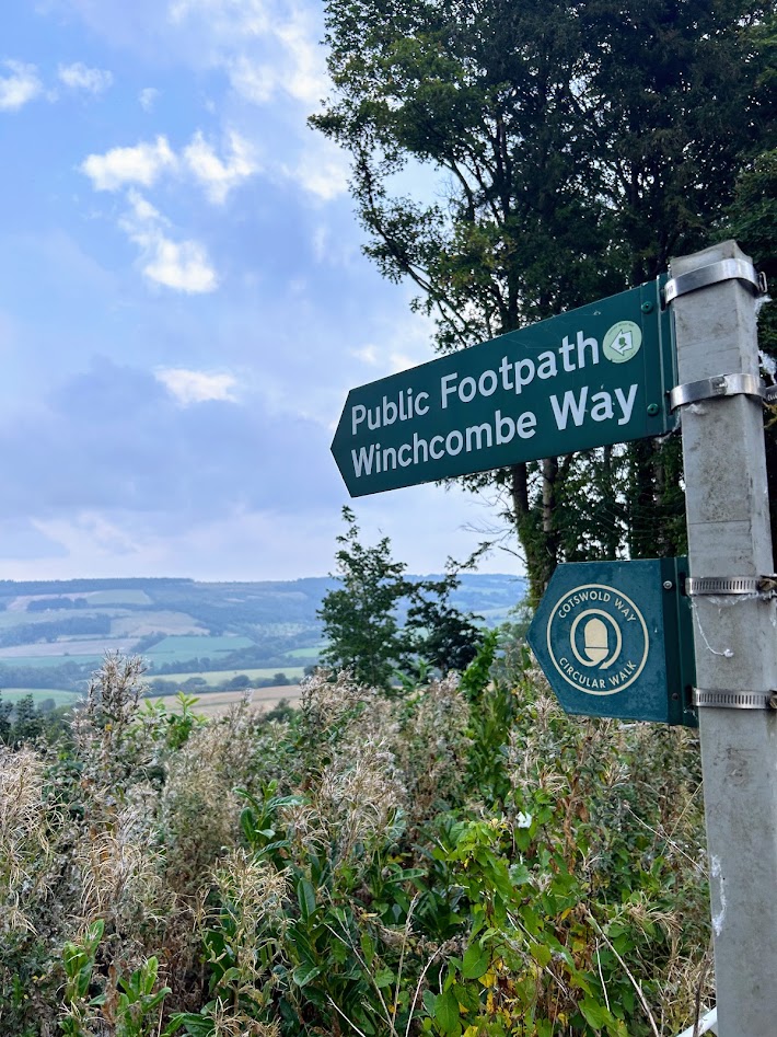
After taking the train into Cheltenham Spa from London, we woke up the next morning and set off on our first day of hiking in the Cotswolds. We left the BnB and headed north through the town, following the app the tour company recommended. This was similar to what I use for the PCT, essentially following a GPS line and checking it every once in a while to make sure you are on the right path.
We started out going through a park with an old Pump House and then cut behind some houses, following the Public Footpath signs.

We soon found ourselves walking a trail next to the “Racetrack”, which is a huge horse racing track, but not how we think of them in America. Much more “equestrian” I guess, with jumps and such.


The trails are fairly well marked, but because there are so many intersecting ones, there are dozens of different blazes, depending on where you are. The official Cotswold Way blaze is an acorn, but we weren’t sticking strictly to the Cotswold Way; we had a mix of trails. GPS was essential, though many of the trails converged back with each other, so even if you got off track, you would mostly stay in the general direction you were aiming for.


After the Racetrack, we got back into a neighborhood before crossing a busy road and then started climbing through a verdant pasture. Up, up, up. One of the biggest and longest hills of the entire hike.


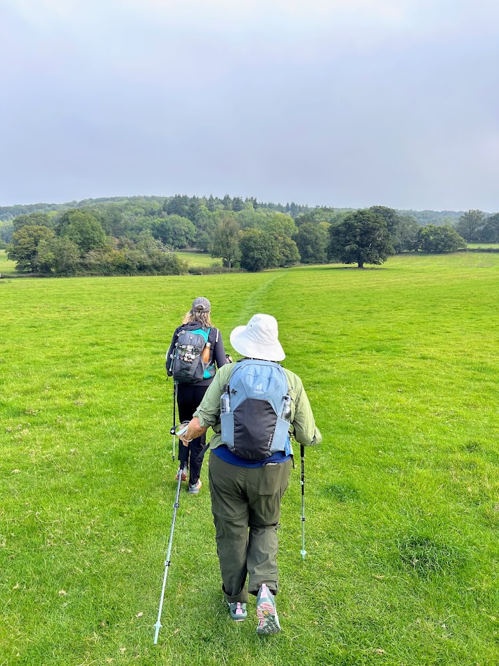


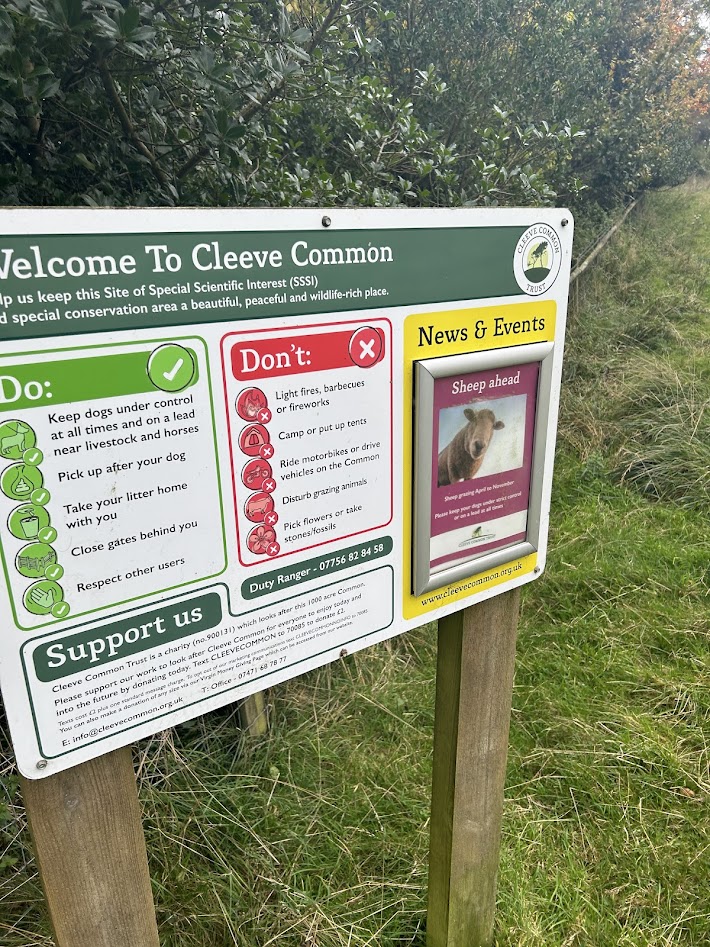
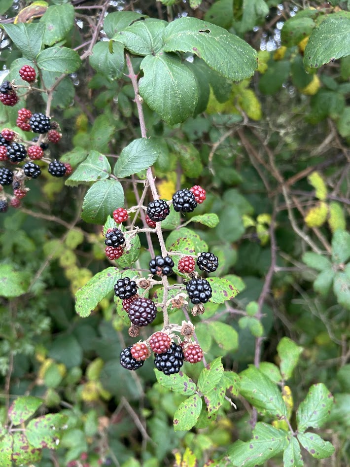
The climb was long and when we got to the top of the plateau (called Cleeve Common), the weather had taken a turn and we donned our rain gear, though it never got too bad. Just cold, windy, and foggy more than anything. We walked a flat trail among the sheep and blackberries for a mile or so until we started to head back down the other side, towards Winchcombe.
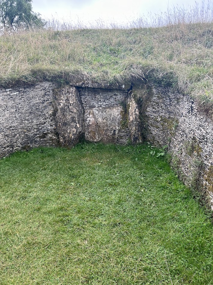
Towards the end of the hike, we came upon the Belas Knap Long Barrow, which is an ancient burial mound from over 5,000 years ago. England is old, but man, this is REALLY old.


We continued downwards through fields and orchards and reached the town of Winchcombe, just before the weather unleashed. We actually caught a taxi (no Uber here) to take us up to the town of Broadway to stay the night, but would return the next morning to Winchcombe to continue our hike.


Cotswolds Overview
September 2024
I figured I would start out by explaining what these next few blog posts would really be about, as I don’t want to just jump into a fairly unique experience without context.
This September, Court and I joined my parents for a long vacation in England which consisted of several days hiking from town to town in the Cotswold region and then finished in London for a few days. The credit to this idea goes to my mom, PJ, who has always been so supportive of my hiking goals and decided she wanted to experience some of the hiking life as well (conjecture on my part).
To be fair, she was certainly one of the main contributors in my early life to my ultimate obsession with the outdoors and hiking, so certainly I jumped at the chance to share it with her later in life as well.
For reference, the Cotswold region of England lies to the west of London and is almost 800 square miles of protected lands and historic villages, criss-crossed by public pathways and trails. The English footpath and public right of way system means that you are allowed to cross private land, providing that you keep to the path (which is often invisible, simply a dotted green line on a map).

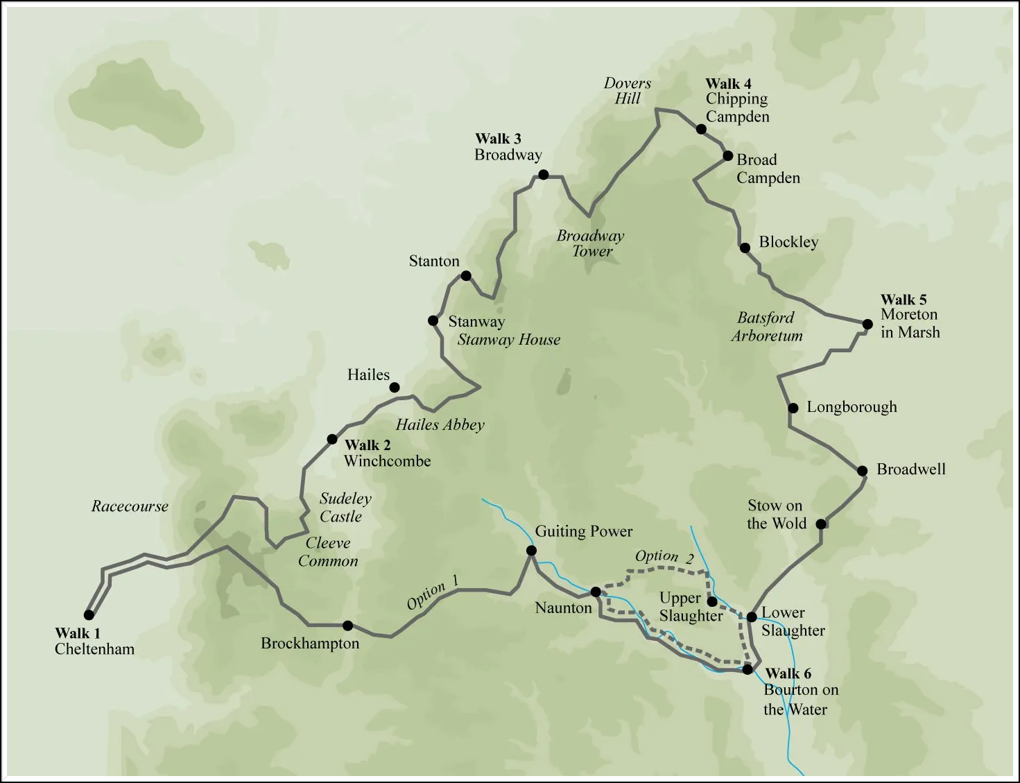
We did a circular loop in the north, starting at the town of Cheltenham. We hiked for 6 days and stayed at bed and breakfast inns or hotels each night. Each day we walked between 6-10 miles through the English countryside. Much of the time it was chilly and rainy, but that just made the experience all that more unique. In the end, Court and I hiked around 45 miles in total, while my mom did a little less. It wasn’t all unicorns and rainbows through grassy meadows, there was some real hiking in there too. I’ll post a blog for each day and document the journey.
Lake Georgetown Training Hike 6/23/24
Sunday, June 23, 2024
Hike: Tejas Camp to almost Russell Park and back (Goodwater Trail)
Weather: Sunny, warm, humid
Hikers: Ian solo
Length: 8.27 miles
I could have put this on my PCT blog under training, but figured it could go here since I haven’t updated this blog in a good while.
This is one of my favorite training hikes because it’s fairly flat and is good for testing gear and just building general endurance. In the summer time, you have to be out on trail early to beat the heat, ideally right around sun up. I started just after 7am on this one.
We haven’t fully hit the blastfurnace phase of Texas summer yet, so it’s still somewhat tolerable, but I still like to be off trail by 10:30 or so.
As I say in the following videos (you may need to click on them individually to get the full screen version and also to up the quality to 1080p – c’mon WordPress!), I’m gearing up to do a section of the PCT in about 3 weeks, starting July 14th (maybe 13th, if I don’t get off the waitlist for a trail maintenance course in Truckee).
I’m testing a couple new pieces of gear, mainly my new bear canister, which I will be carrying all 65 miles of my hike. It’s bulky, but fits decently enough in my pack. Also, I’m going stoveless, so that’s a pice of gear I will NOT miss. It never fit right in my pack and I only used it three times in a month on the PCT last year. I can survive off tortilla roll ups and clif bars and such just fine.
Anyway, if anyone wants to follow that hike, check out my other blog here.


Golden Gate National Recreation Area – Lands End Coastal Trail 2/10/24
Saturday, February 10, 2024
Hike: Golden Gate National Recreation Area – Lands End Coastal Trail
Weather: Clear, sunny, nice, low 60s
Hikers: Ian, Court, Greg, Cat
Length: 1.76 miles
It’s springtime again! Yahoo! The Texas weather is the best it will be all year and I’ve been doing my best to take advantage and get out on some hikes with old friends. I won’t blog the repeats, but if I find some new trails, I’ll be sure to put them up. Plans are still on for a PCT section hike this summer, probably at the end of July.
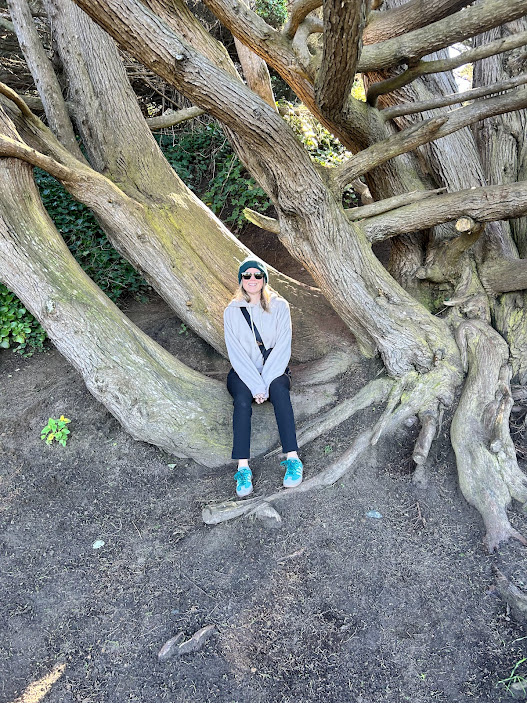
For now, I wanted to write about another trip out to the Bay Area in February to see our friends Greg and Cat. We got in a beautiful short hike along the San Francisco coast with amazing views.
I had wanted to go to the Golden Gate National Recreation Area for a long time and it was great to finally get the chance. The weather also cooperated, as often times the area is shrouded in fog.

Before the hike, we went to the Lands End Visitor Center where we couldn’t help but buy some more National Parks gear and of course get our stamps!

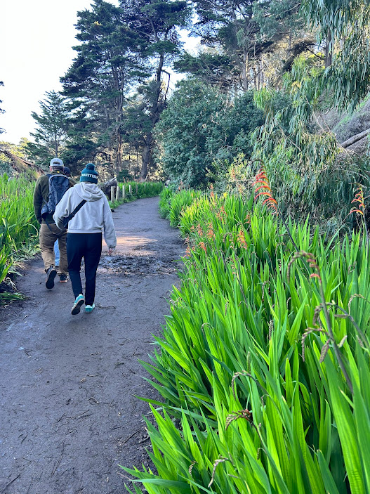
We then headed down the trail, first descending down to the remains of the Sutro Baths, which was destroyed in the 1960s after falling into disrepair.


The views of the mighty Pacific coupled with the salty, cold breeze and the smell of the ocean is one of my favorite things and why we continue to come out here.

As we continued down the crowded trail on this beautiful day, the views of the Golden Gate Bridge started to peek out from behind the rocks and became more and more pronounced as we moved along. The plant life was beautiful too and I got some good use out of my Seek app by iNaturalist, which makes it easy to identify plants using your phone camera.


Towards the end of the trail we got the best view of the iconic bridge.

Afterwards we strolled through the streets of San Francisco on our way back to the car and then got ready for Cat’s birthday dinner downtown. Thanks friends!


Hornsby Bend Bird Observatory – River Trail 2/4/24
Sunday, February 4, 2024
Hornsby Bend Bird Observatory – River Trail
Sunny, clear, mid 50s, breezy
Ian, Court, Biff, Finn
5.82 miles
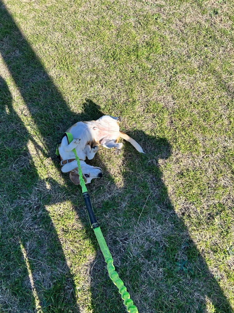
This ended up being a much longer hike than anticipated. I blame the map not being to scale. Instead of a 1.5 mile hike, we ended up going almost 6 miles. Had it not been so windy, I wouldn’t have minded as much, but it was a bit chilly and I only had one liter of water, which I had to ration for the dogs. Just another reminder to always carry 2 liters even if I think it’s going to be short hike.
That said, we saw some ducks and other water fowl on the ponds and it was good to get out and see a new hike around Austin that I didn’t know existed. The trail is mostly flat and wide and follows along the Colorado River for much of the way. We also saw a herd of deer which Finn desperately wanted to chase. That is why he stays on leash.


I will probably try and come back in the spring or summer when the leaves are out and the weather is warmer.


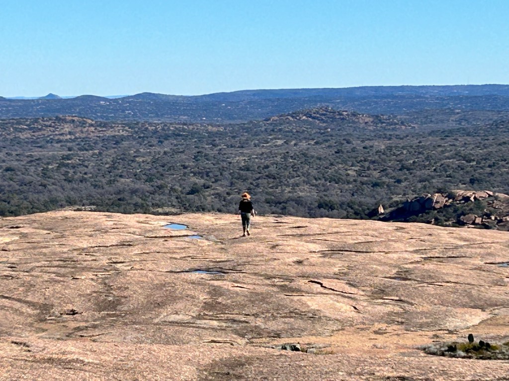
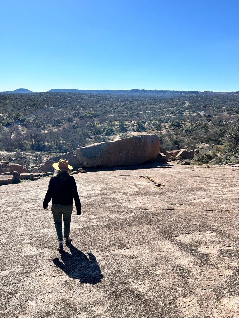
Enchanted Rock – Summit Trail 1/28/24
Sunday, January 28, 2024
Enchanted Rock – Summit Trail
Near Fredericksburg, TX
Cool, Sunny, mid 50s
Ian and Court
1.4 miles
One of the first hikes we ever took together was this trail to the top of Enchanted Rock more than 10 years ago.
We don’t usually have the chance to do this trail, as we usually have the dogs with us and they aren’t allowed on the summit trail due to the fragile flora and fauna, not to mention extreme temperatures in the summer. We took advantage of this rarity and got out to the rock around 10am.
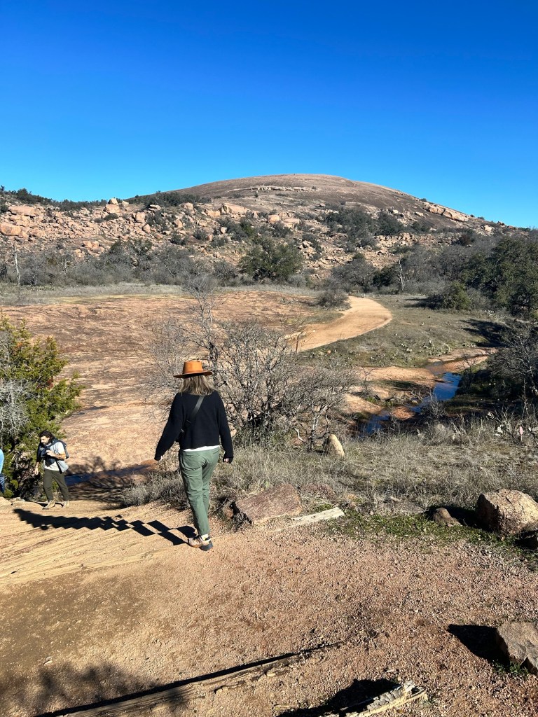
It’s only a 440 foot vertical gain to the summit, but the angle is fairly extreme at one point. Good calf workout.

We did a lap around the top and then back down. The views are nice and it’s always a cool experience to hike Enchanted Rock.


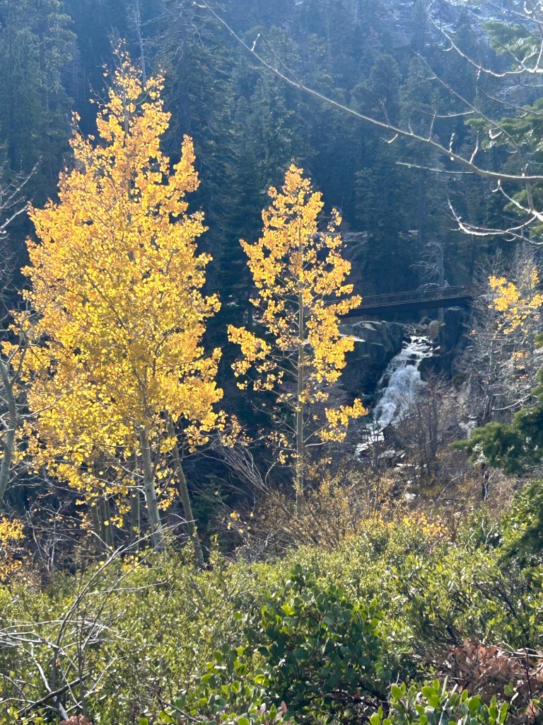
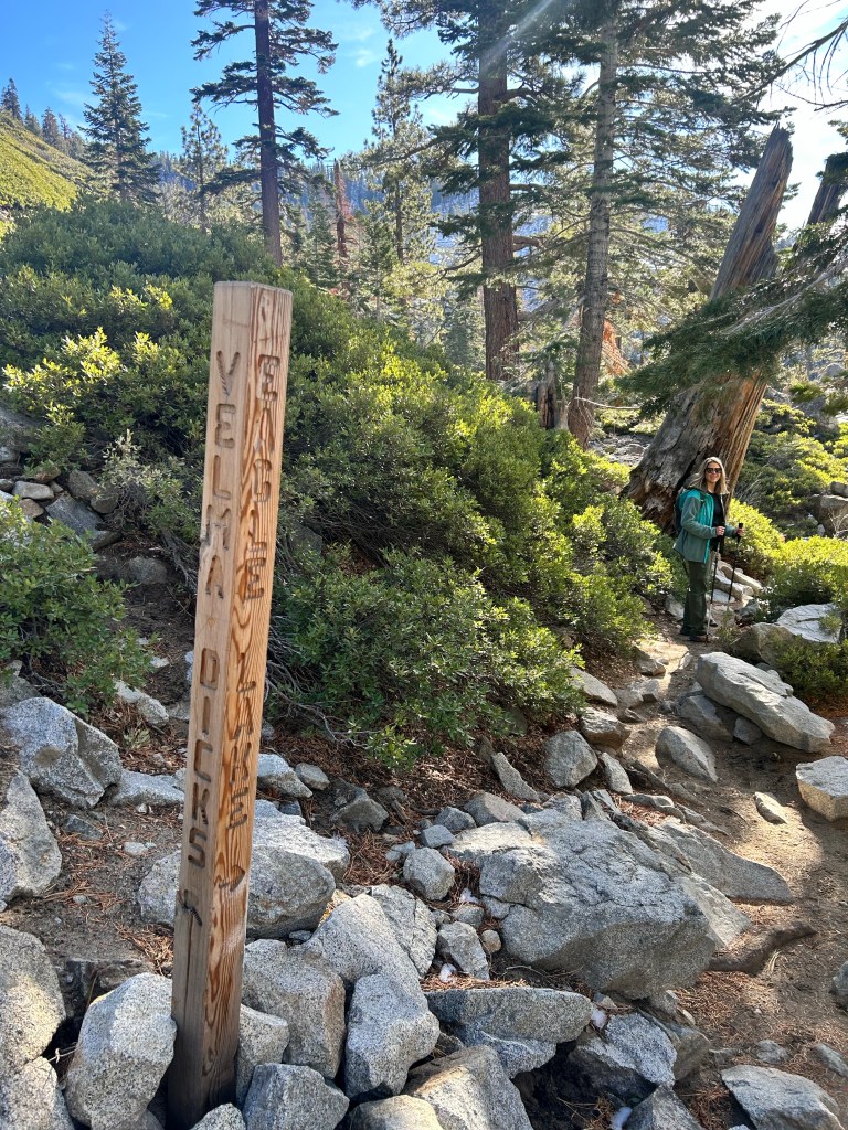
Eagle Lake Trail – Lake Tahoe, CA 11/10/23
Friday, November 10, 2023
Eagle Lake Trail – Lake Tahoe, CA
Clear, sunny, mid 50s
Ian, Court, Greg, Cat, Isaac, MB, Laci, Larry, Angela, Phil, Logan (big group!)
2.1 miles
After Court and I attempted to access the PCT trail head at Echo Lake (in which we almost slid off an icy mountain road in our rental car), we regrouped with the entire group that had come up to Tahoe for Greg’s birthday and did one of the most popular hikes in the area: Eagle Lake.
Even though it is the shoulder season, parking was a challenge. It took us about 20 minutes of waiting to snag a spot. I can’t imagine attempting this in the summer. But we prevailed and headed up the trail, which was a lot of steps, but only one icy section.
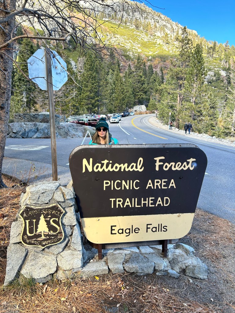
It was only a mile to the top and the views just got better and better. Everyone had a good hike and I’m glad we got this one in, since the PCT seemed to be off the table for this trip.


Recent Comments