Pierce Wanderings
Texas Hiking (and elsewhere)
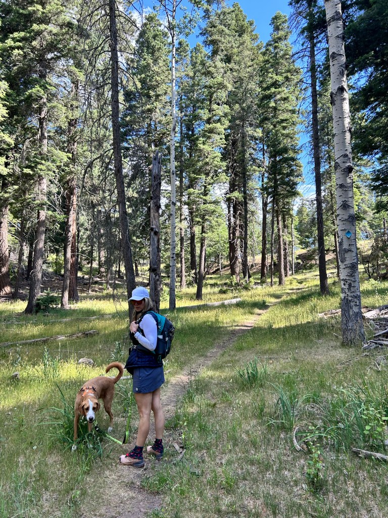
PCT at Donner Summit – Truckee, CA 11/9/23
Thursday, November 9, 2023
PCT at Donner Summit (mile 1158) – Truckee, CA (near Lake Tahoe)
Ian, Court, Greg, Cat, Isaac, MB
Sunny, cold, snow on the ground!
Only a quick jaunt
We flew up to Lake Tahoe for my buddy Greg’s 40th birthday and got some hiking in, despite the snow and ice, which I’ll get to later.
The first day we drove up to Truckee along the west side of the lake and also stopped at the Tallac Historic Estates on the way up. We used the GuideAlong app, which if you aren’t aware, is the best road trip app ever made. It follows you via GPS and tells you all kinds of facts about the area and places to stop along the way. They’ve massively expanded their tours in the past year or so and I am a HUGE fan.
www.guidealong.com for anyone interested


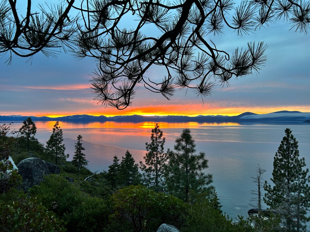
We then kept driving up the west side of the lake and stopped at the overlook for Emerald Bay.

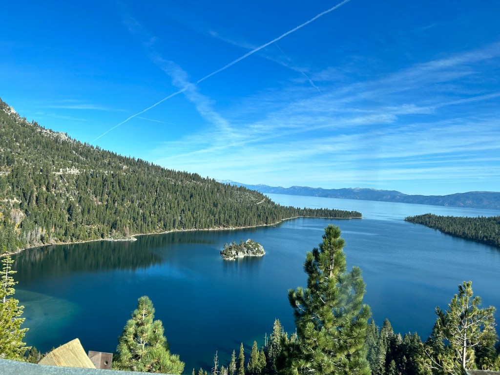
We carried on up to Truckee and we’re planning on getting a couple of miles in on the PCT at Donner Summit, but the snow had other plans.
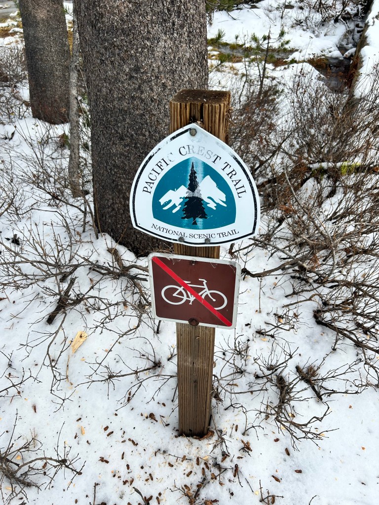
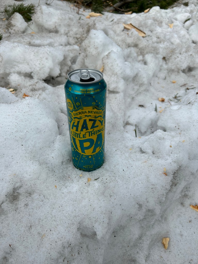
Literally a mile down the road toward the lake there was no snow at all. We decided to just hike in a few hundred yards, had a snowball fight, and then a beer at the trail head instead.

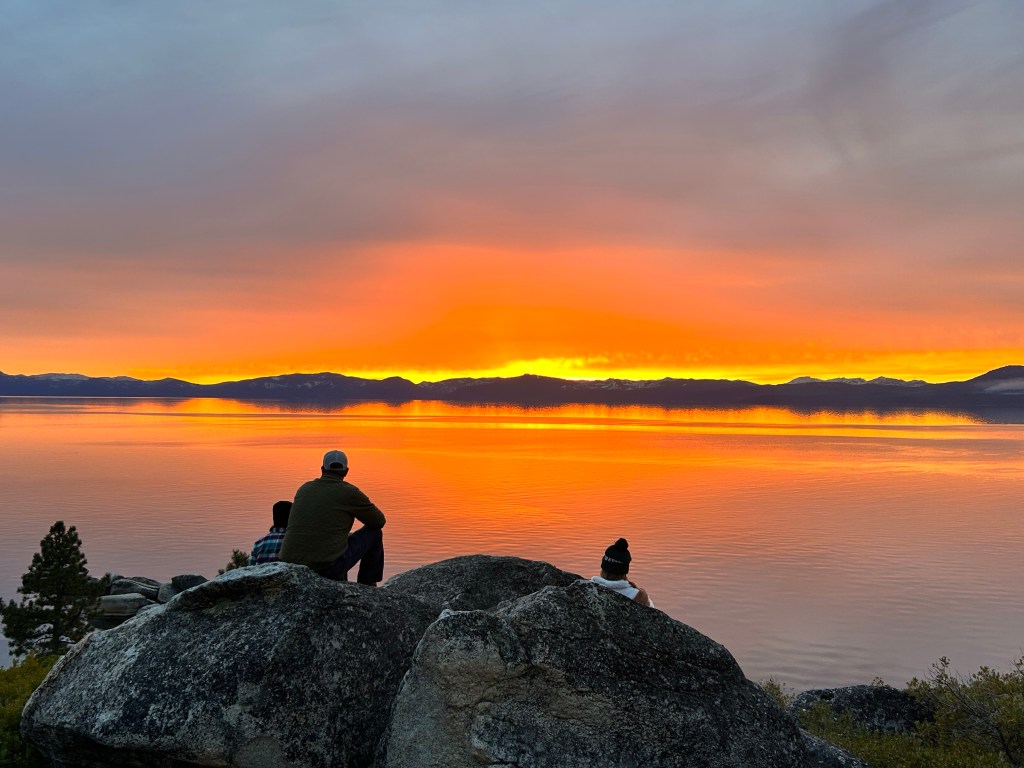
It would turn out to be a good thing we didn’t do this hike, as the drive back on the east side of the lake treated us to one of the most beautiful sunsets we have ever seen. We stopped for a good 30 minutes to watch the ever changing sky and took probably 50 pics.

More Tahoeadventures coming on the next post.
2023 Annular Eclipse
October 14, 2023
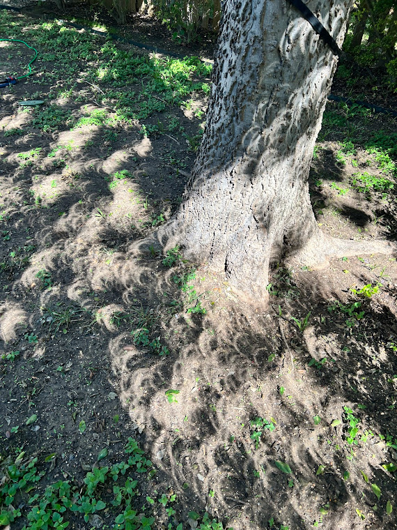
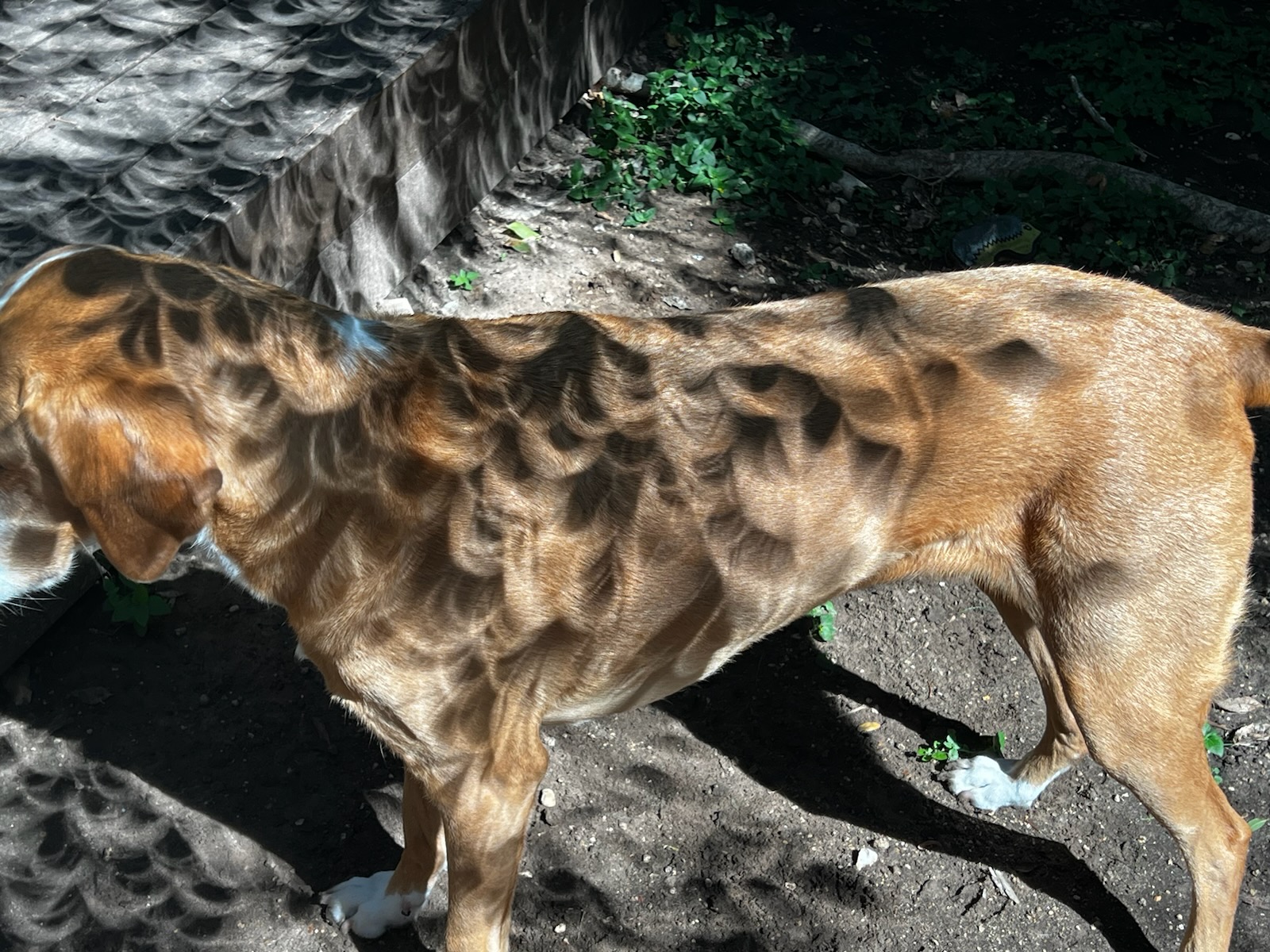
Austin was in the path of the annular eclipse this year and I got some cool pics of the shadows. Didn’t have a filter for the camera to look directly at the sun, though we did have glasses. I’m also going to try and get camping reservations for the full eclipse next April, as the path of totality will go over several state parks in Texas.


Court looking through the glasses at the sun
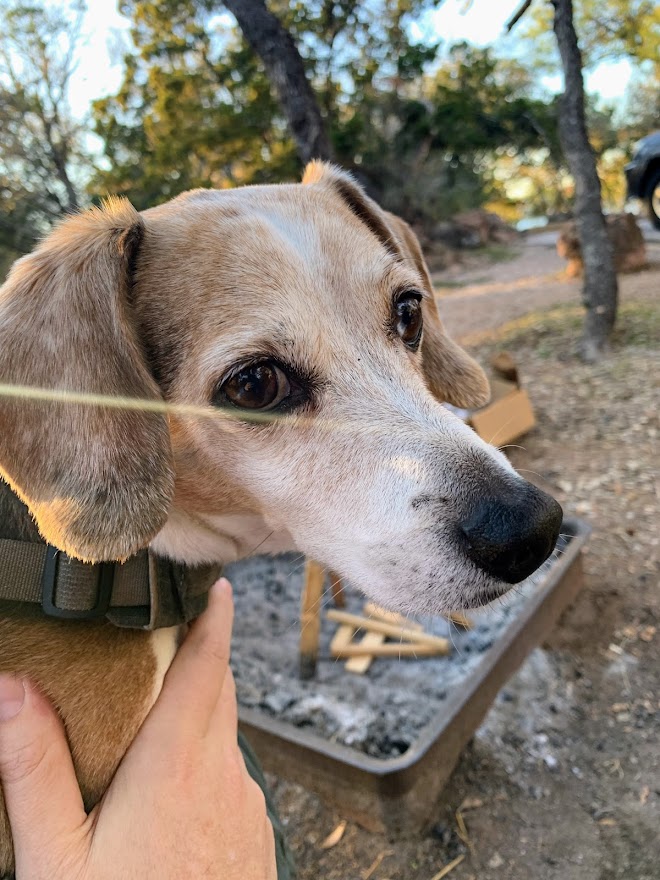
Finnigan
White Sands National Park – New Mexico 7/3/23
Monday, July 3, 2023
White Sands National Park – New Mexico
Ian, Court, Biff, and Finn
About a mile
This may be the only national park we get to this year, despite my attempt on the PCT.
It also may be the only time we ever go here. I’m glad we did. The park is a unique experience and a beautiful place.

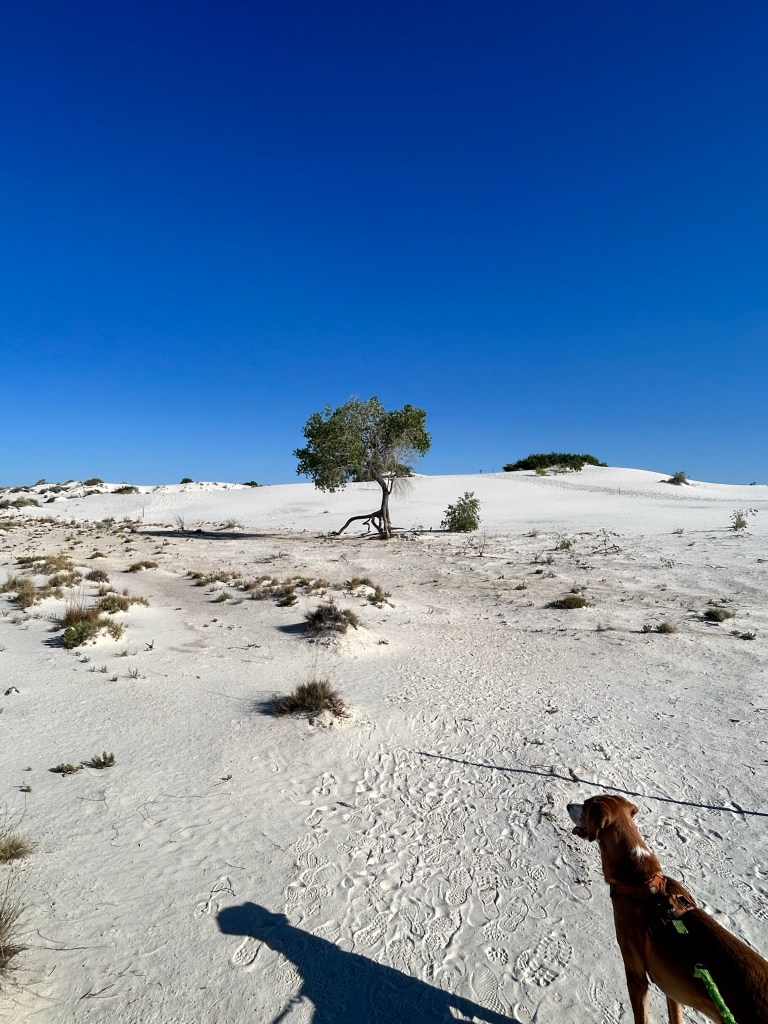
We got out to the park early, before the visitor center even opened, in order to beat the heat. Because of this, the sand was actually quite cool. This is also one of the only national parks where dogs are allowed on all trails. I suspect this is due to the lack of wildlife here.
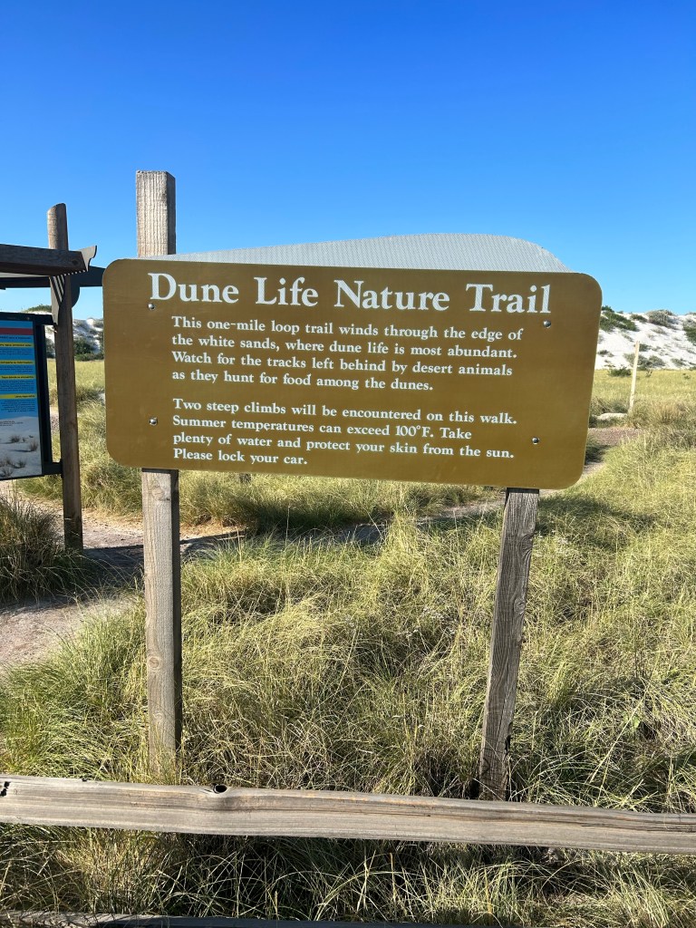
The pups loved the sand (especially Finn) and we had a nice walk on the Dune Life Nature Trail, which is in the “interdune” area. This means it is mostly sand, but also has some vegetation, so it is home to more wildlife than the straight sand dunes further out.
The trail was found using markers set about 50 yards apart, among the dunes. It was very unique and beautiful.


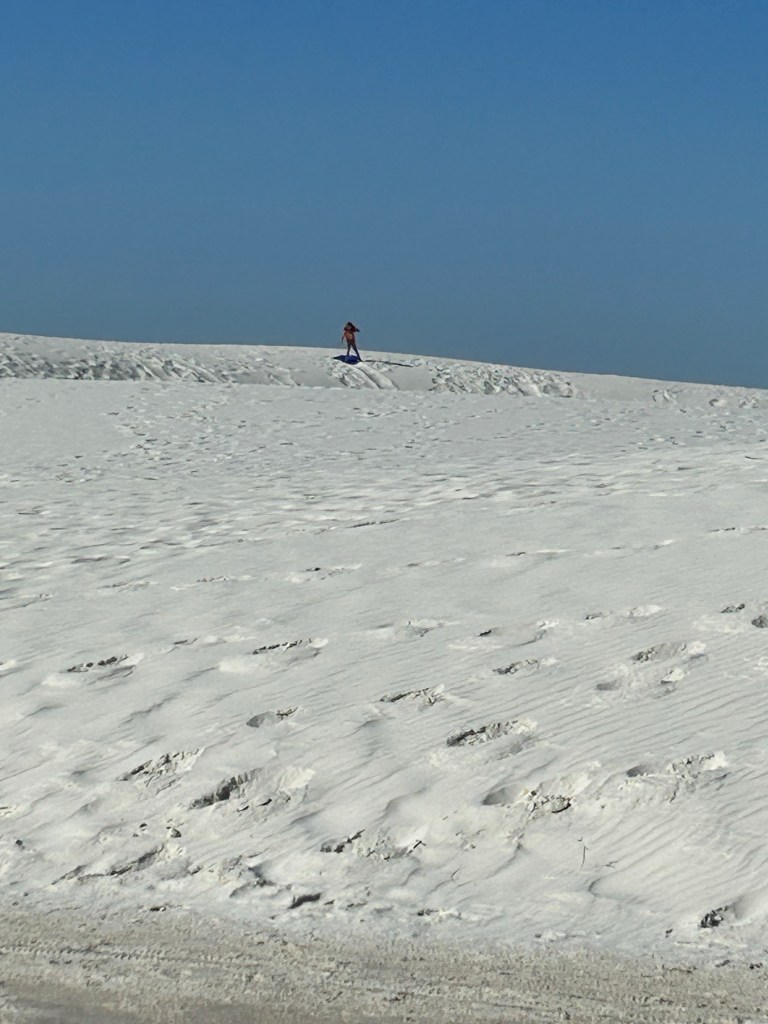
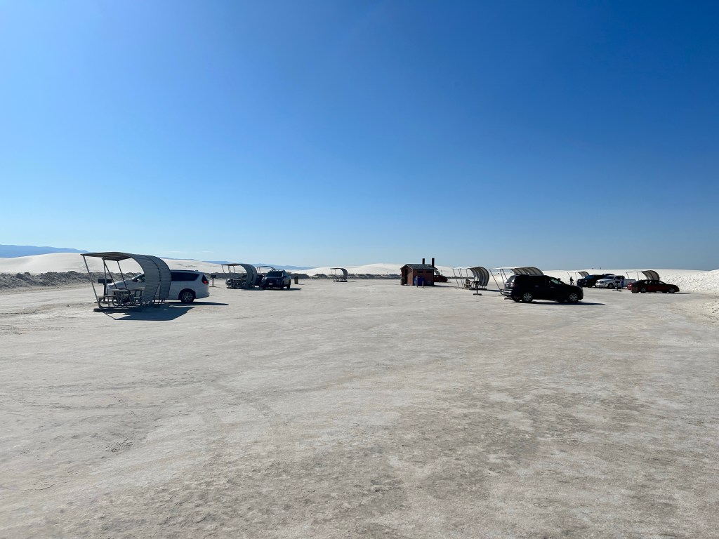
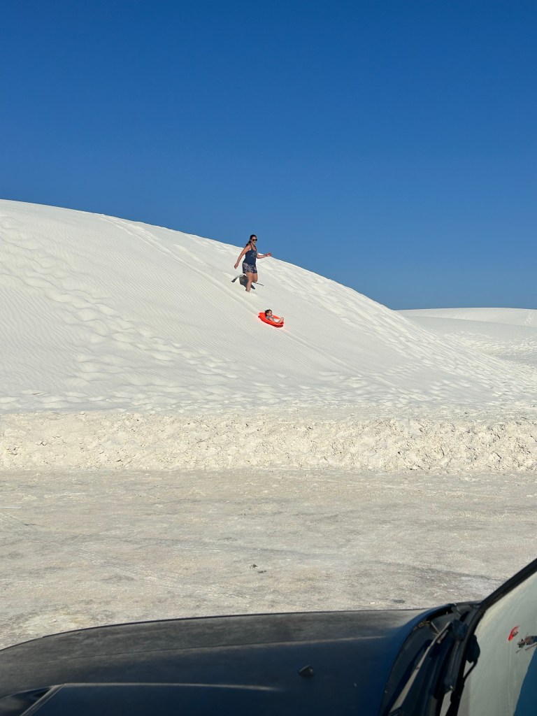
We got back to the car and drove the rest of the road out to the main dunes and saw a bunch of people had arrived while we were out hiking. It was interesting seeing so many people sledding, playing, and even tanning (!) out on the white sand. My dermatologist wife did not approve. 😝
We drove back up the mountains to Cloudcroft once the sun started getting to be too much and were glad to be back at elevation. We are definitely mountain people, not desert or beach people.
Fir and OSHA Trails, Lincoln NF – Cloudcroft, NM 7/2/23
Fir and OSHA Trails – Lincoln National Forest – Cloudcroft, New Mexico
Ian, Court, Biff, and Finn
3-4 miles total
We got out of the summer heat of Texas (some of the worst ever, so far) for the 4th of July weekend and headed up to the mountains of Cloudcroft, New Mexico. My good friend Nikki has a house there and graciously let us stay before she heads up from Burnet for the summer.
The temperatures were in the 70s in the day and 50s at night vs 100+ in Texas. It’s just getting worse and I don’t know how much longer we can take it.

We brought the pups and got a couple of hikes in.
First was the Fir Trail in Lincoln National Forest.

We had planned to link this with another trail to form a longer loop, but the weather had other plans.


We got close to the car again where we were to take another trail, but the clouds were gathering. We knew the forecast had a chance of thunderstorms this day, but they weren’t supposed to hit until 1pm. Alas, at 11am, the skies opened up. Luckily, we only had about 50 yards to get to the car to escape the rain and hail that would last for over an hour.
We went back to the house for a bit and enjoyed the cool rain on the back deck overlooking the forest. The temperature dropped to 49 degrees!
Once the rain subsided, we decided to go on another hike, since we only had two full days here. The OSHA Trail begins just outside of Cloudcroft and is one of the most popular in the area. It’s a nice loop that isn’t too hard, but has some nice views and good shade in the forest as well. Lots of dogs on this one!


The next day, we would drive down to the desert to White Sands National Park, just recently promoted to that status.
Escaping the Texas Heat
Friday, June 30, 2023
I’m heading out to New Mexico tomorrow to escape the Texas heat and I’m going to visit White Sands National Park. Yes, it will still be hot in the park, but I’m staying in Cloudcroft at 9000 feet, so overall it will be lovely. That said, since this is, ironically, going to probably be the only national park I visit this year, I wanted to post this quote by Dayton Duncan, main writer of the Ken Burns National Parks documentary. I have paraphrased this quote many times to people and it chokes me up every time. Especially when I’m on trail.
“At the heart of the park idea is this notion:
By virtue of being an American, whether your ancestors came over on the Mayflower or whether they just arrived, whether you’re from a big city or from a rural setting, whether your daddy owns the factory or your mother is a maid…
You, YOU, are the owner of some of the best seafront property this nation’s got. You own magnificent waterfalls, you own stunning views of mountains and stunning views of gorgeous canyons. They belong to YOU. They’re YOURS.
And all that’s asked of you is to put it in your will, for your children, so that they can have it too. Hopefully, you won’t let it be sold off, you won’t let it be despoiled. Hopefully, you’ll provide for proper maintenance of this property that is yours.
But that’s all you’ve got to do, now…that’s quite a bargain.”
PCT 2023 blog!
Dear reader,
Just a heads up that I am starting my PCT hike on April 24th! This blog will be quiet for a while, but if you’d like to follow, I’m blogging the hike at www.mexicotocanada2023.com
Happy Trails!
Inks Lake Overnight 12/3/22-12/4/22
Saturday, December 3 – Sunday, December 4, 2022
Inks Lake Overnight
cloudy, chilly, slight breeze
Ian, Court, Biff, Finn
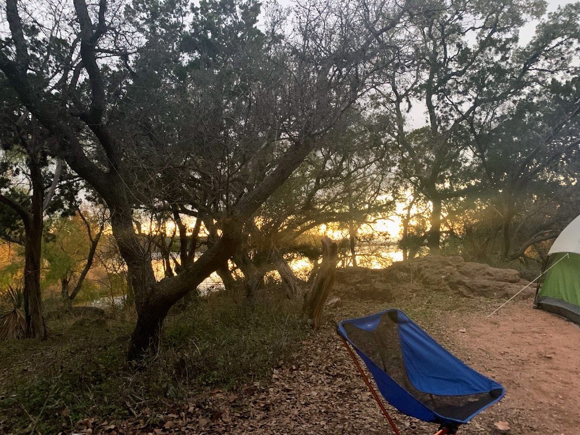
We made it out to Inks Lake after having to reschedule on Thanksgiving weekend due to weather. It worked out much better and I’m glad we moved our dates.
This will probably be my last camping trip with the fam for a while, as my PCT hike is happening this spring! More on that later.
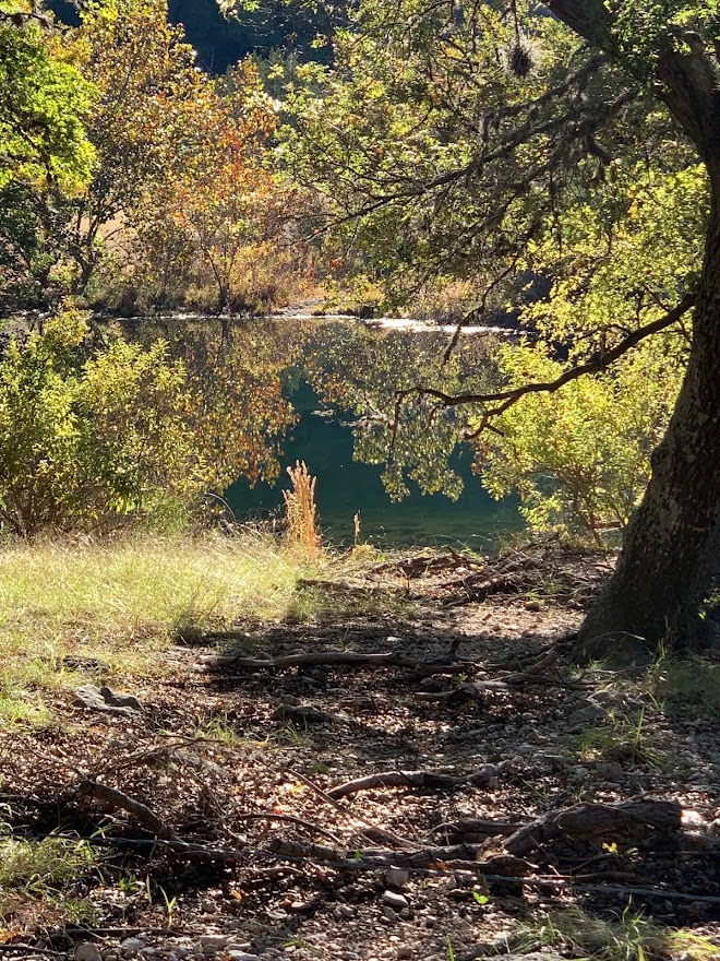
We just had the wettest November in years, so the water out at Inks was flowing really well and we also have some of the best fall color in central Texas that I can remember. We had a cold snap last week and all of the trees apparently took that as a sign to change all at once.


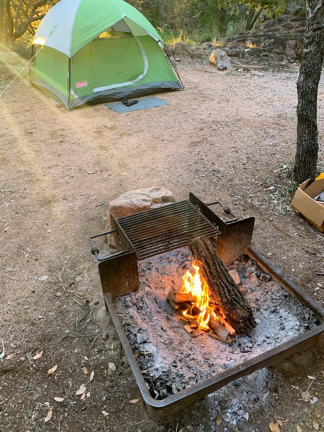
We got to try out the new lead line we got to attach the dogs to while we set up camp. It worked great. Thanks Ryan and Kelly for the idea! We also used our new Eureka car camping stove that we got last Christmas to make a real dinner.

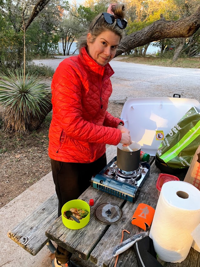
This was also the first time in a while we’ve been able to have a campfire, as the wet November did away with the burn bans in the hill country. It was a fairly chilly night, so we enjoyed sitting around the fire with the dogs, playing games and sipping beers.
Everyone was cold in the morning, but we made coffee and breakfast tacos before packing up a getting a quick hike in. There was a nice waterfall that hasn’t usually been there in the past, but the water is flowing great right now.


one of my favorite views at Inks
We just did a short loop of about 1.5 miles, but it was a nice way to start the morning and get a little warmed up before we hit the car on the way back. Biff was happy to fall asleep on Courtney’s lap on the way home.


As I mentioned, my Pacific Crest Trail hike is on for 2023! Some of you may remember that I was going to go for it in 2020, but a variety of things derailed my attempt, including Covid of course. As of this writing, I have an approved starting date of March 8th, though I’m going to try and change that date in January to something a little later.
My posts here will probably slow down and then dry up completely as I get closer to my hike, but I will be blogging it on my other site, http://www.mexicotocanada2023.com!
I’m doing this mainly to have a record of my hike for my future self, but follow along if you like!
Lost Maples State Natural Area Overnight 10/29-10/30/22
Saturday, October 29 – Sunday, October 30, 2022
Lost Maples State Natural Area Overnight
Calm, chilly, low 40s overnight
Ian, Court, Ryan, Kelly, Biff, Finn, Darcy
7 miles round trip
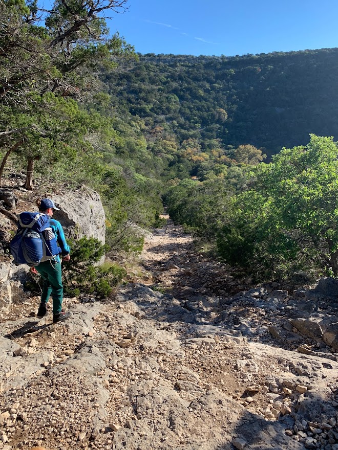
We got out to Lost Maples and met up with Ryan and Kelly and their Giant Schnauzer, Darcy, for an overnight backpacking trip. They had actually gotten to the park the day before and snagged a good camping spot for us, as the primitive sites are first come, first serve. Thanks guys!
Ryan and Kelly live near Ft. Worth and we’ve hiked with them a couple of times in the past, including at Yosemite when Greg and Cat got married in 2019.
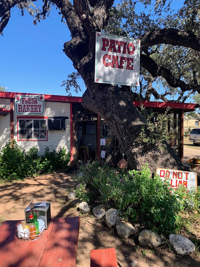
Court and I stopped at our usual spot in Medina to grab a veggie burger on the way to the park.

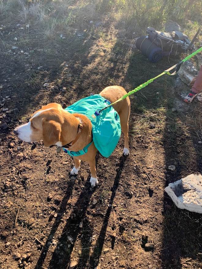
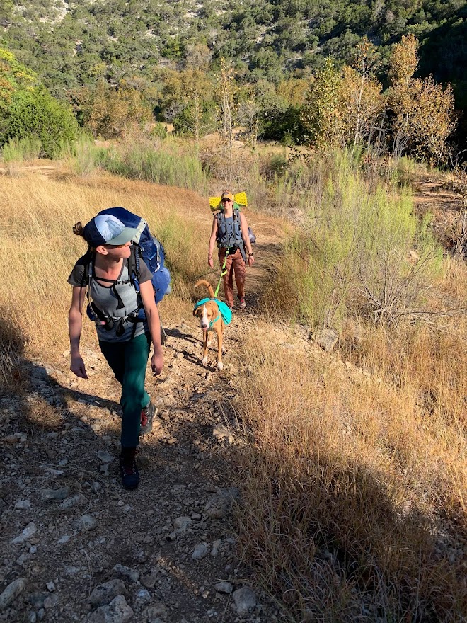
The weather has been too warm for any real vibrant color in the leaves this fall, but there were a couple of trees that did their best. Nothing like where we were in northern Georgia a week ago, but what can you do? This was also Finn’s first hike with his new backpack! He wasn’t super excited at first, but I think he got used to it. He was able to carry all the dog food and bowls for us. Biff got off easy.

We had arranged to meet up with Ryan and Kelly at the pond in the middle of the park a couple of miles in, and luckily we found them quickly, as there is no cell service in most of the park. They had procured a spot up on top of one of the plateaus with great views. We made the climb up the rocky trail and proceeded to set up camp.
Biff was very excited.
After getting set up, we took a quick hike to the overlooks on the plateau before the sun went down.


I brought along my binoculars that Court had given me last Christmas. Ryan is big into astronomy and astrophotography, but I never even thought about using the binoculars at night. We got great views of the moon, stars, and planets through them. We could even see a couple of Jupiter’s moons. The Milky Way was visible too, which is always cool.
After an hour or so of star gazing, we retired to our separate tents. The night before had been very windy for Ryan and Kelly, but the winds died down this night and we all got good sleep.

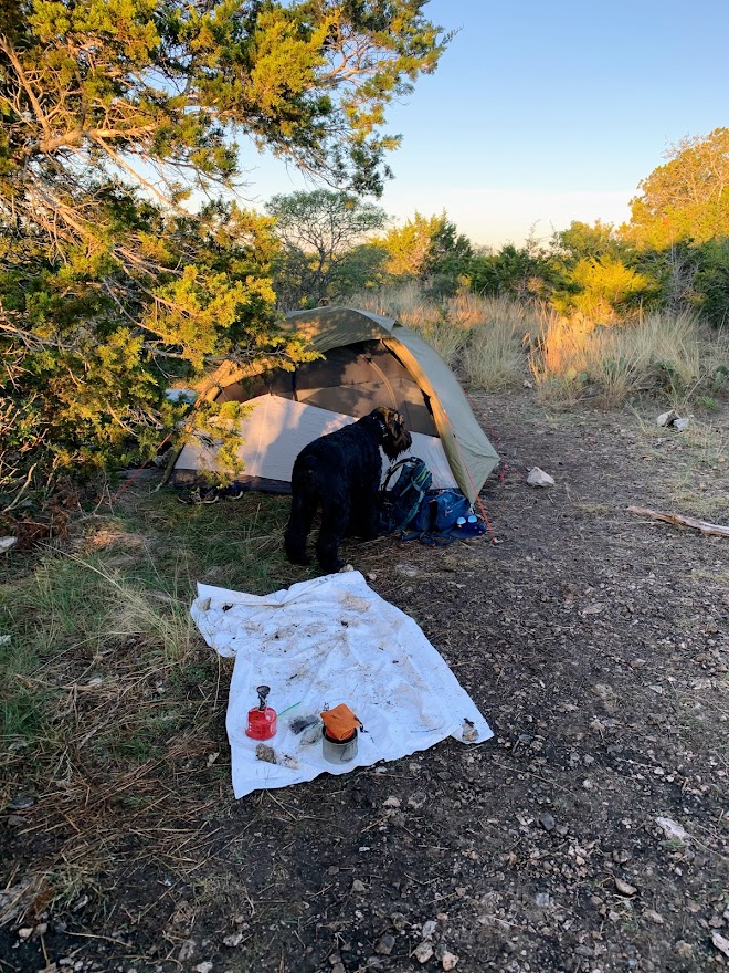
We woke up with the sun and some fairly chilly temperatures. It was only in the low 40s, but Biff quickly found he wanted to be back in the tent under the quilt. We had forgotten his jacket, but Kelly came to his rescue with a warm blanket.

We boiled water for coffee to warm up and sat around chatting as the sun came up and did away with the shadows.

After a leisurely morning, we packed up and started the hike back down the plateau to the car under sunny skies. Mornings at Lost Maples are my favorite time of day.

Lost Maples was the first place we ever went backpacking and is always a beautiful and fun place to come back to. Til next time!
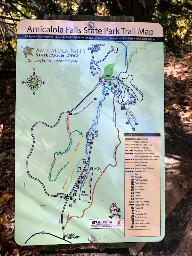
Amicalola Falls and AT Approach Trail – Amicalola, GA 10/23/22
Sunday, October 23, 2022
Amicalola Falls and AT Approach Trail
Cool, upper 60s, sunny
Ian, Court, Greg, Cat, Ike, MB
.5 miles or so
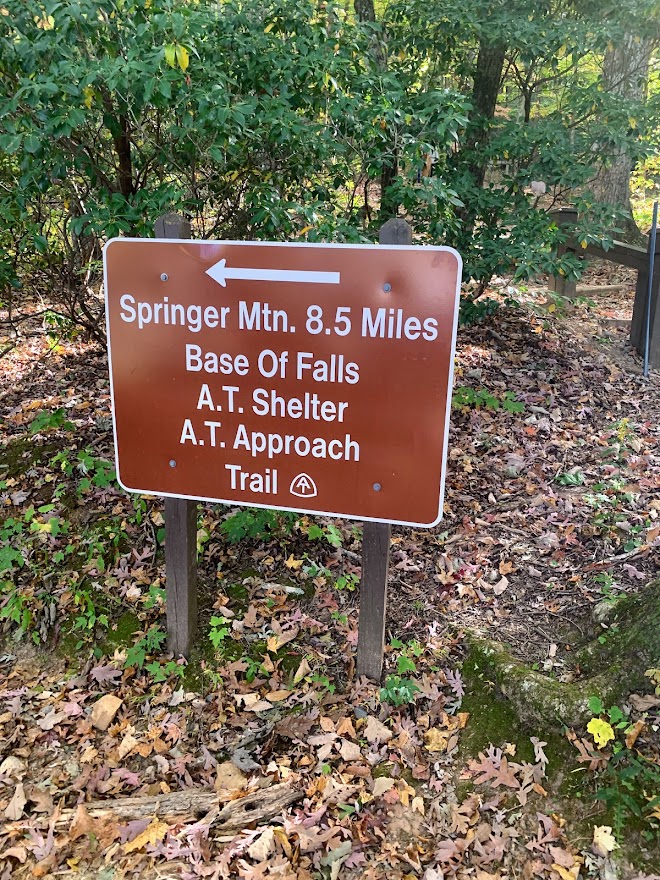
I loved this hike. The Appalachian Trail Southern Terminus is technically at Springer Mountain, which we hiked to a few years ago. The Approach Trail is where most AT Northbound hikers start though. This is 8.5 miles from Springer Mountain and the stone arch marks the beginning of a 2190 mile trek for these intrepid souls.


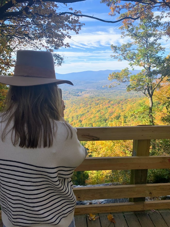
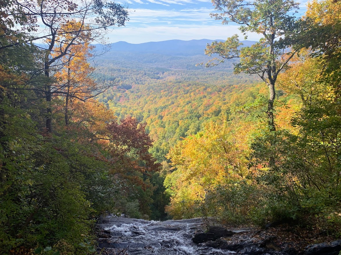
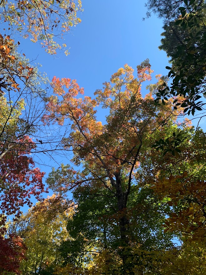
Instead of hiking up from the arch, we decided to drive up to the top of the falls and hike down the 600 or so steps back to the bottom. MB was nice enough to shuttle us to the top and pick us back up at the bottom, since this is a park she comes to often with the kids. Nobo hikers go up the stairs to start their hike and it’s quite the baptism by fire with a heavy pack, I’m sure. The view from the top of the falls is lovely, especially with the fall colors of northern Georgia.
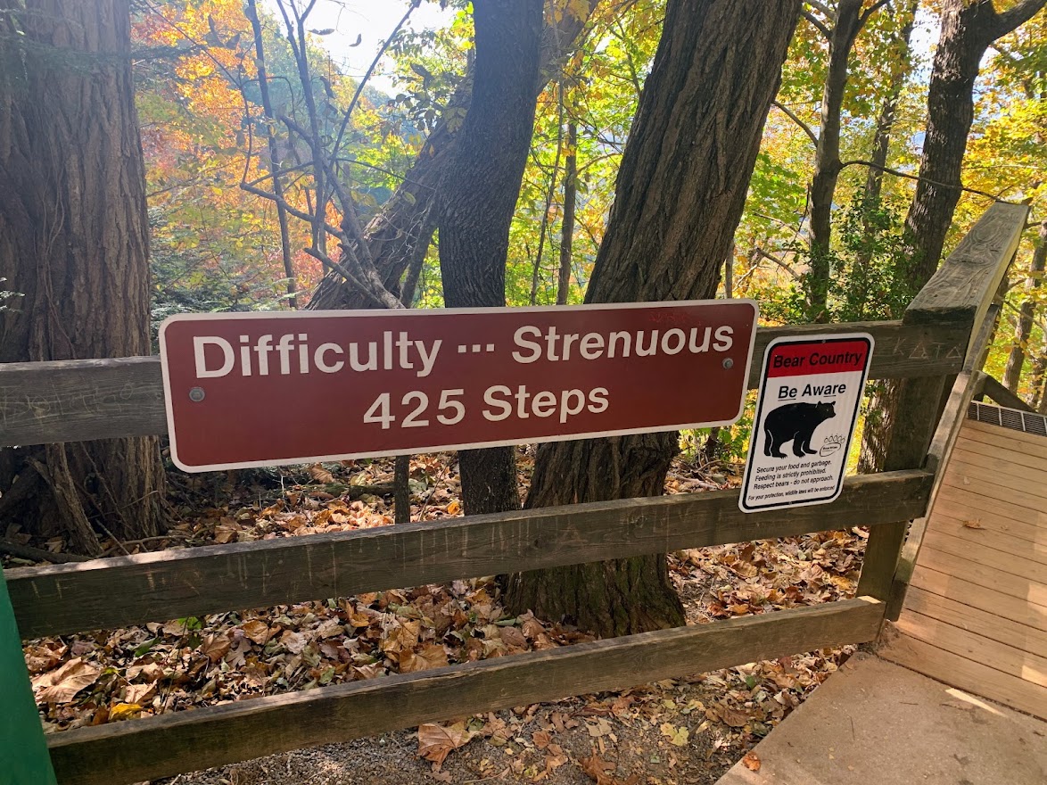

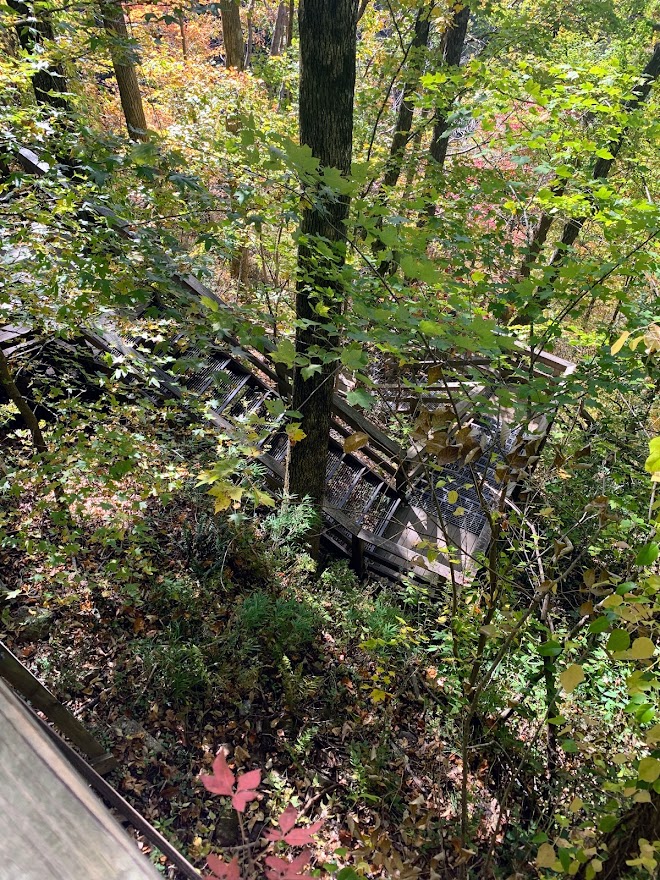

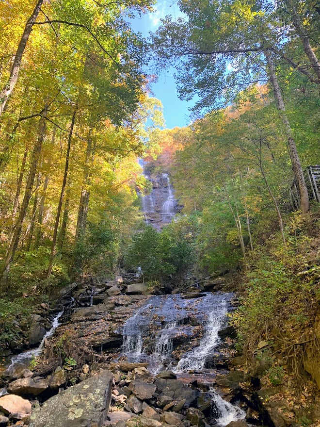
I was very glad to have seen the arch and the approach trail. Yet another long trail landmark checked off my list.
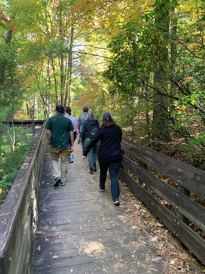
Duke’s Creek Falls – Near Helen, GA 10/22/22

Saturday, October 22, 2022
Duke’s Creek Falls, GA
Cool, low 70s, sunny, pleasant
Ian, Court, Ike, MB, Greg, Cat
2.4 miles
Hey, new blog post! I’ve been hiking the past couple of months, but nothing new until now. We flew to Georgia and met Cat and Greg in Atlanta (they came from San Francisco, where they live) and then drove up to Dahlonega to surprise Isaac for his 40th bday. This was a fun weekend.
On Saturday we drove out to Duke’s Creek Falls for a quick and easy hike. The falls are right along the edge of the Raven Cliffs Wilderness. The trail is partly paved at the beginning and then has a few quick switchbacks down to the falls at the bottom of the ravine, which are accessible via a viewing platform and boardwalk.
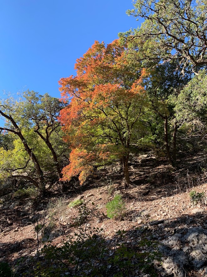
The trees are at peak color change in the mountains of northern Georgia right now and it was beautiful.


Recent Comments