Pierce Wanderings
Texas Hiking (and elsewhere)
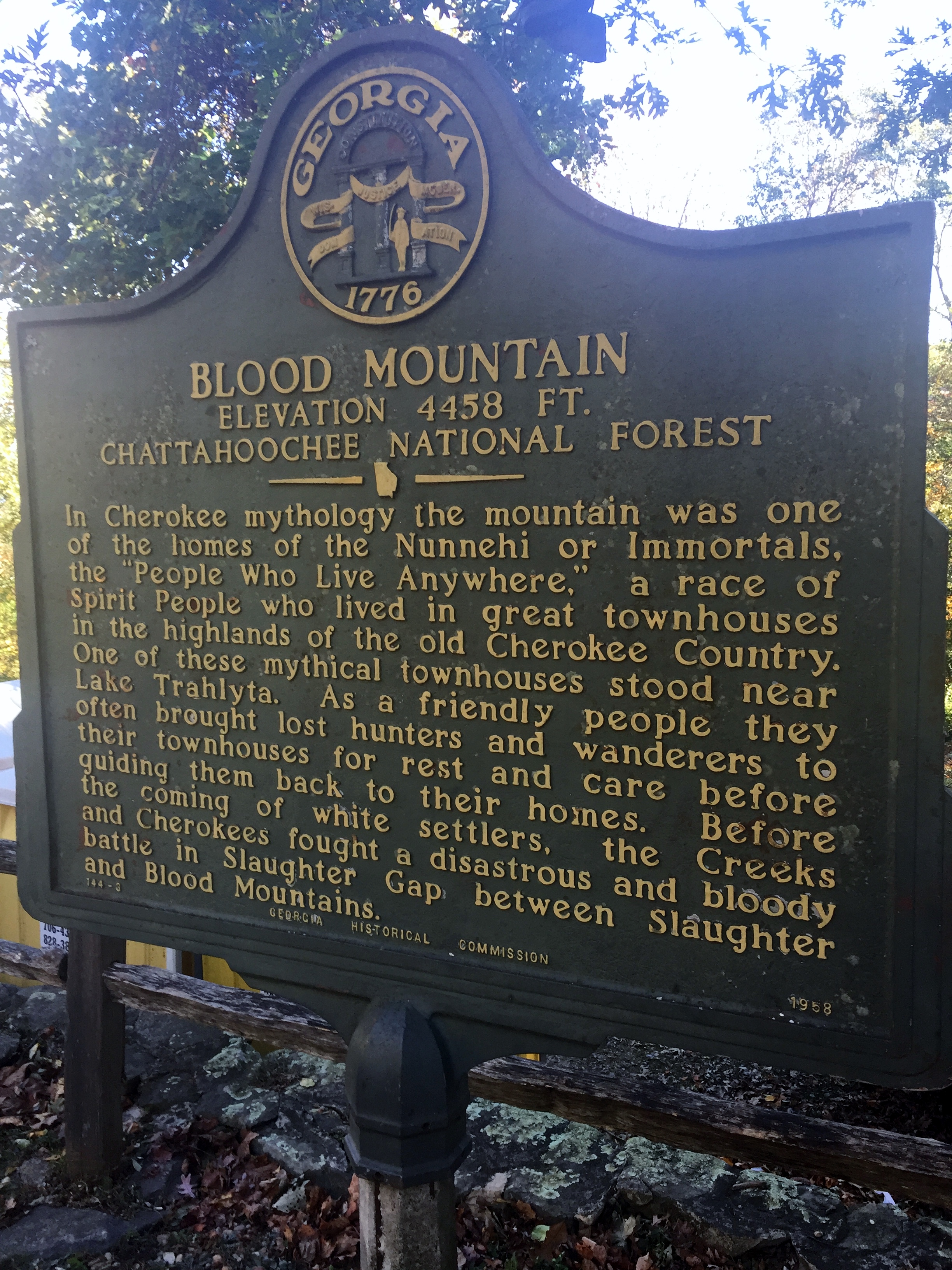
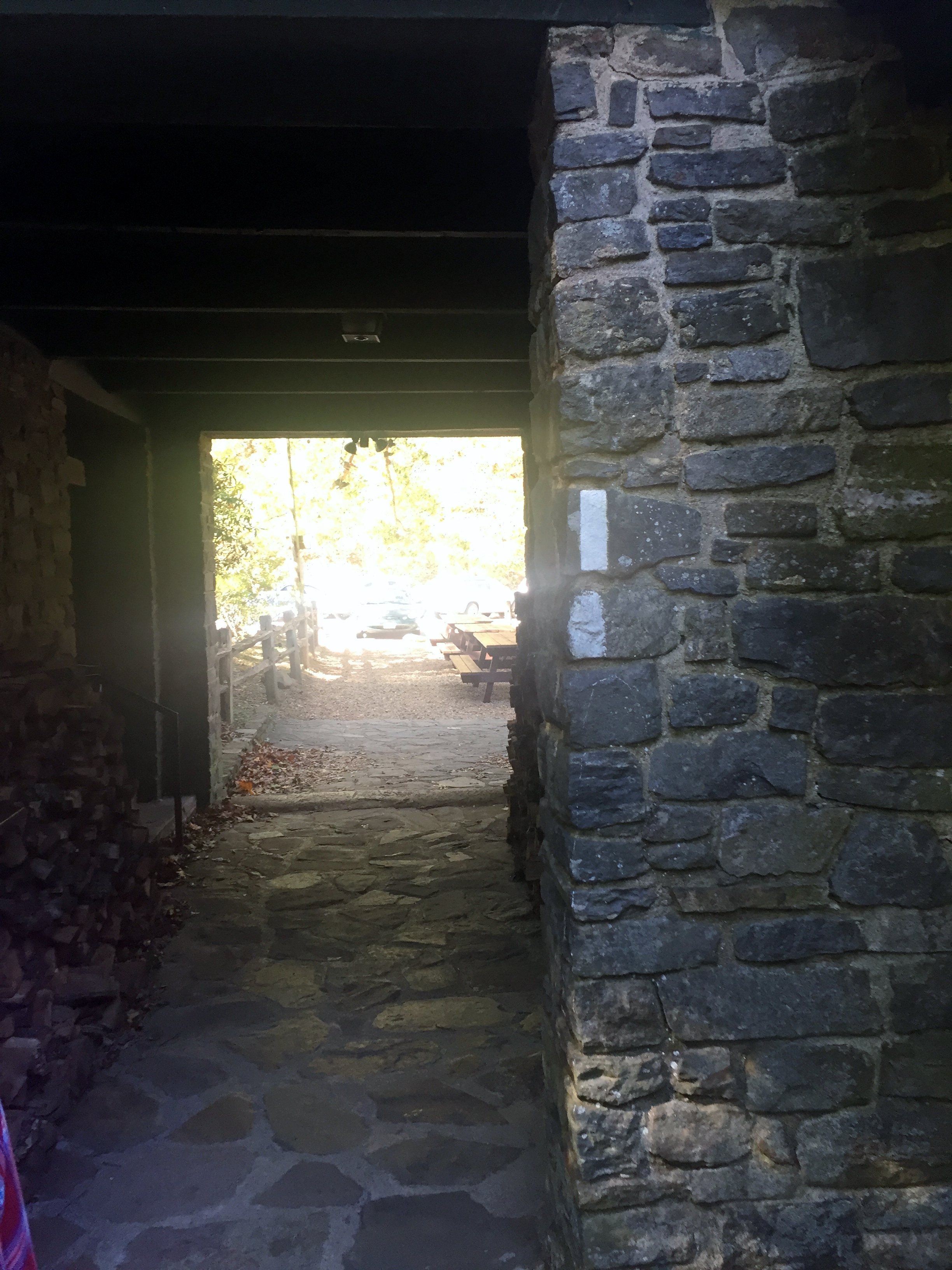
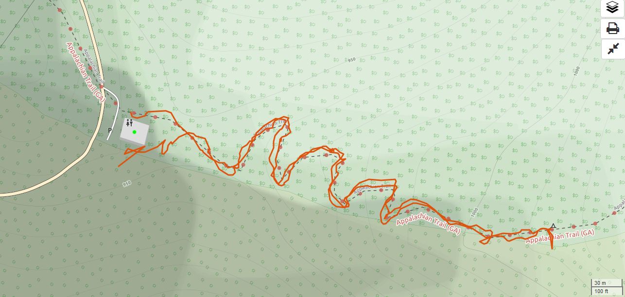
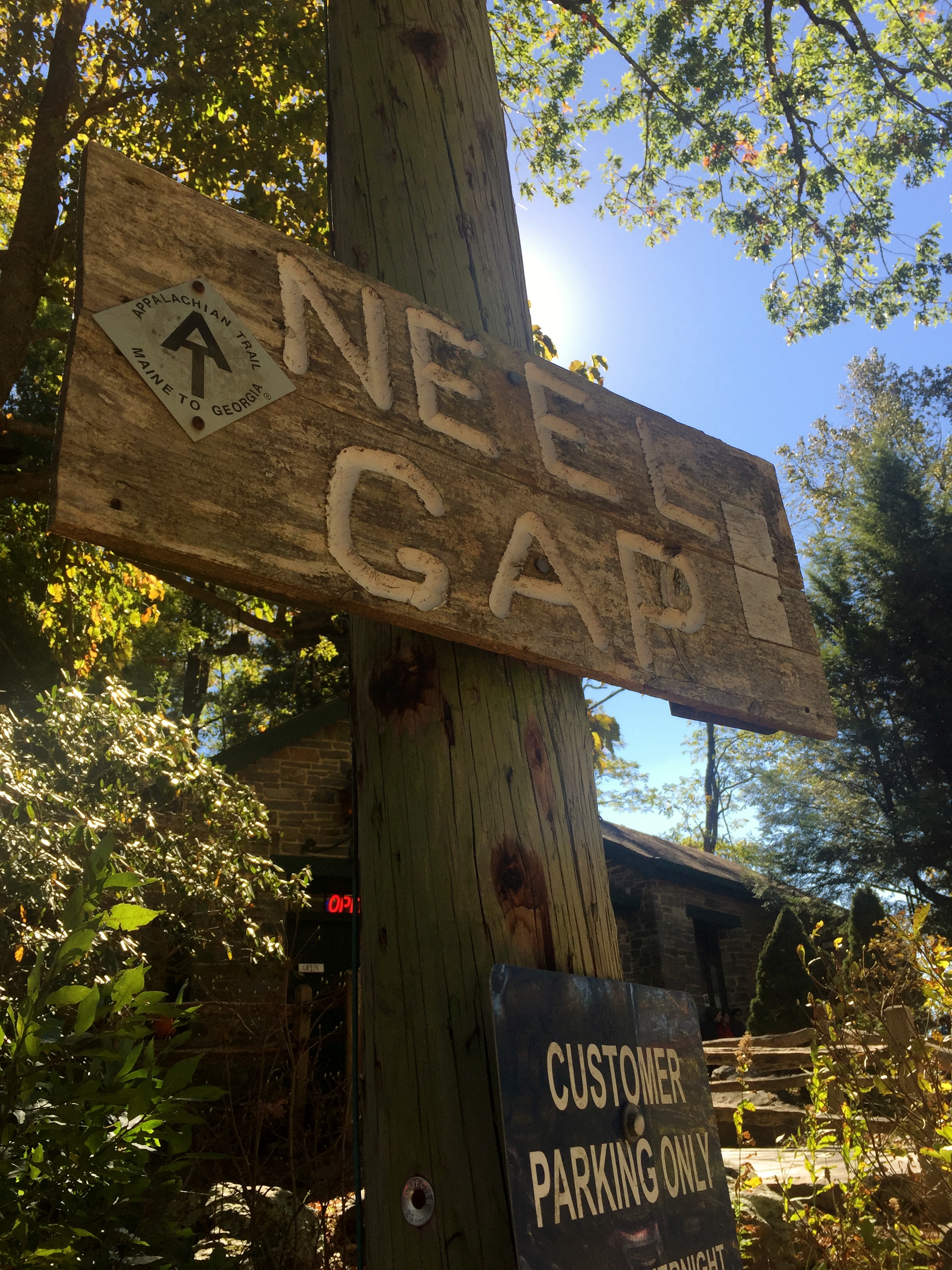
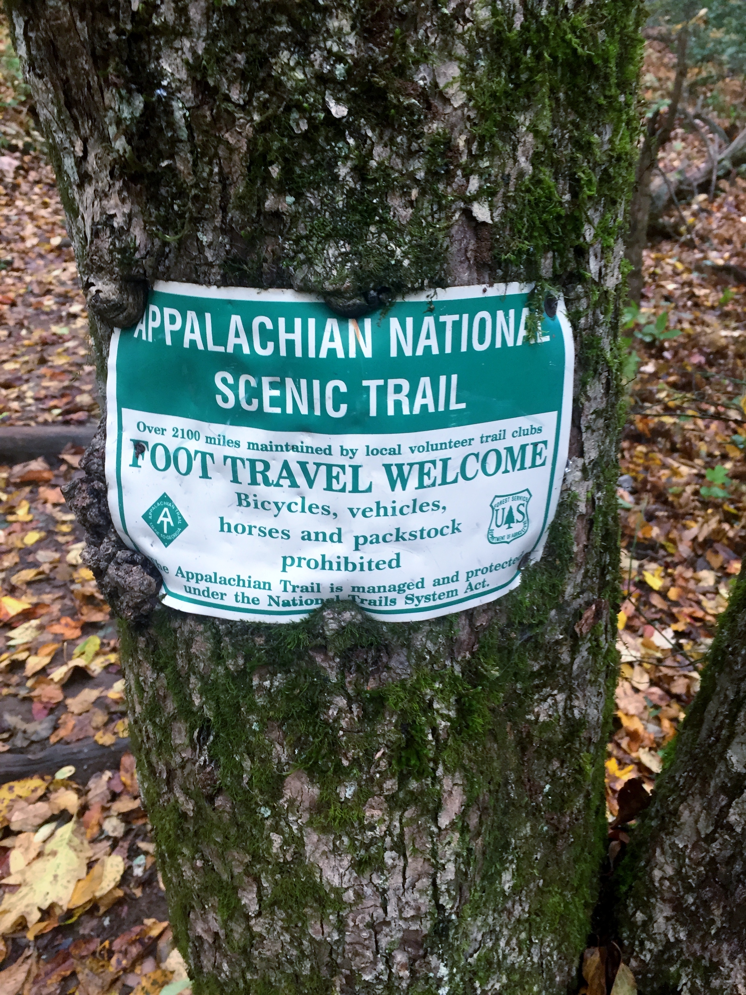
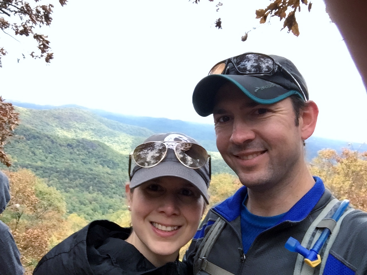
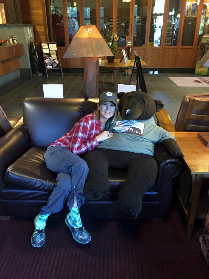
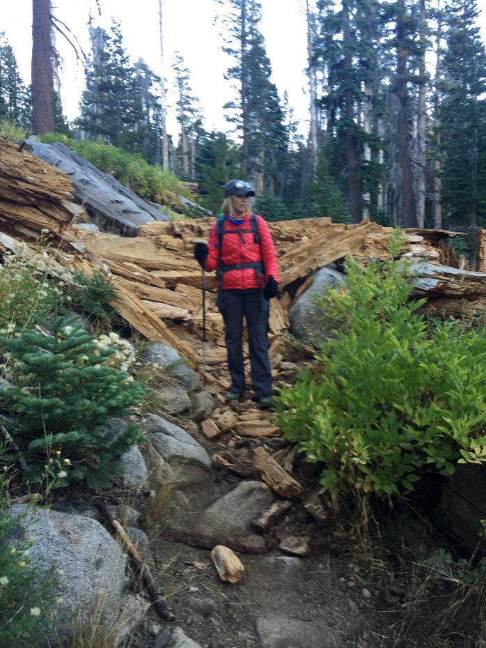
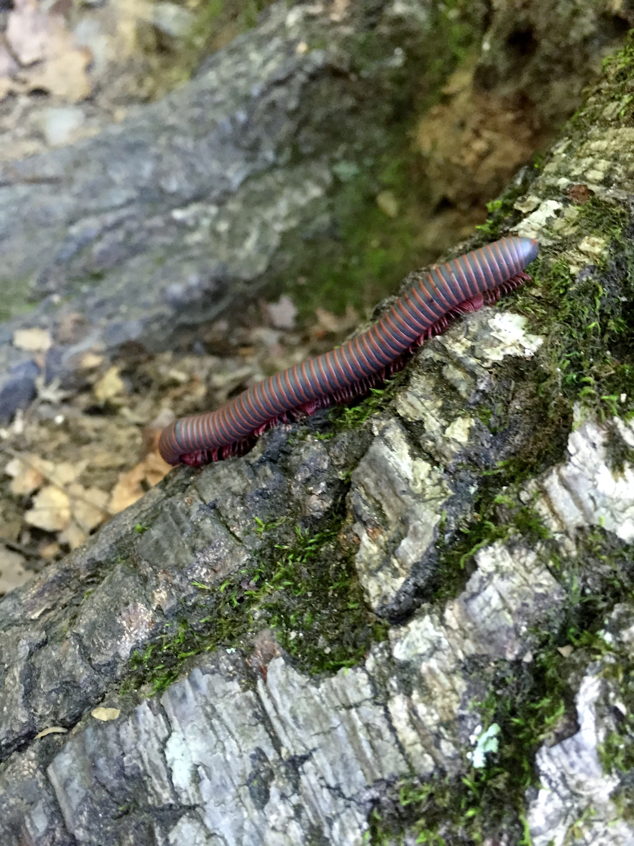
Neel’s Gap and Mountain Crossings Store – Georgia AT 10/23/16
Sunday, October 23, 2016
Hike: Neel’s Gap (Neel Gap?) – Southern AT – near Dahlonega, GA
Weather: cool, sunny, mid 60s
Hikers: Ian, Court, Isaac, MB, Baby Grace
Length: 1 mile
The main highlight here was actually the Mountain Crossings Store which is where a lot of thru-hikers re-supply as well as drop gear they’ve realized they don’t need once they’ve been on the trail for a couple days. We bought several pieces of gear and AT paraphernalia and I could have stayed in that store all day.
After the store we hiked just a bit up the AT heading northbound and then needed to get back because Isaac and MB’s new baby Grace was ready for nap. She went on her first official hike though! Not bad to start on the AT. Got some pretty pics even on a short hike.


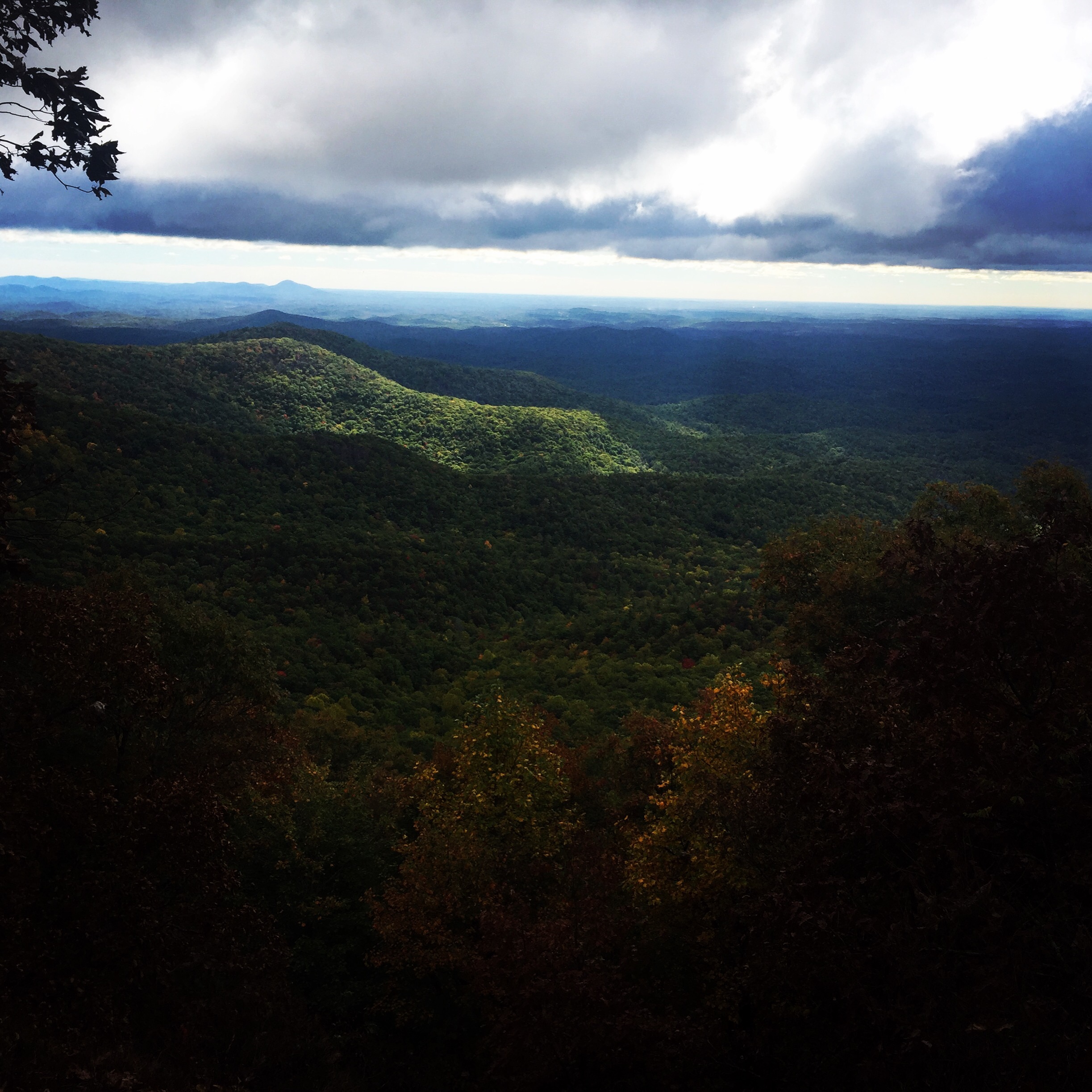
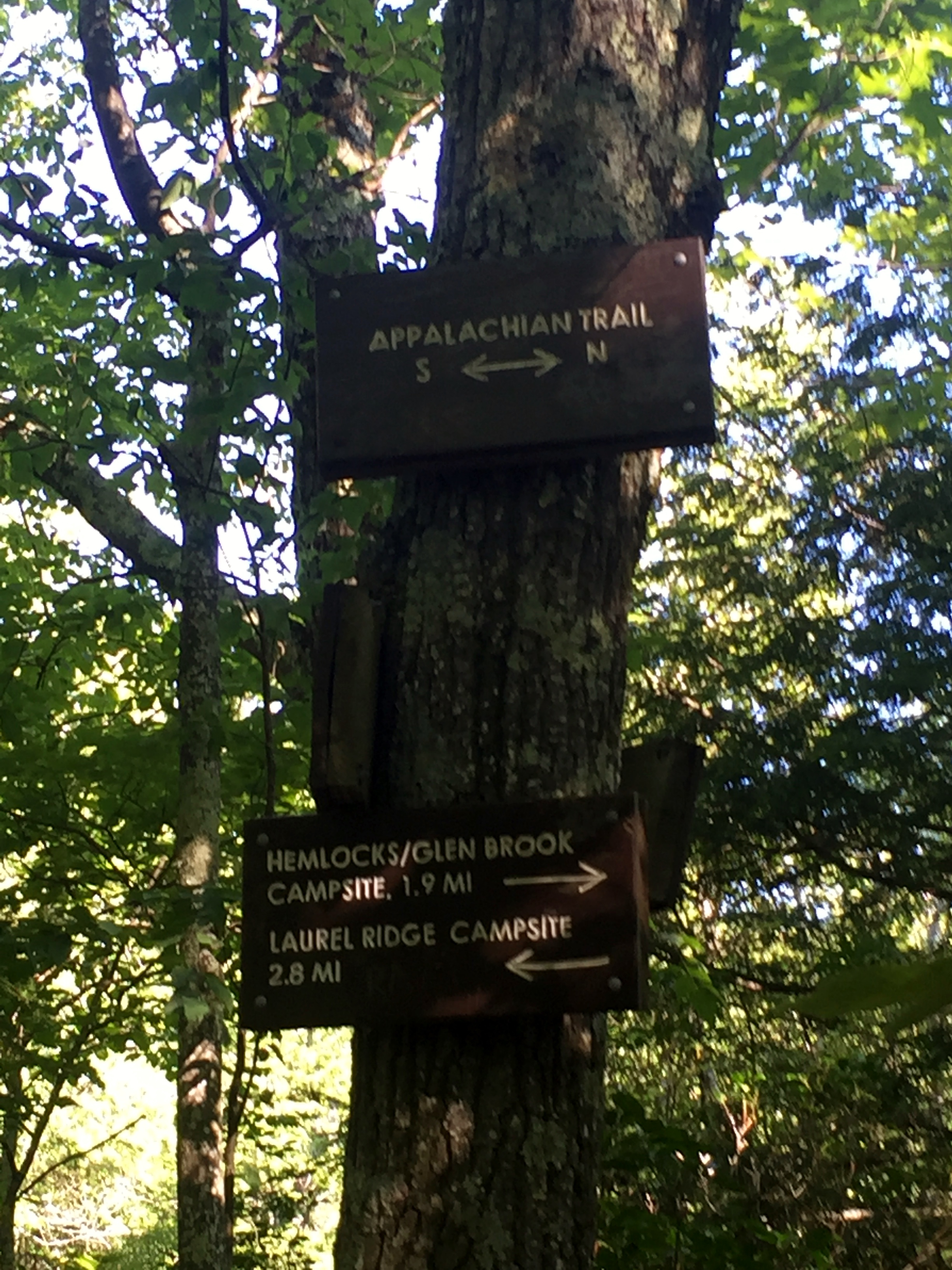
AT Southern Terminus and Benton MacKaye Trail 10/21/16
Friday, October 21, 2016
Hike: Appalachian Trail Southern Terminus and Benton MacKaye Trail, near Dahlonega, GA
Weather: windy, misty, cold, mid 50s
Hikers: Ian, Court, Isaac
Length: 5.13 miles
This was my second hike on the AT in the last couple of months. Last time was in Massachusetts, just a few hundred miles from Kathadin, and this time we were at the beginning of the Trail in Georgia. Quite the change of scenery.
We were staying with Isaac’s in-laws at their house in Dahlonega for his birthday, which is only about an hour drive to Springer Mountain and the Southern Terminus. We woke up early and made the drive, which would be a relatively short trip except the second half is straight up the mountain on a bumpy Forest Service road.
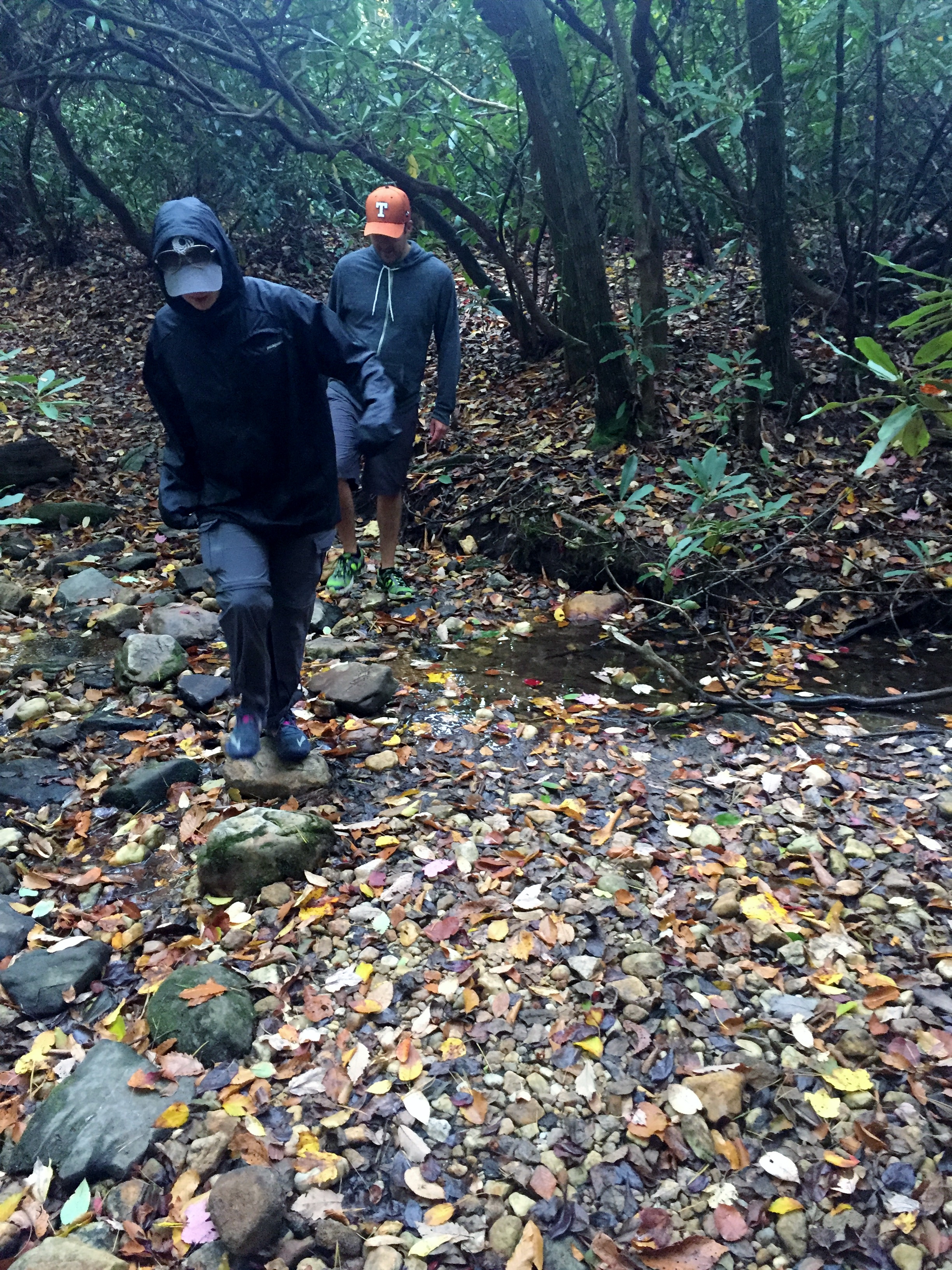
When we got to the Springer Mountain parking lot the clouds were starting to gather. We knew there was a small cold front blowing in, but the front was looking a little more than small at the top of the mountain. Luckily the rain stayed away and it was mostly just a cold wind and some fog, which made for an interesting hiking environment. Court donned my Patagonia Houdini and we set off down the trail…the wrong way.
I realized we were heading north on the AT, when we should have been going south about one mile to the Terminus. We flipped around and headed back the correct way. There were three section hikers heading the same way that we passed who said they were starting a 10 day hike. Good luck to them.


The AT is rocky in this first section, but well maintained, as it was in Massachusetts as well. We quickly reached the Southern Terminus and took photos. There was no view because the clouds had socked us in and the wind was getting stronger, so we didn’t linger. It was very cool to have been at the monument though.
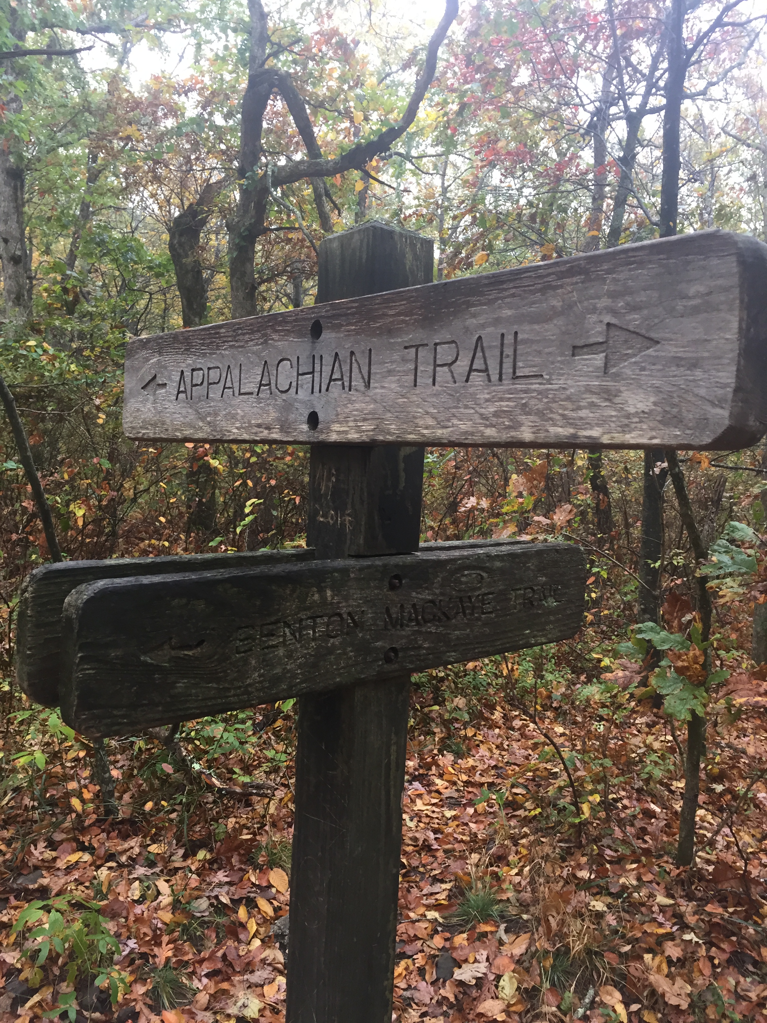


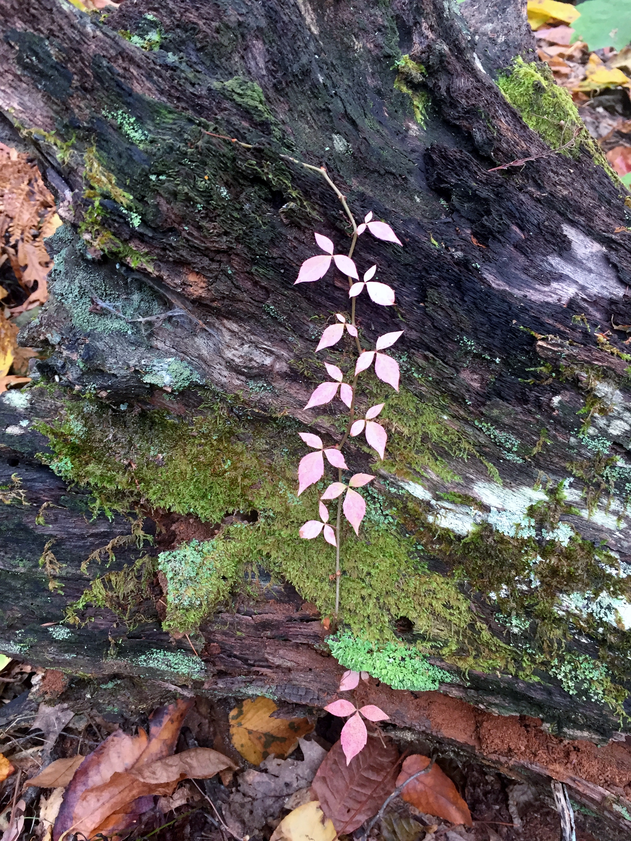
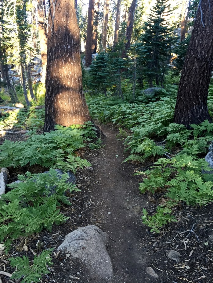
We headed back north, made a quick pit stop to check out the Springer Mountain shelter (we actually just saw the campsites, not the shelter), and then jumped onto the Benton MacKaye Trail to make a loop back to the parking lot. This trail was fantastic. It was really well groomed and actually was grassy in parts, making for a very pleasant tread. The autumn leaves coating the forest floor wove a colorful tapestry of yellows, reds, browns, oranges, and purples.


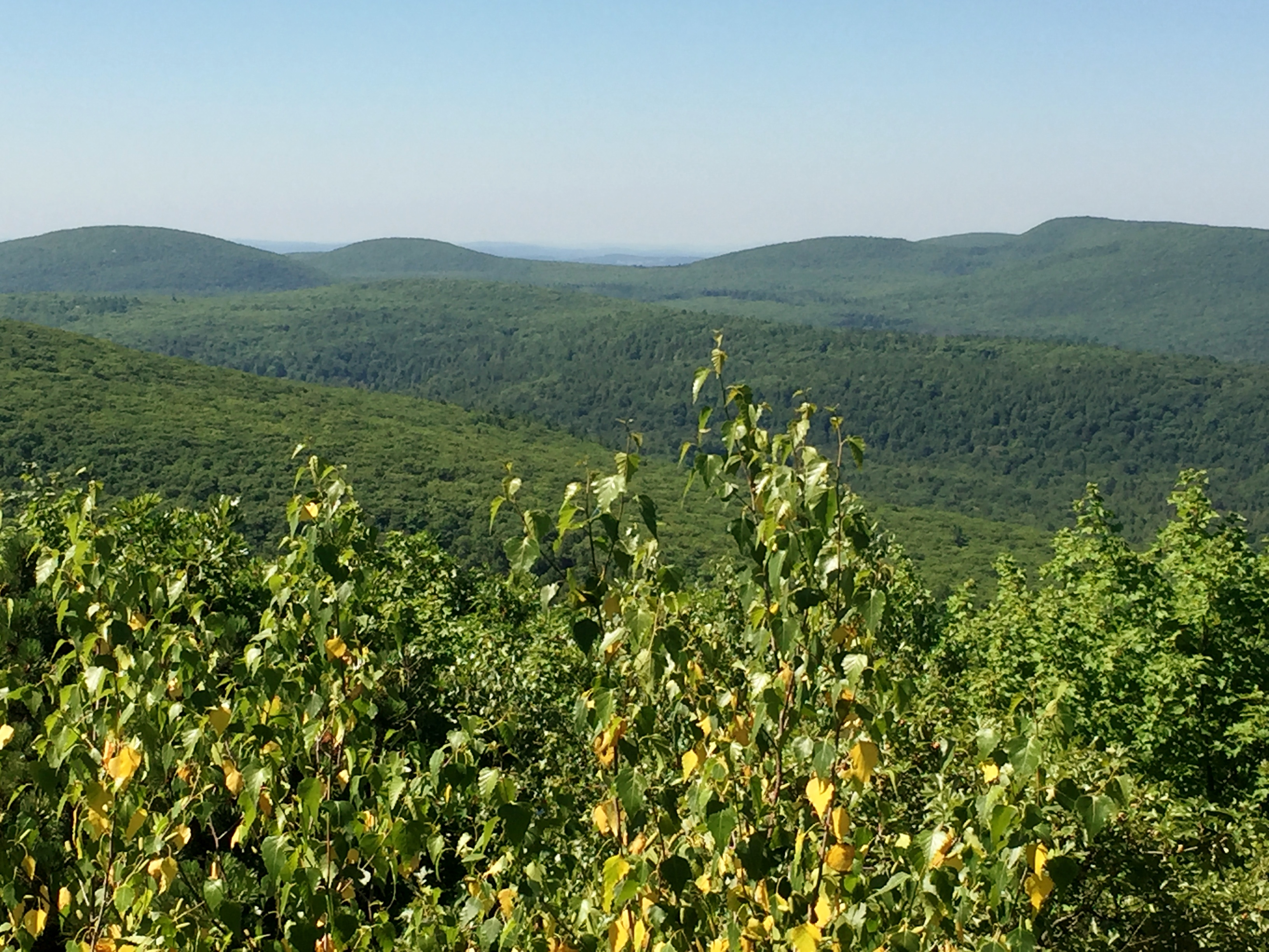
We almost missed the best (and only) view of the Trail because the sign at the junction is barely legible. Luckily we figured it out and found the viewpoint looking south off of Ball Mountain. The sun had started to peek through and the views were spectacular. Of course the photos can’t capture the depth.


We continued on down the Benton MacKaye Trail, crossed the Forest Service road we came in on and wound down into a ravine where it almost started to feel jungle-like instead of forest-like. We decided the bugs here in the summer would likely be intense. The trail climbed back up and intersected the AT where we headed back southbound for a short distance back to the car.
Great hike and glad Ike got to join.


St. Edward’s Park 10/01/16
Saturday, October 1, 2016
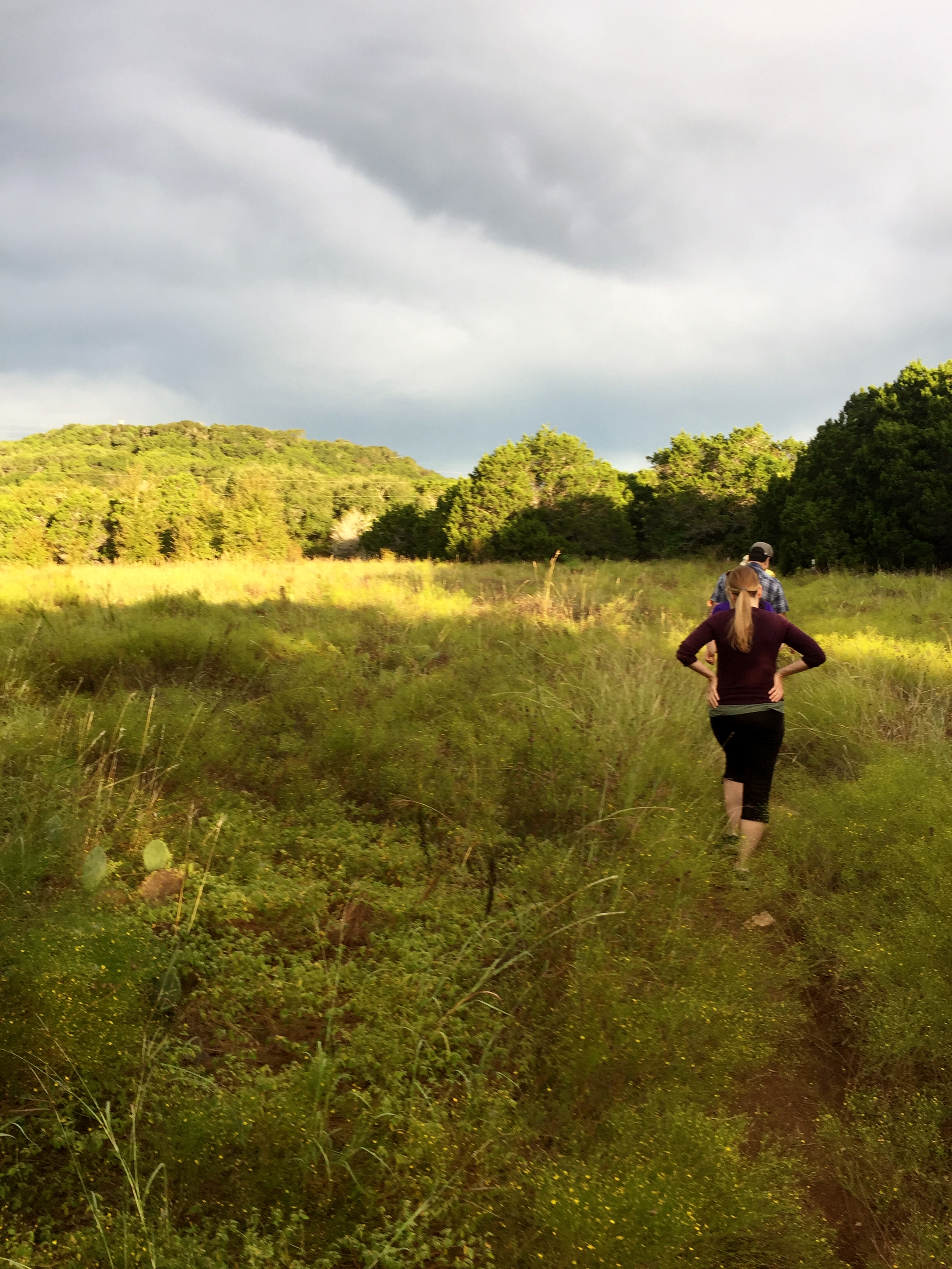
Hike: St. Edward’s Park – Austin, TX
Weather: cool, overcast, upper 60s
Hikers: Ian, Matt Tray, several others from Meet Up
Length: 2.8 miles
My buddy Matt Tray sent out a facebook invite to go hike on Saturday morning and I realized I haven’t done a local hike in over 2 months, so I gladly took him up on the offer. It turns out he had organized it through Meet Up and there were probably about 10 of us total on the hike.
I had signed up on Meet Up about a year ago, but never had actually gone on any of the hikes I was presented with, so I eventually turned off all the notifications. Thank you Matt for putting out the invite.

I have done this trail several times before, in all different seasons, and every time is a new experience. It was a bit overgrown this time, but the weather was good and it was fun to experience the trail with several people who have never done it before. The skies were somewhat overcast with the sun peeking through every once in a while, which made for some pretty scenes.
Matt led us down to the water and then over to the road where we could start climbing up to the bluffs for some views. Along the way we kept seeing these little orange and white contraptions hanging in the trees. I learned that they were orienteering markers for a class that was coming out later that day. I should probably take a class like that, as my compass skills are, well, nonexistent I guess. I get the concept and have the basics, but have never put it into practice.


After walking up on the bluffs we headed back down to the creek and back the way we came. It was good to get out on an early morning hike at the beginning of one of my favorite times of year. Shoulder season is actually prime hiking season in Texas, in my opinion, because the temperatures are actually tolerable compared to the summer.
This was a good group and I told Matt to keep me updated when and if he does this again. And Matt, you are welcome to come hike with me anytime as well.

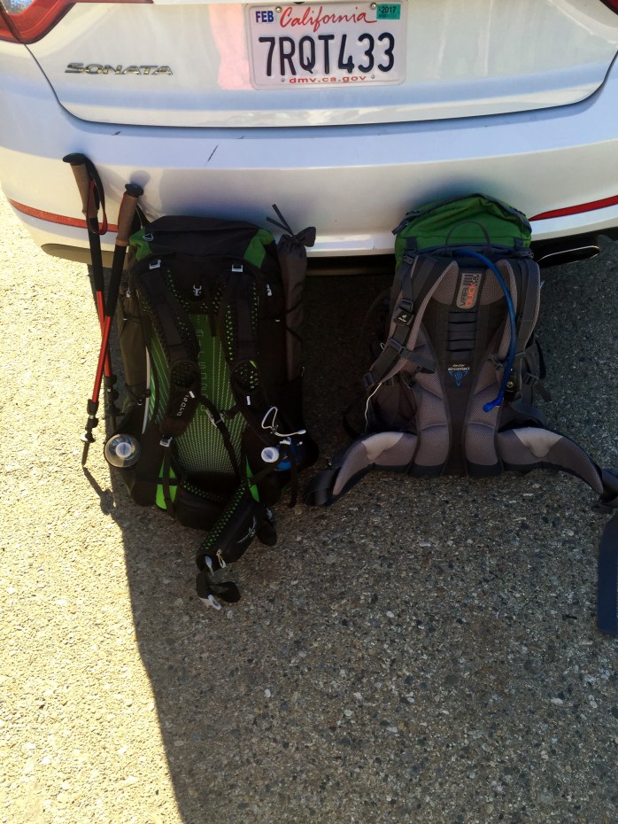
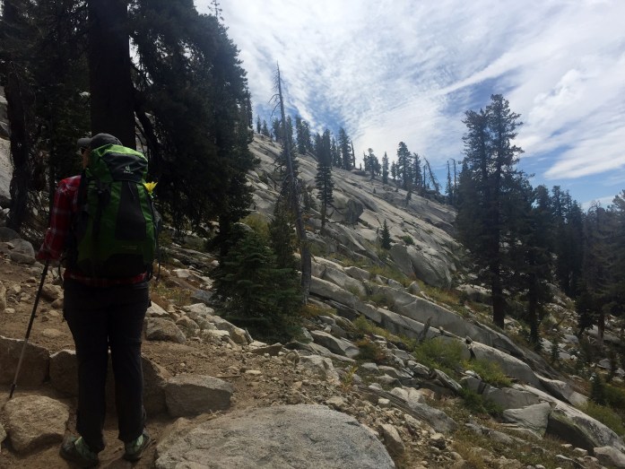
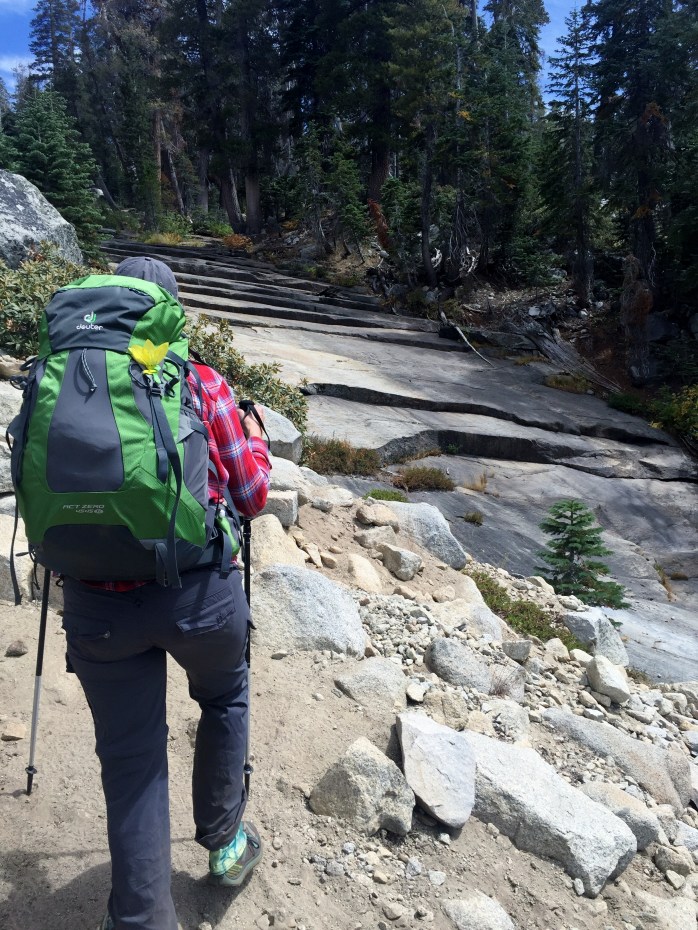
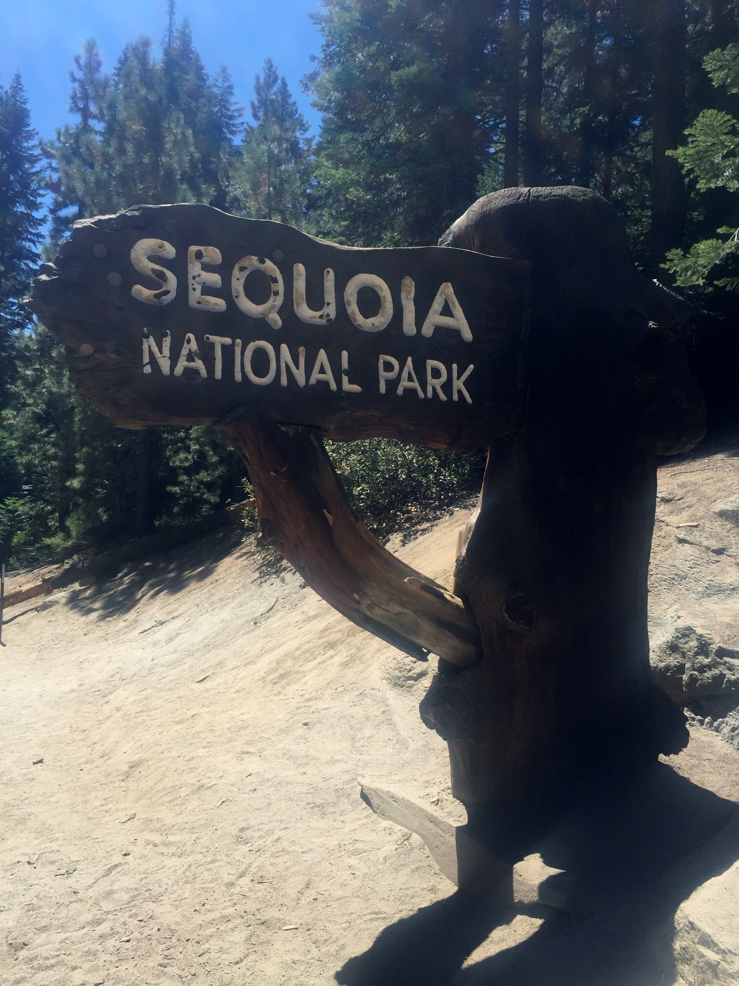
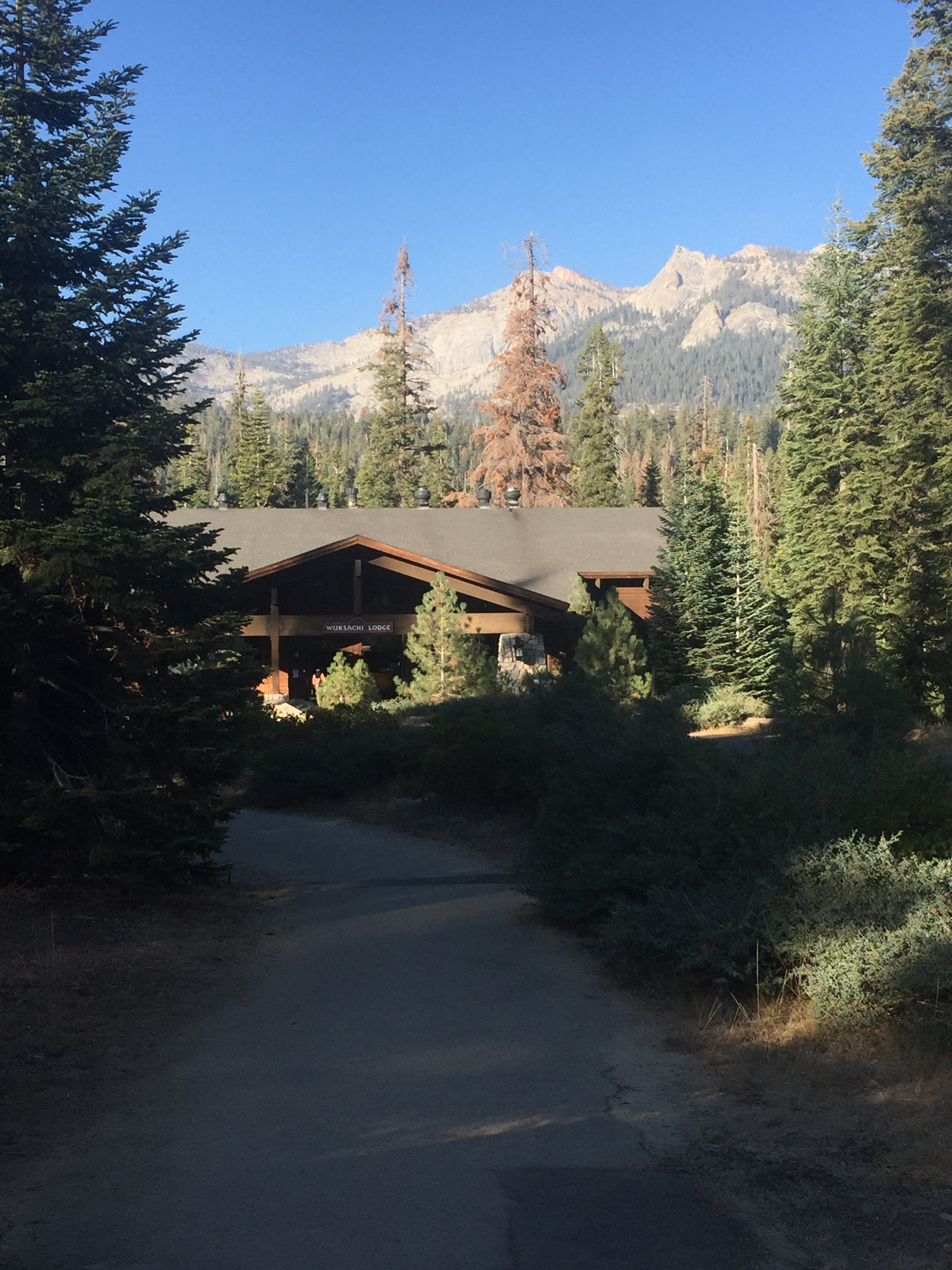
Wuksachi Lodge Trail/Twin Lakes Trail Overnight – Sequoia NP – California 9/3/16 – 9/4/16

Saturday and Sunday, September 3-4, 2016
Wuksachi Lodge Trail/Twin Lakes Trail Overnight – Sequoia NP – California
~18 miles

This was the big hike for this trip. I sent in my wilderness permit application on the first day I was able, back in March, to make sure we got one. This was probably overkill, but I didn’t want to take any chances, and as Court will tell you, I love to plan.
We had arrived in the park the day before the hike and picked up our wilderness permit at the Lodgepole Visitor Center. The line was long and I found out that a lot of people were trying to get walk-up permits. In my opinion, there should be two lines: one for walk-ups and one for people who have had reserved permits for FIVE MONTHS. Anyway, after about an hour, we got our permit. I was prepared to rent a bear canister, but the ranger told us the bear boxes at the campsite at Twin Lakes would work fine.
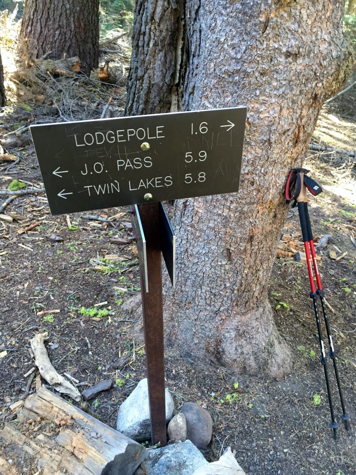
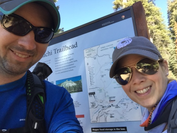
We woke up early and had breakfast in the lodge and then hit the Wuksachi Trailhead nearby, which met up with the Twin Lakes Trail after about 1.5 miles.


The morning was chilly, but nice, probably in the low 50s to start. Watching the sun come up through the trees as we hiked along was great and it was nice to have a dirt trail with relatively few rocks, unlike most of the Texas trails we are used to. You can actually look around instead of down at your feet!


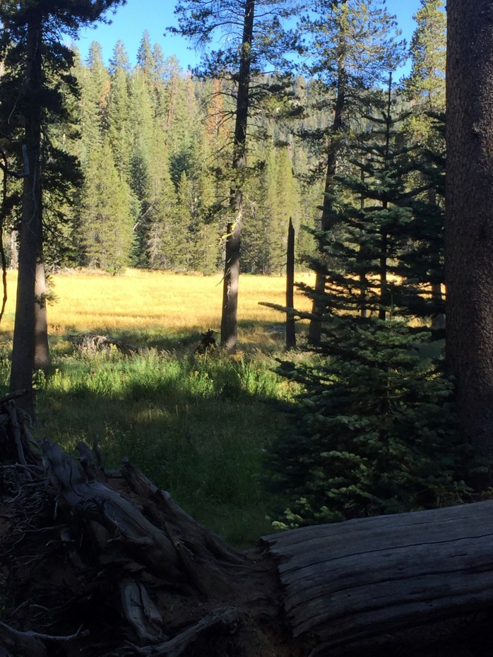
At the junction with the Twin Lakes Trail we turned north and started to climb. We crossed Silliman Creek several times, which provides Lodgepole with all of its water. It was too late in the year for a raging river, so we were able to rock hop across easily.


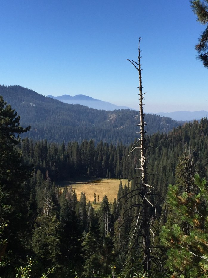
We would pass Cahoon Meadow and later have a great view of it from above.


We stopped for lunch and to filter water at a creek just after Cahoon Gap. We packed in a chicken pita that we got from Lodgepole the day before and it was great.

After filling up we hiked on and quickly heard a strange sound that turned out to be a young deer sneezing! He was apparently not happy with our intrusion, as he actually charged me for a second when I tried to take a picture. His brother was there too, but didn’t seem to mind us as much. We continued and the trail began to switchback up for the steepest part of the hike up to Twin Lakes.

We came to a granite outcropping that looked like it would have a good view slightly off trail and as we approached the edge two marmots were there to greet us. One scampered off, but the other looked at us, contemplated for a moment, and then lay down to take a nap. This was one of my favorite wildlife sightings of the trip.

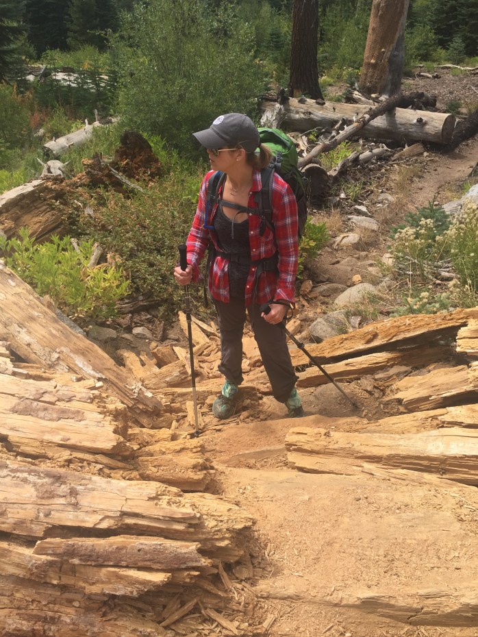
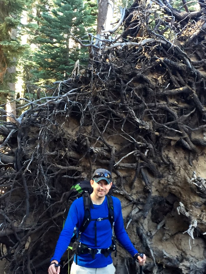
Continuing to climb up the steep switchbacks, the altitude started to make breathing a bit more difficult and we slowed our pace. We came to a granite “staircase” that would have been an amazing cascade of water if we were here earlier in the year, but it was still beautiful, even if dry.
Finally we reached the top, after passing a couple of hikers who were taking an extended break to rest before attempting the rest of the climb up. They did eventually make it I think. There were two bear boxes to choose from and an open air pit toilet that we decided not to investigate. The lakes were gorgeous and surrounded by towering granite walls.

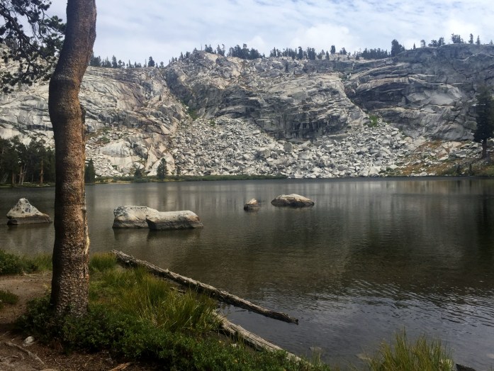
After exploring for a bit we chose a campsite near Big Lake and settled in and washed our feet in the water. Even with long pants and gaiters, the dirt still found a way in and our toes were filthy. I filtered water while Court put the finishing touches on the tent and then we went up to the bear box to cook dinner on the new Jetboil Minimo. Beef Pho was the freeze-dried choice of the night (Backpacker’s Pantry) and it wasn’t my favorite, but it did the job.
After a slight tent mesh mishap by Courtney (now I need to order some Tenacious Tape), we got snug under our quilt and read until we fell asleep. We didn’t even make it til 9pm. It got COLD overnight, but for the most part we were comfy. We woke up at 6:30am to a pretty sunrise and decided to hit the trail and eat bars for breakfast on the way back down the trail.


We descended down 2500 feet to the trailhead in about 3.5 hours, as opposed to the 5 hours it took to come up. Court had a blister on one of her toes, but other than being dirty, we were in good shape.
We ventured back down to Lodgepole in the car to get some food and drinks for dinner in the room, but the chaos and crowds in the prime of Labor Day Weekend were insane. After over an hour of parking and standing in line for groceries with screaming kids and their bedraggled parents, we gratefully retired to our room, showered, and watched Texas beat Notre Dame for our football season opener. It was a beautiful hike and an amazing experience for our first Sierra backpacking adventure.


General Sherman Tree Trail – Sequoia National Park – California 9/2/16
Friday, September 2, 2016
General Sherman Tree Trail – Sequoia National Park – California
Length: .5 mile
Court and I flew out to California for Labor Day Weekend and stopped for a night in Monterey to check out the coast and the aquarium (both awesome) before driving across the state to Sequoia and Kings Canyon National Parks.
We stayed at the Wuksachi Lodge for two nights near Lodgepole Village and it was fantastic. We knew we were going on a busy holiday weekend, but we went early enough on Friday that the crowds weren’t too bad. The first day we went to see the General Sherman Tree.

The sequoias really are just enormous and the pictures don’t do them justice. To stand there and look up and just be completely dwarfed by this living thing and know that it has been here over 2000 years is just stunning.


General Sherman is the largest living tree on earth by volume.
From visitcalifornia.com:
Other trees are taller or wider, but none has the combined weight and width of this leviathan. The General Sherman Tree measures 103/31-metres around, and soars 275 feet/84 metres into the blue Sierra sky—and it’s still growing. Every year it adds enough wood to make another 60-foot/18-metre-tall tree. Still can’t grasp the size? One branch of the General Sherman is so big—almost 7 feet/2 metres in diameter—that it’s larger than most trees east of the Mississippi River. Considering the giant sequoia’s size, you might think it’s the world’s oldest tree, but it’s not. Admittedly, at roughly 2,200 years old (no one knows for sure), the General Sherman is no spring chicken. But giant sequoias are only the second oldest living trees: ancient bristlecone pines, found in the White Mountains to the east.


The trail was paved and not long, but it was a nice walk. Coming back up we saw our first (and only) bear of the trip! He was literally about 15 feet off the trail just sniffing around. Of course, dumb tourists were trying to get selfies with him and I secretly hoped he would get angry with them, but he did not seem to care. He scampered off before I could get a pic (not a selfie).
We headed back to the lodge after General Sherman to eat dinner and rest up for the big hike the next day.

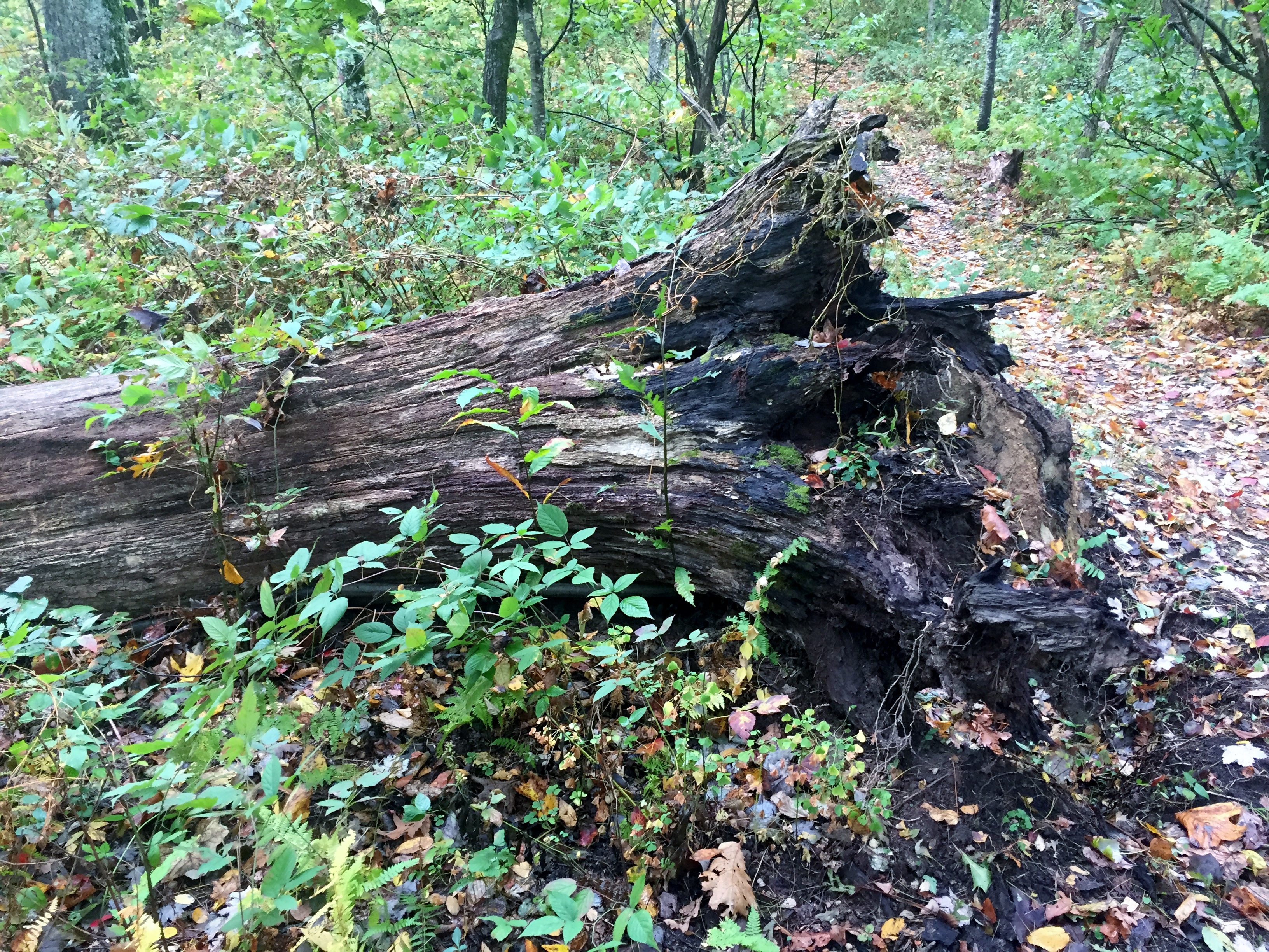
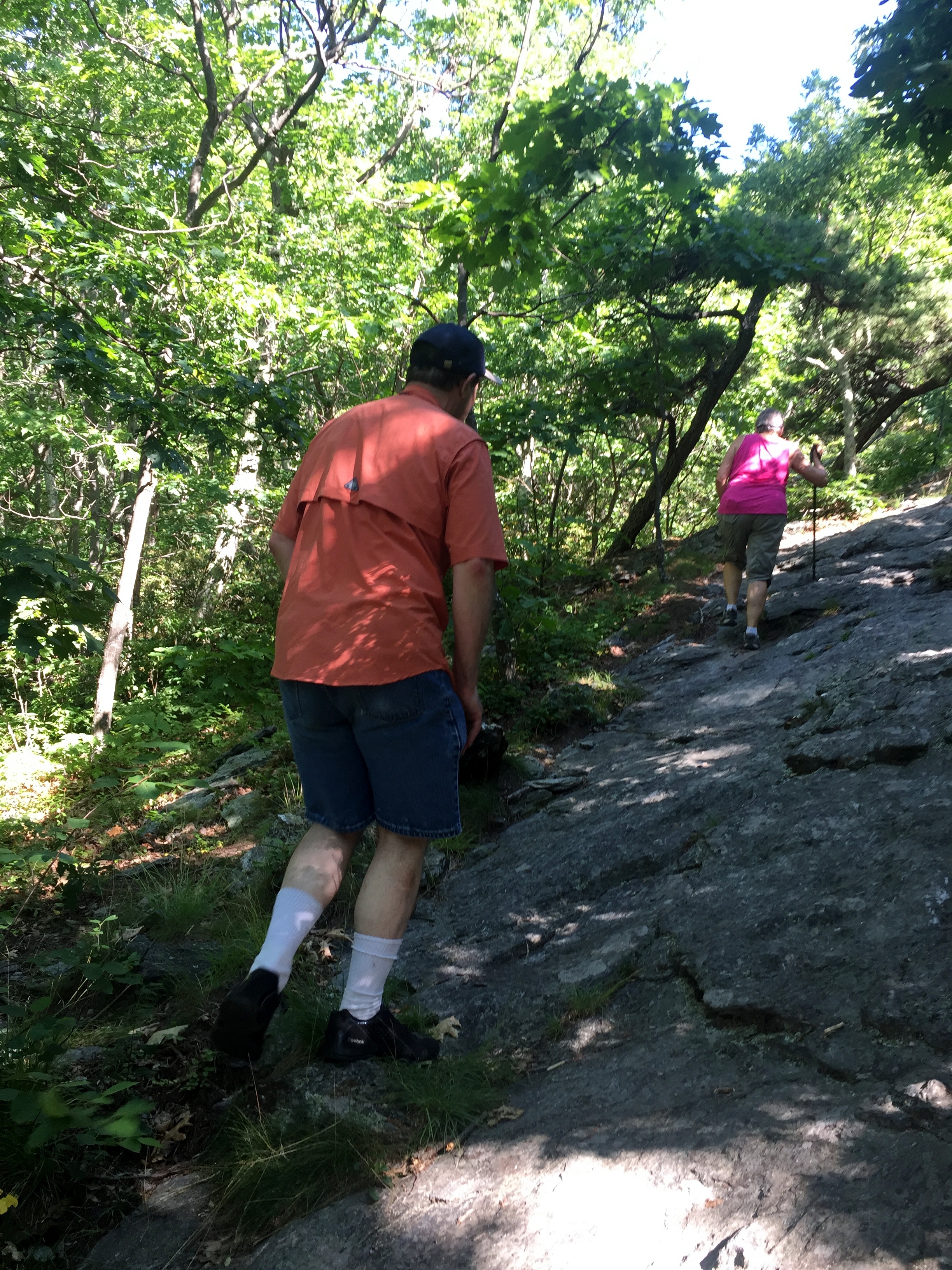
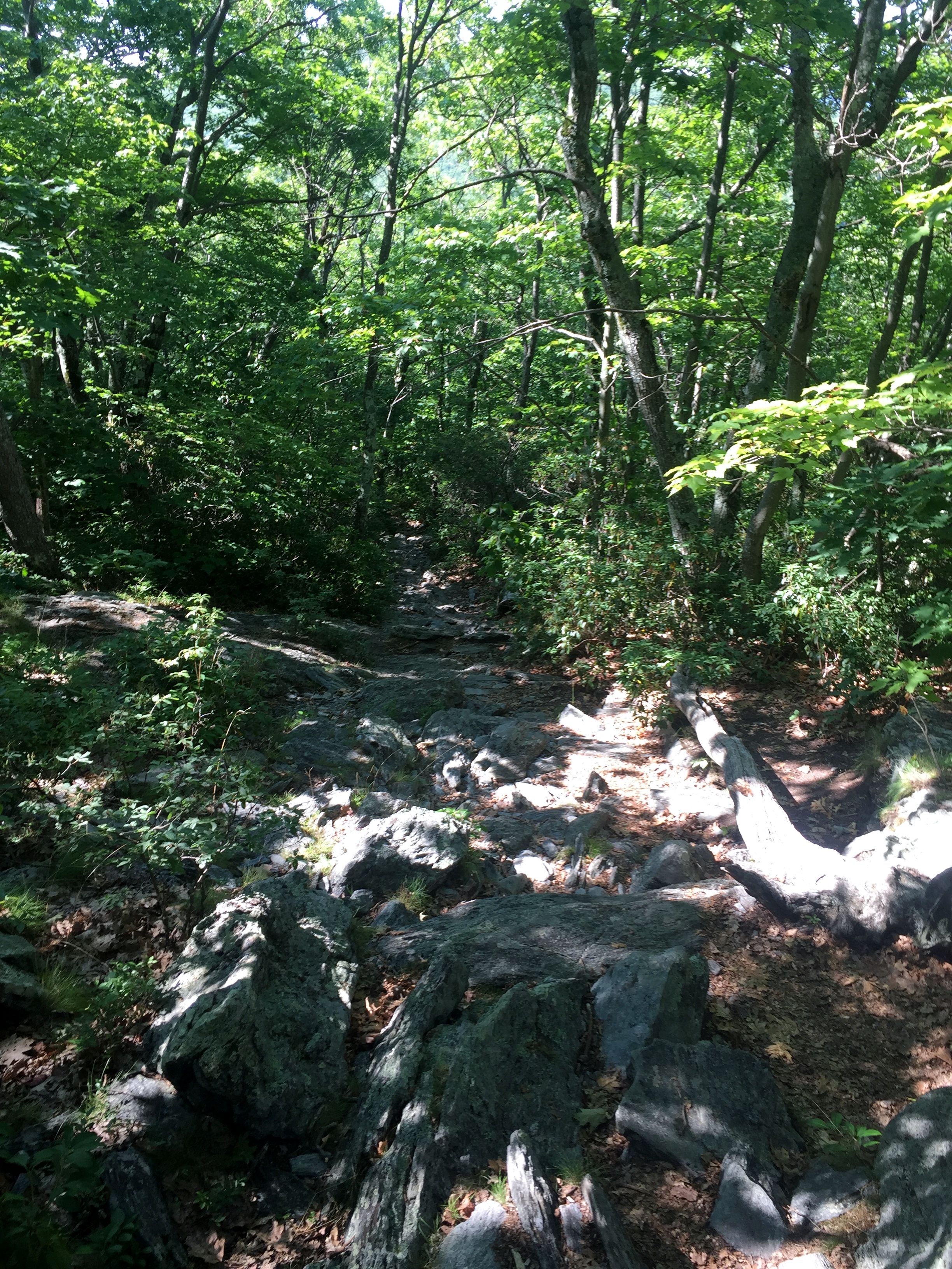
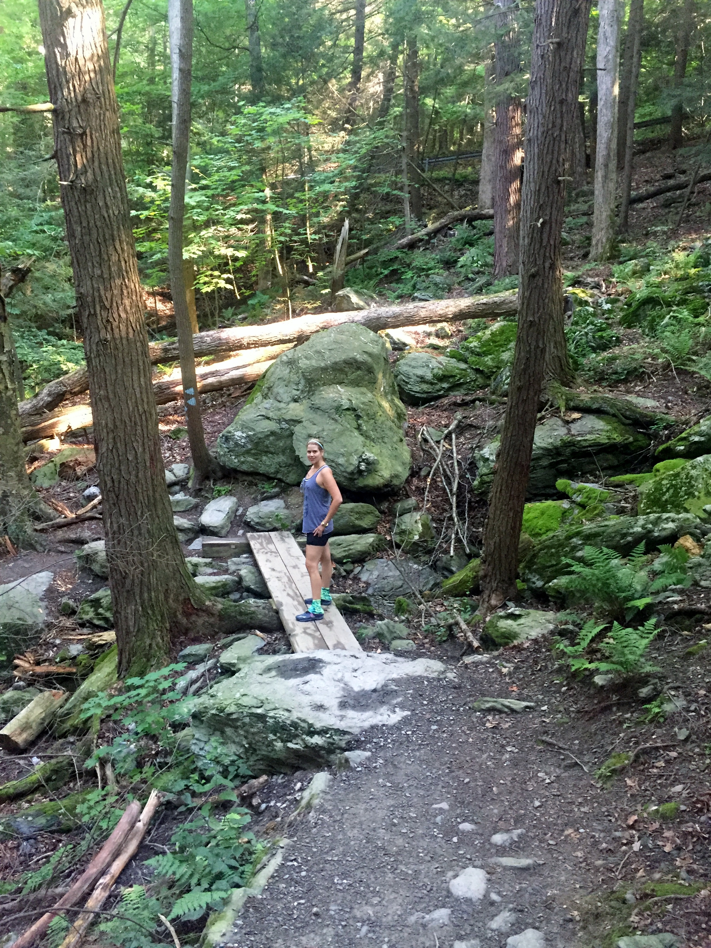
Race Brook Falls Trail to Summit of Mt. Everett via The AT – 7/28/16
Wednesday, July 28, 2016
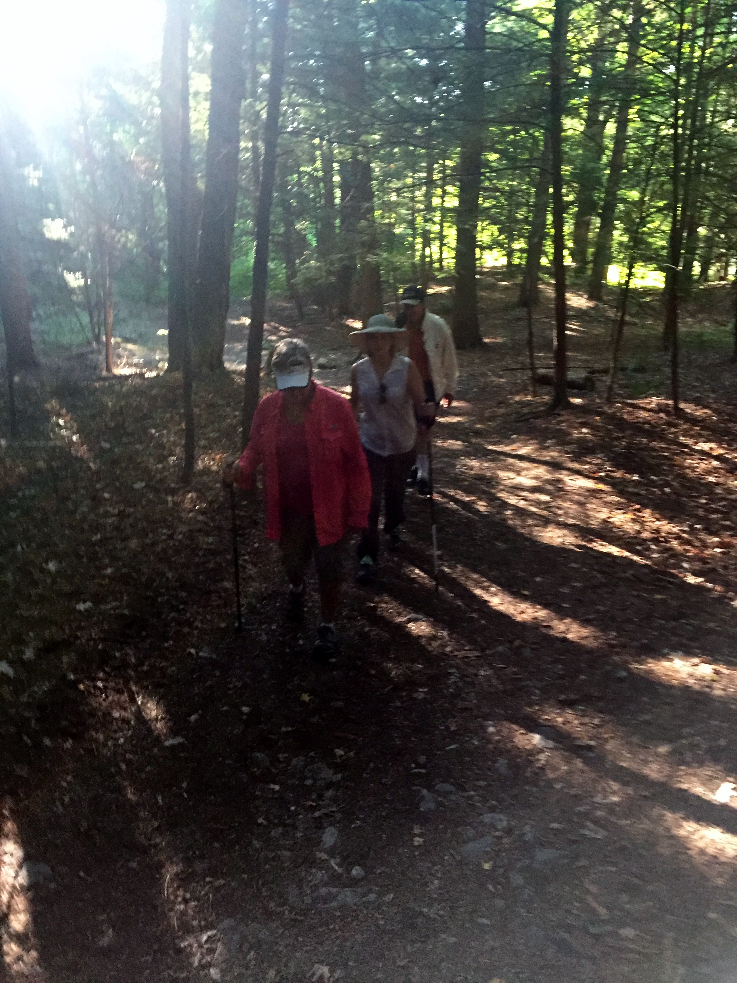
Hike: Race Brook Falls Trail to Summit of Mt. Everett via The Appalachian Trail – near Sheffield, MA
Weather: partly cloudy, warm, but comfortable
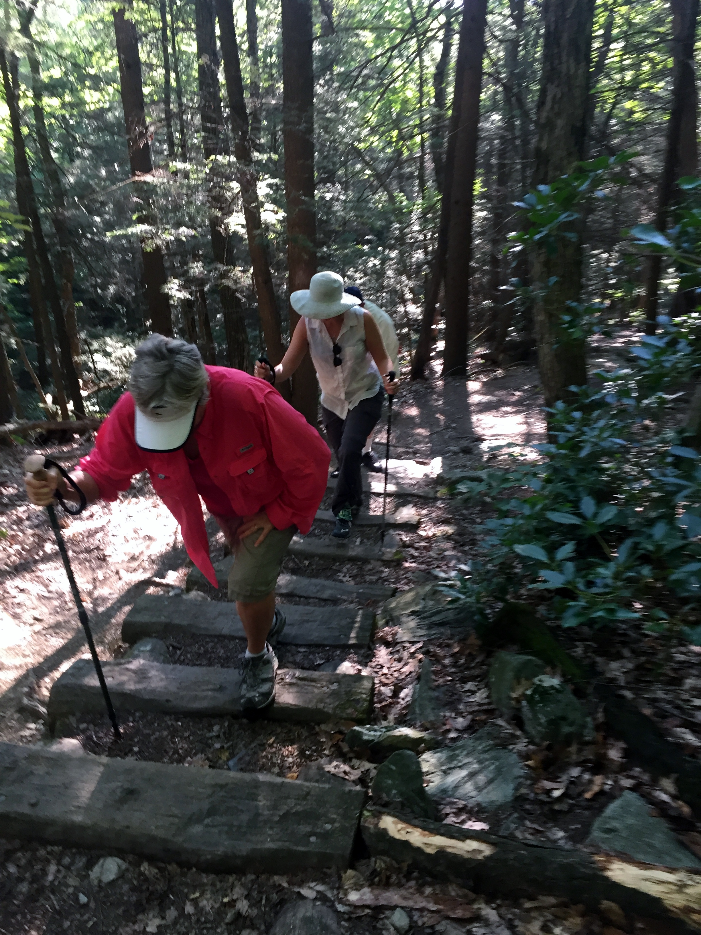
Hikers: Ian, Court, Doc, PJ
Length: 7.1 miles
This was the main hike I was looking forward to on this trip, mostly because it would mark my first official hike on the AT, which would also be my first hike on one of the Big 3 long distance trails (AT, PCT, and CDT). I tried to edit myself, but there are a lot of photos on this one.
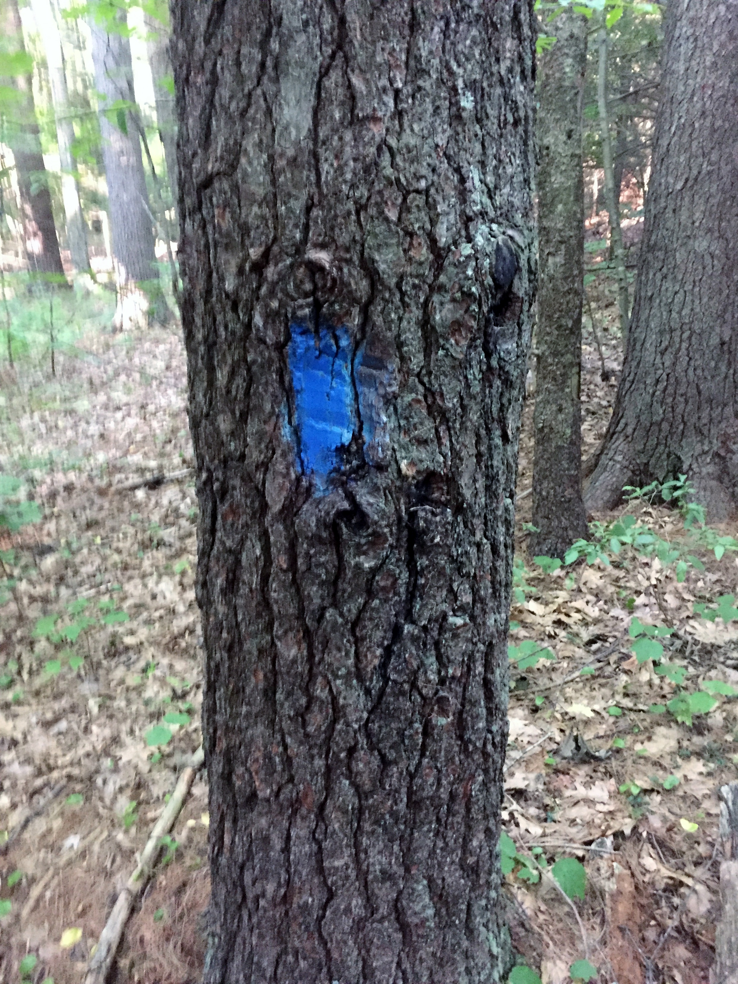
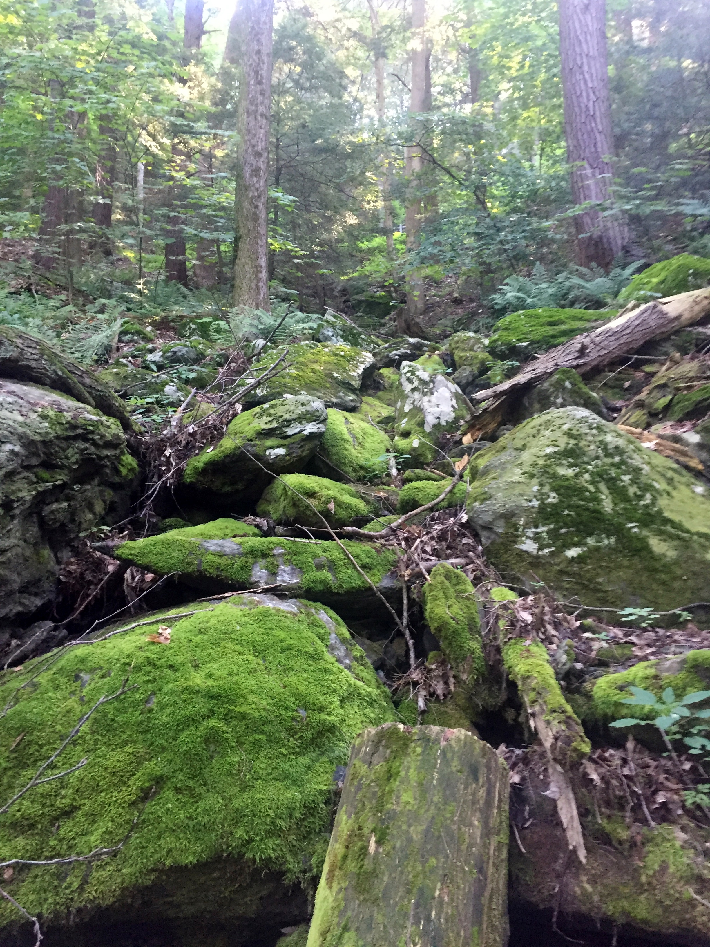
After spending the prior day in the various towns of the Berkshires (Great Barrington, Stockbridge, and Lenox) we woke up really early and got to the trail head just after 7am. The trail was marked with blue blazes and started off in the deep woods and gradually started to gain elevation.
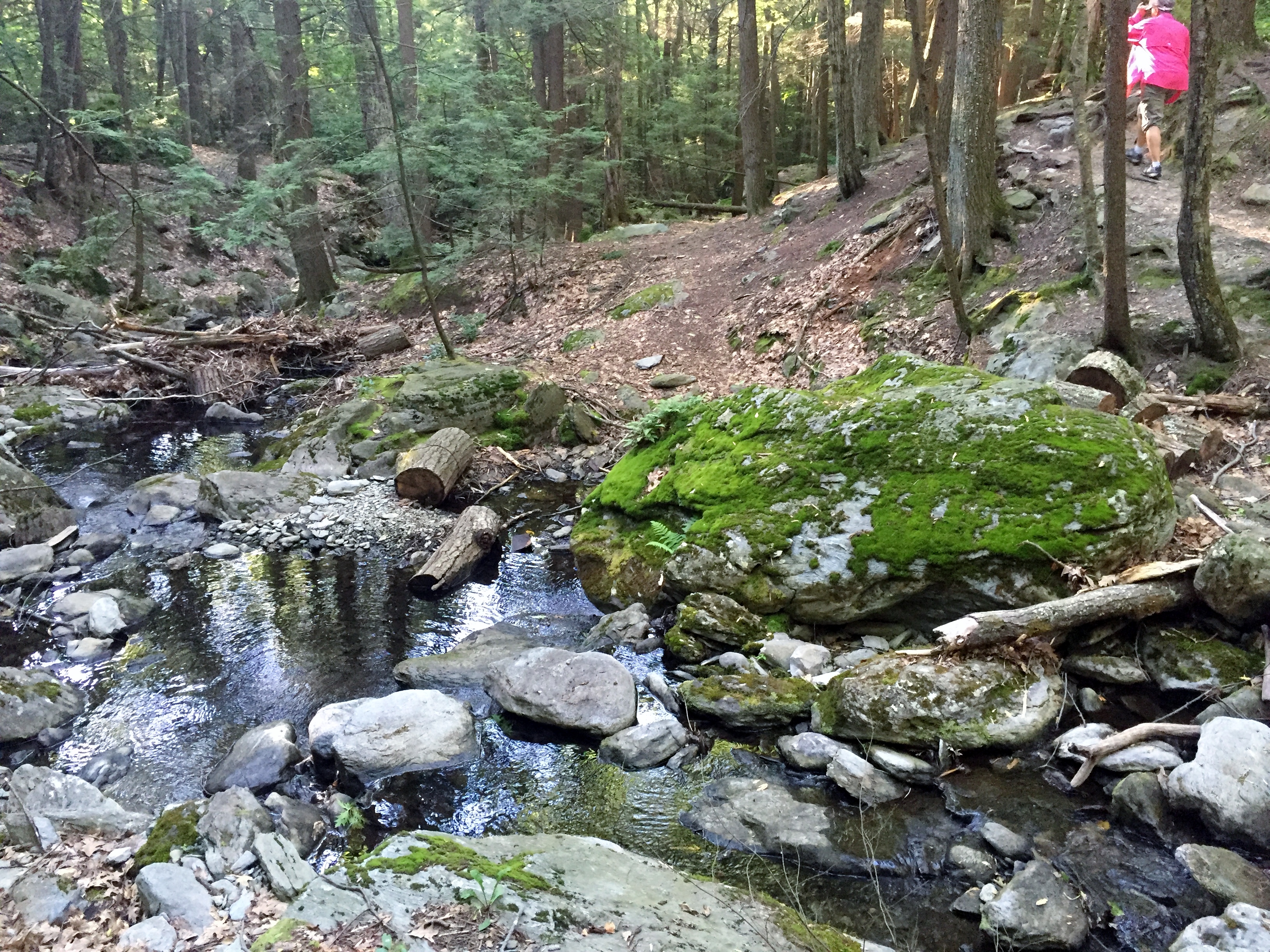
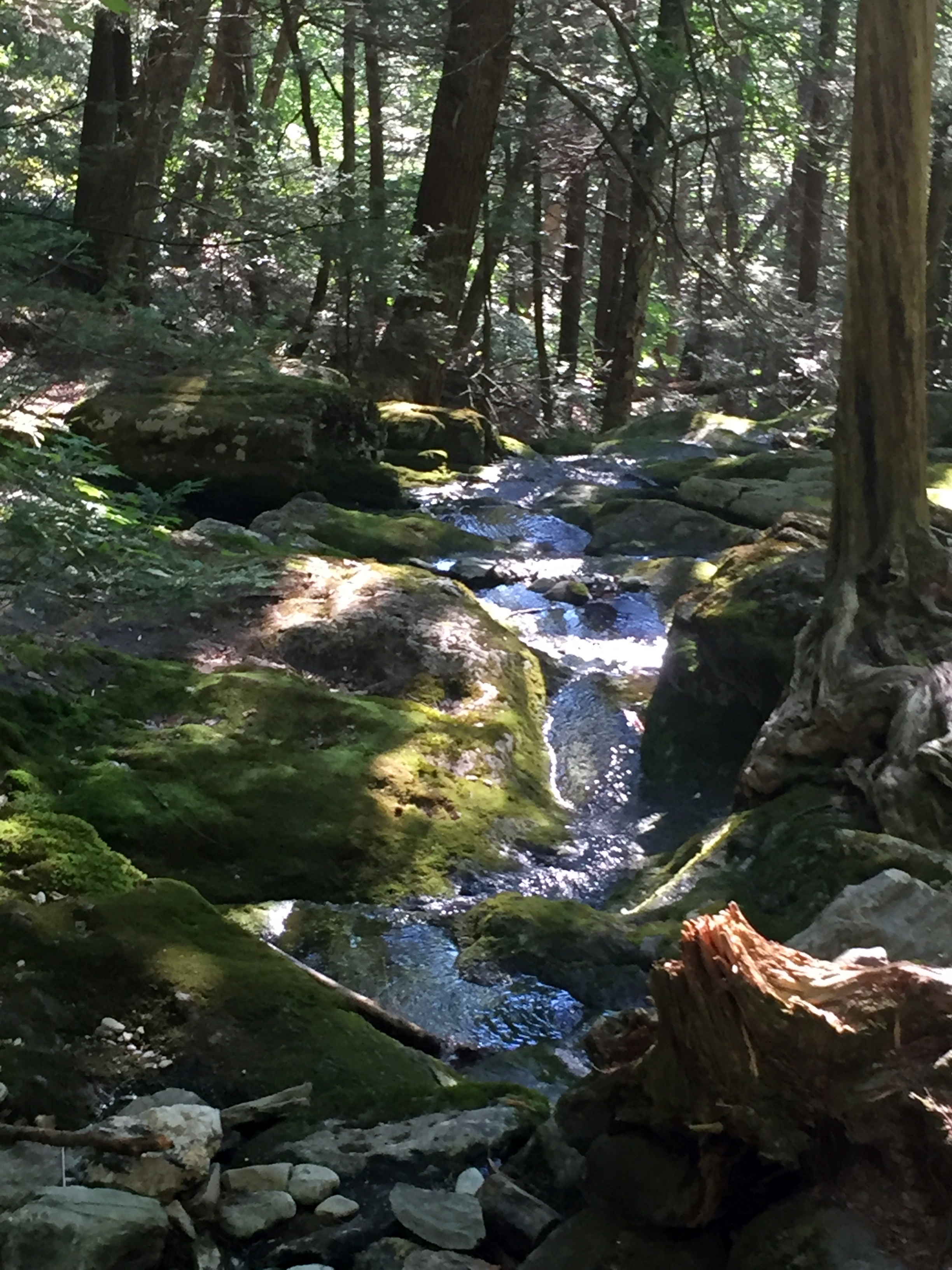
We crossed Race Brook once and then took the left trail to the Upper Falls, bypassing the Lower Falls. As we climbed higher and higher, we could start to see more distant hills in the Berkshires through the trees. It was beautiful. Unfortunately the Falls were not flowing very much at all so we would have to rely on other water sources later.
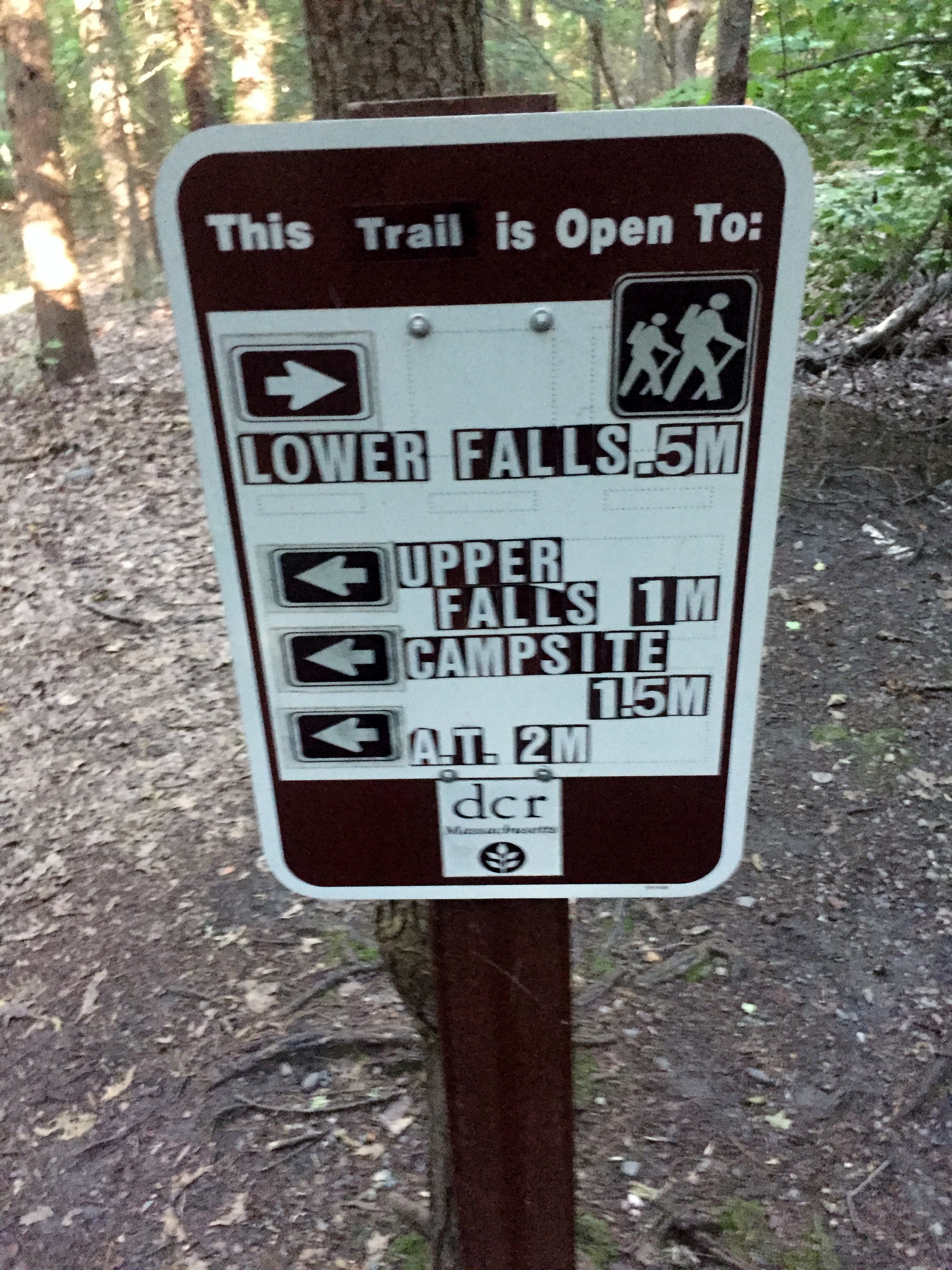


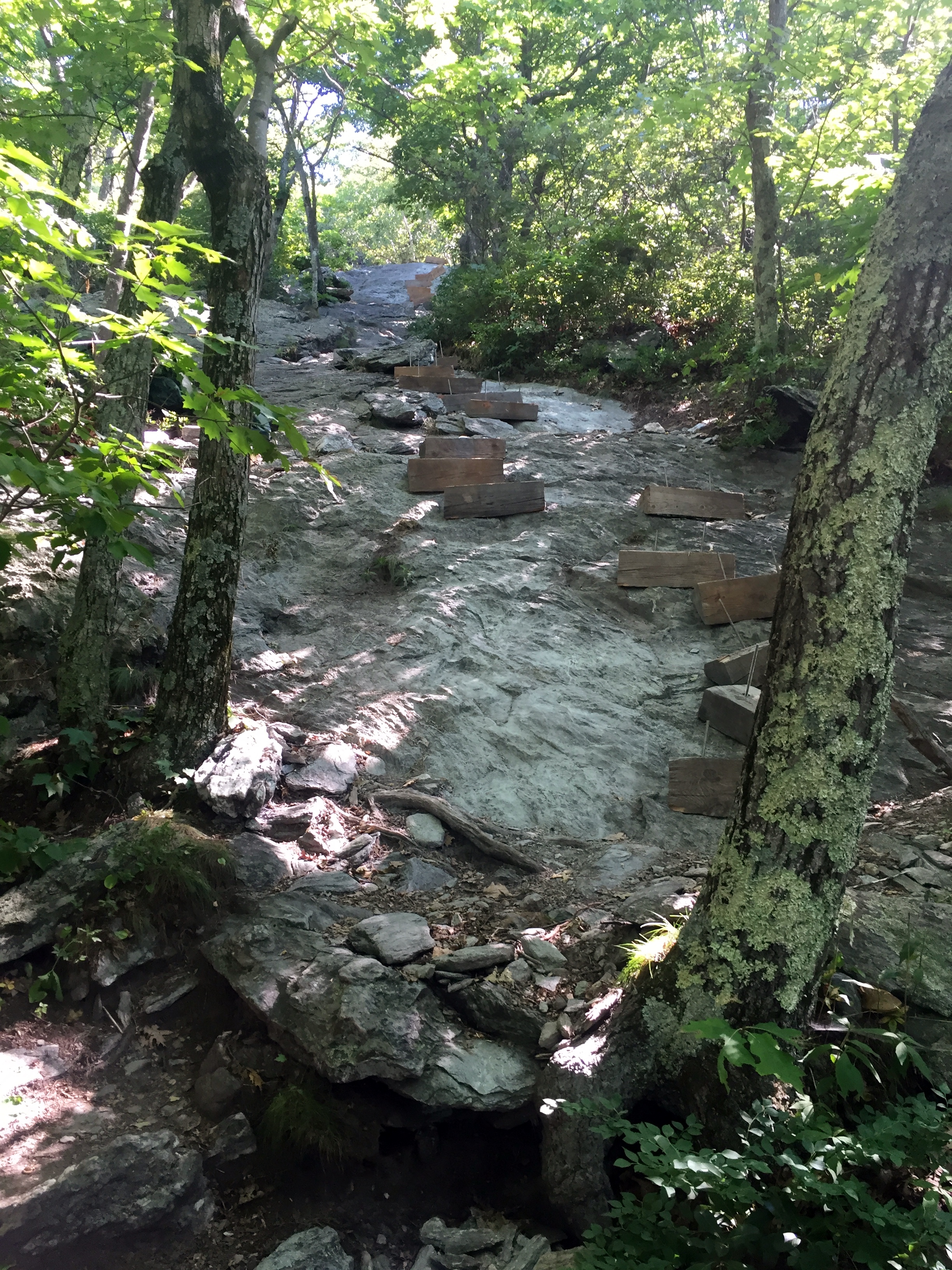
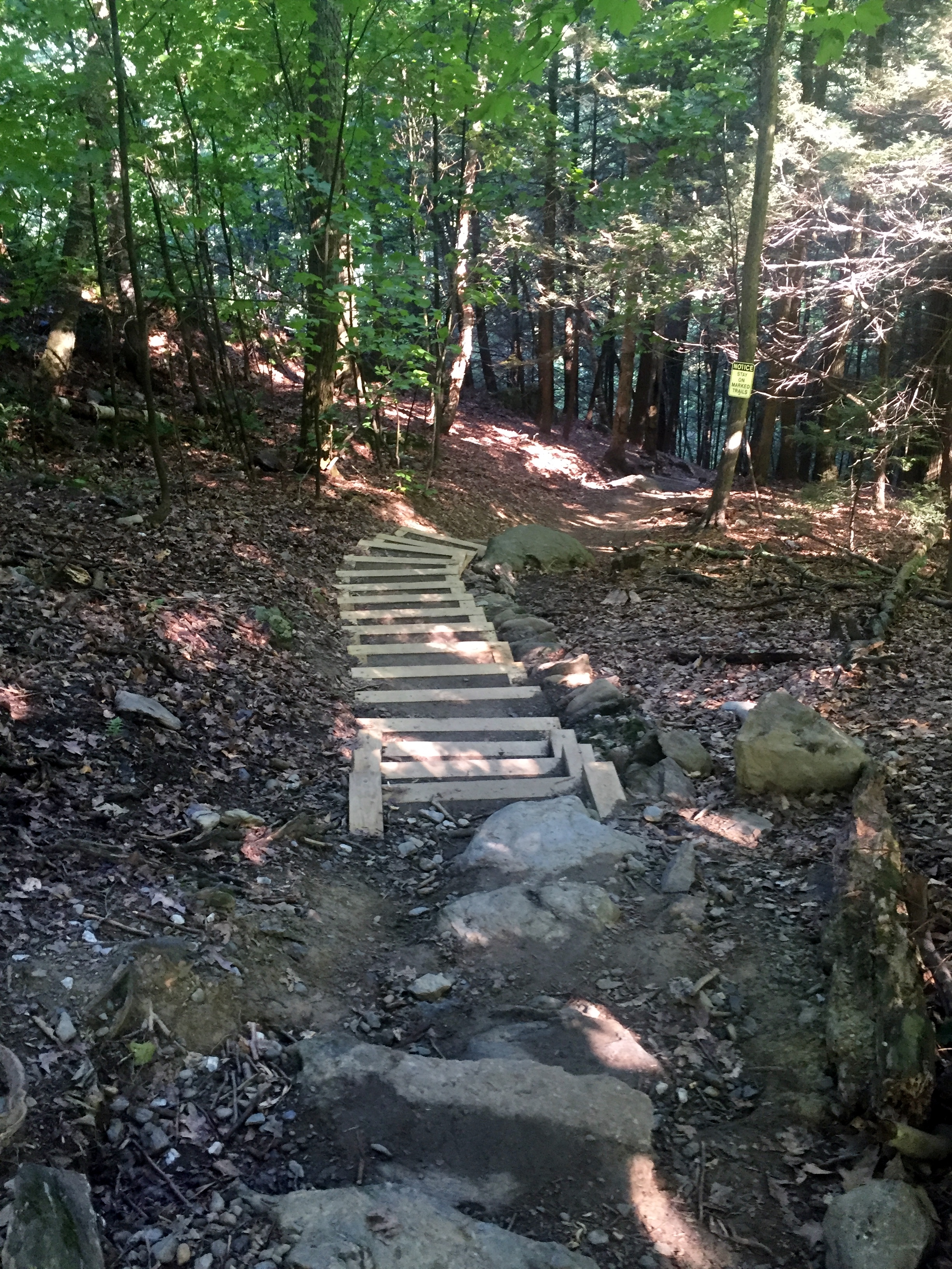
As we neared the AT we ran into a couple of young guys filtering water with a large gravity filter hanging on a tree. They explained that they were with a group called the Greenagers which is a youth organization out of Great Barrington that, among other things, puts kids to work on the trail during the summer. They told us today they were working on putting in some wooden stairs on a steep section of the AT. We ran into the rest of their camp a little further up the trail at Race Brook Falls Campsite. There were probably 7 or 8 tents set up and most of the kids were just getting up and running.


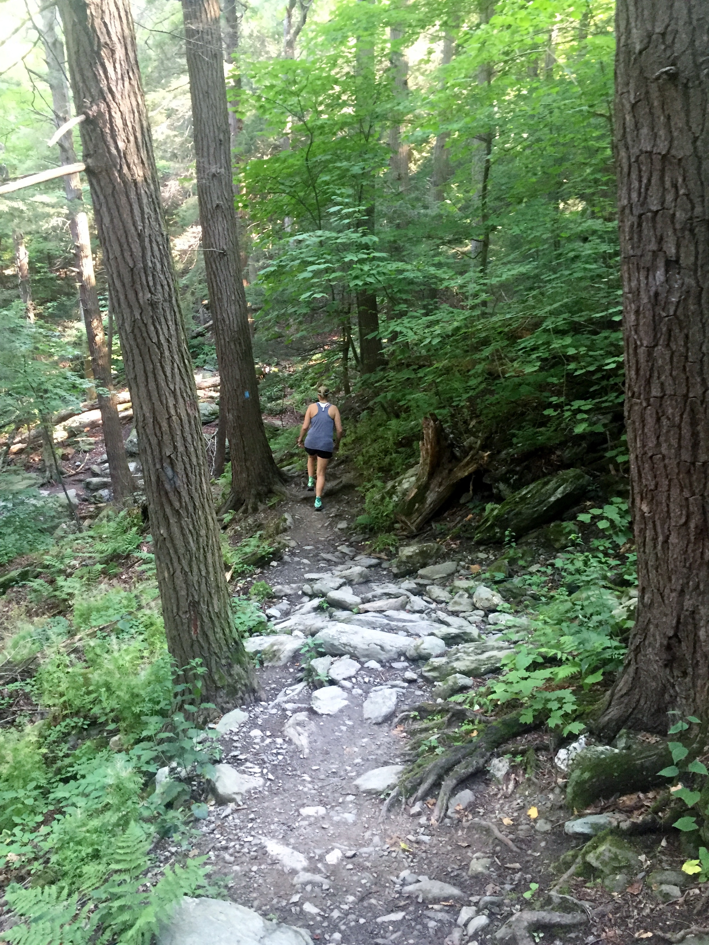
We continued on past the camp and hit the junction with the AT just .2 miles later. I didn’t think it would be that big of a deal, but I ended up being super happy and excited once we got to the first white blaze and headed north on the AT. The trail was a lot rockier and ultimately tougher than Race Brook.

Court and Doc saw a porcupine off trail, but it got away into the brush before the rest of us could catch a glimpse. We continued up the rocky trail and then started the ascent to the summit of Mt. Everett. We ran into several thru-hikers which was also really cool for me. I asked most of them their names and when they started.
The first was Goodtalk, though he said today wasn’t a good example, as he was tired and just trying to make it up the steep trail. He started on March 20th.
We also ran into Crash who started April 14th and incidentally is currently living in Austin. I told him to come to the Crown and Anchor sometime and I’ll buy him a beer.
About halfway up was where we again ran into the Greenagers and their stair project. It was looking good, but the stairs weren’t quite ready for use yet, so we continued up the slick, steep rock that hikers have been using for years.
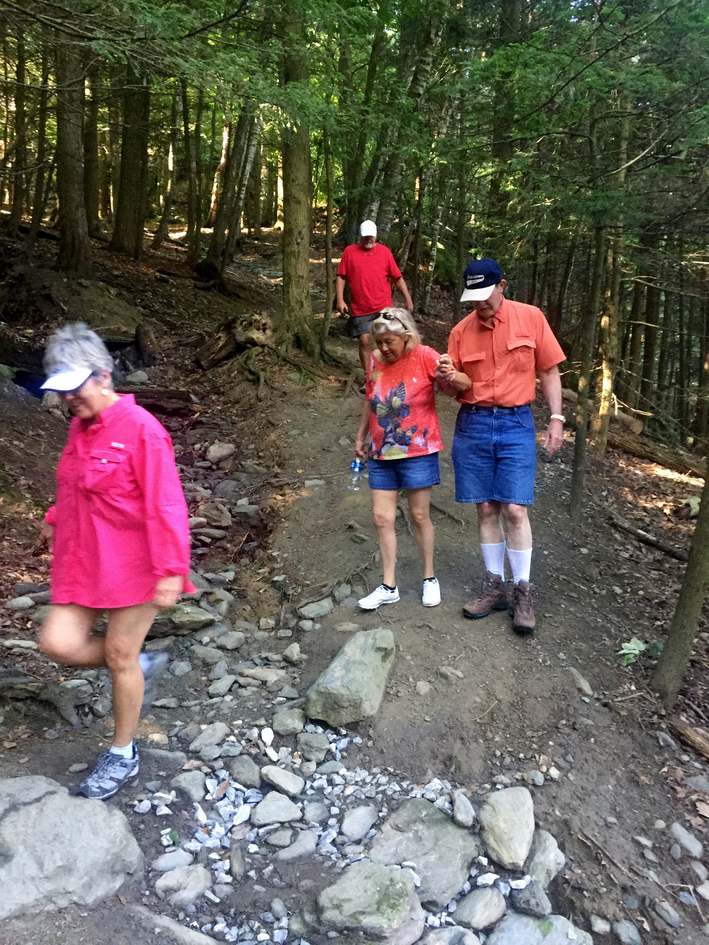
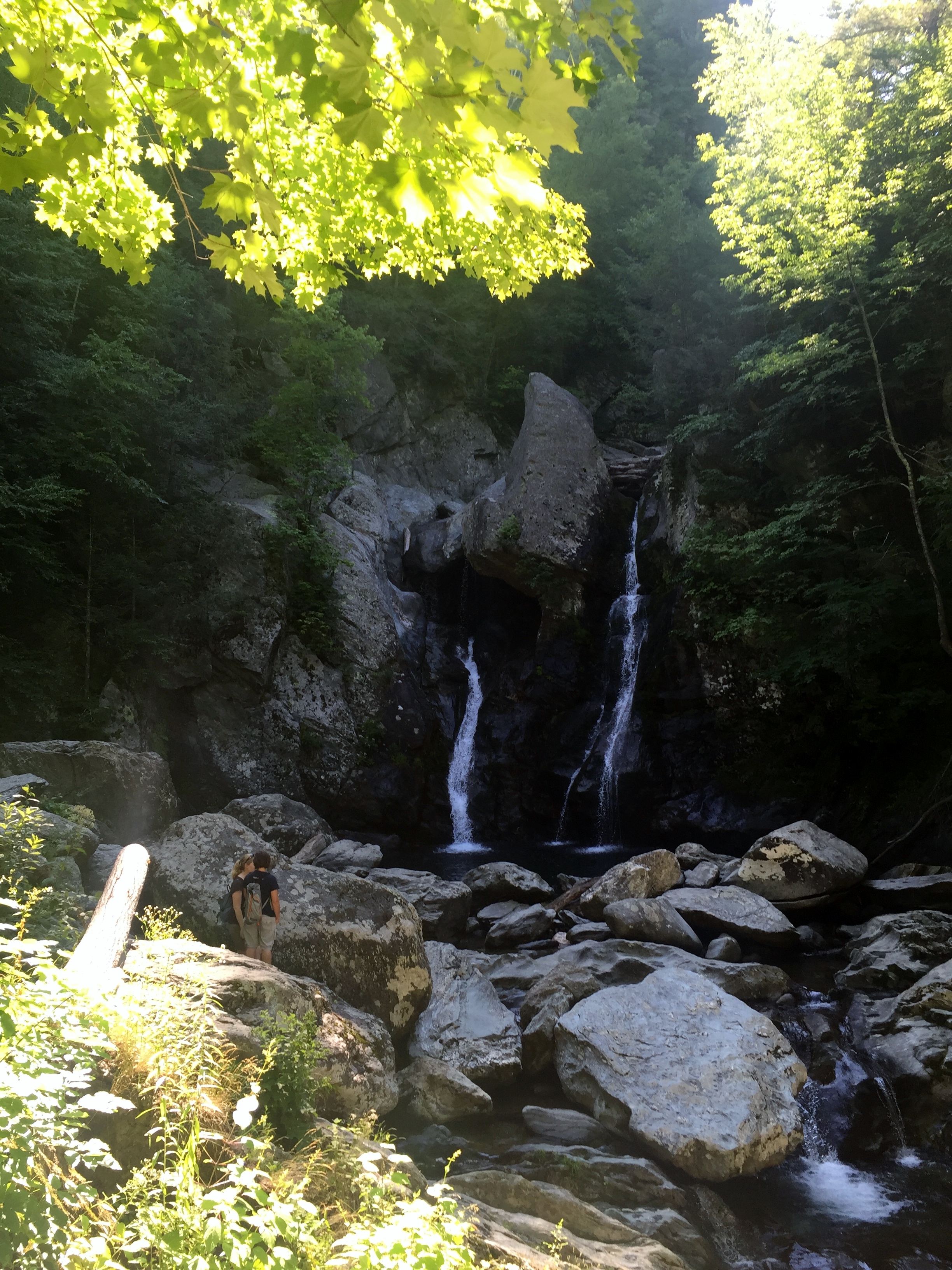
Finally we reached the summit and the views were great. The top of Mt. Everett has the remaining foundation of an old fire tower that was decommissioned in 2002. There were a couple of other thru-hikers here as well. Morel and Backseat Driver started on April 1st and are living in Abilene right now. Lots of Texas hikers! We talked to them for quite a while up top while they had their lunch. I wonder if thru-hikers get tired of answering the same questions I’m sure they get all the time from day hikers?


We headed back down, which would prove to take a bit longer than the way up because the descent was pretty hard on Mom’s knees, but it was good to take our time. We ran into one more thru-hiker by the name of Throne who started mid-May, so he was moving quick.
We left the AT and headed back down Race Brook Falls Trail and the Greenager’s tents had vanished from the campsite. We stopped to filter water out of Race Brook and it was cold and delicious.
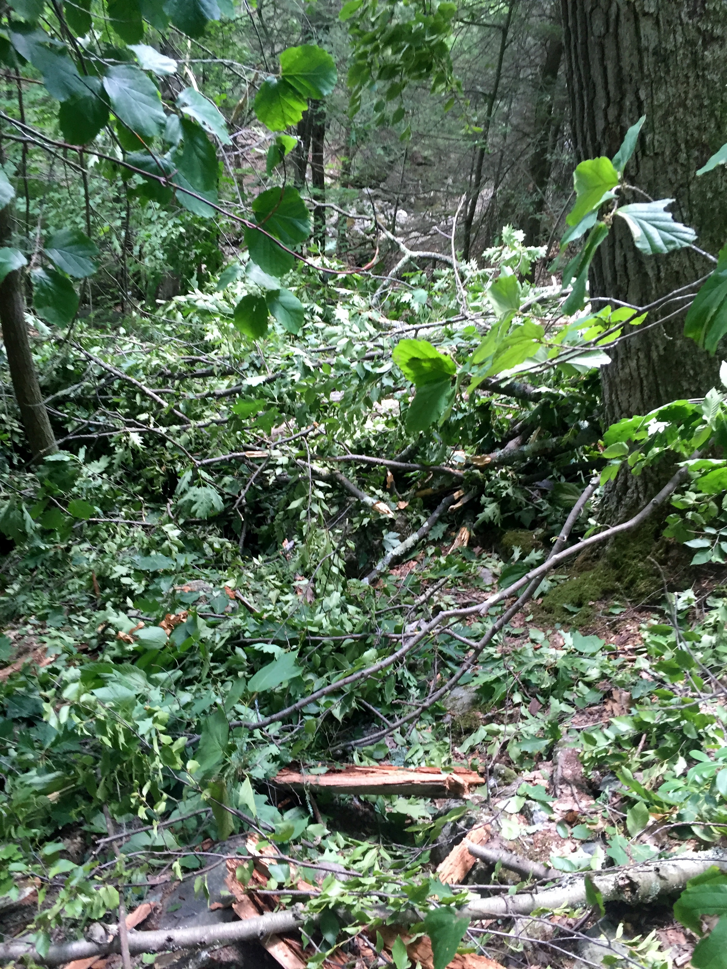
Just after the non-flowing Upper Falls, Doc called out for me to check the GPS, as the trail was gone. Surely not. But oh yes, while we were up top, a huge tree had fallen across the trail and wiped out the well manicured trail we had come up. It wasn’t hard to get around and we were all glad we weren’t there when it fell.

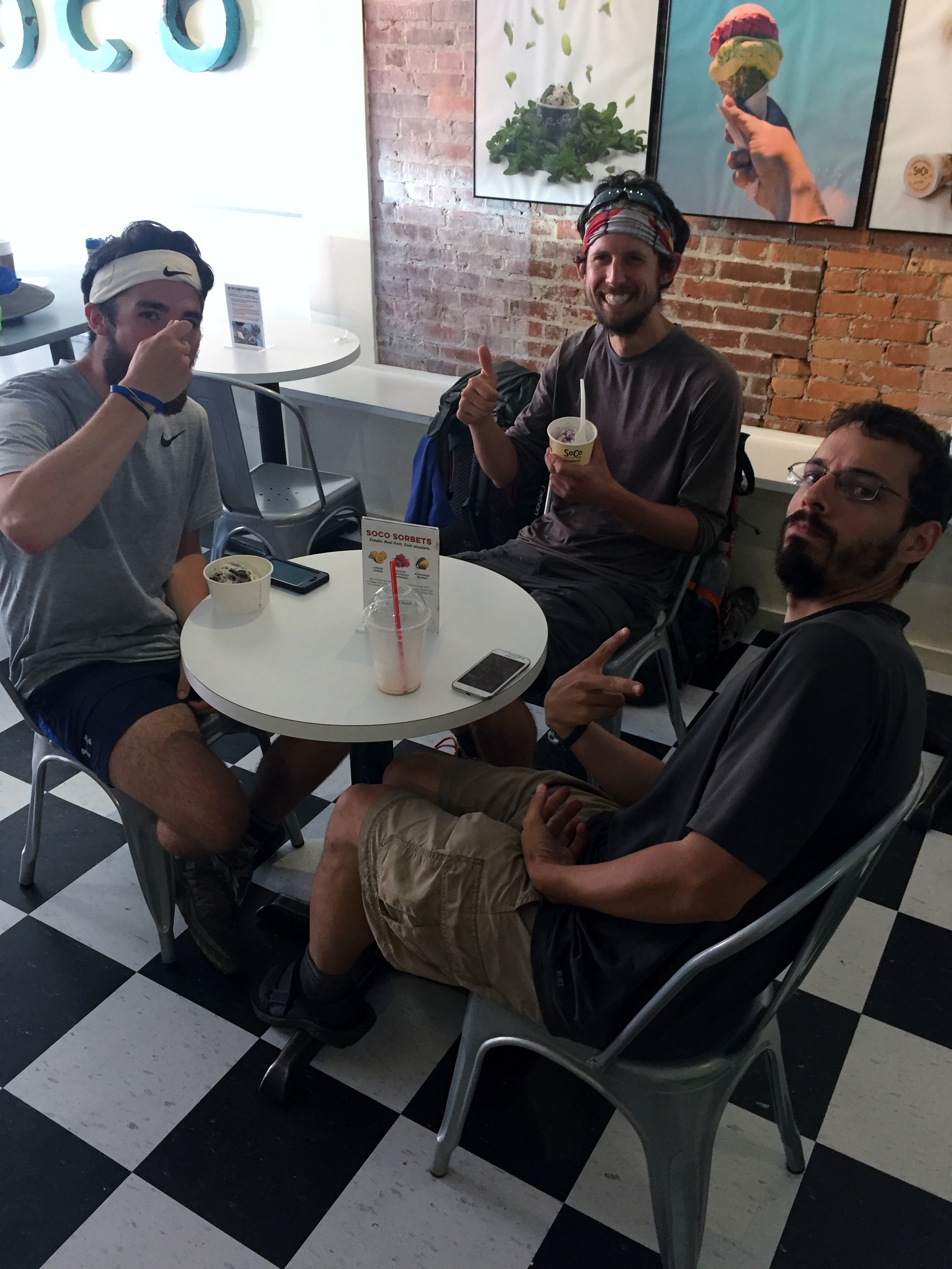
We got back to the trail head and were all tired, but happy. We drove straight into Great Barrington to meet Jack and Suz for lunch. I had a great burger and afterwards we went to SoCo Creamery, recently voted one of the best ice cream joints in the country.
There were three more thru-hikers eating ice cream in the shop and they actually asked if I was on the trail, I guess because they spied my shoes. I told them I was just day hiking, but had my sights on the PCT sometime in the next few years. Their names were Karate Kid, Stretch, and Box. We wished them good luck and I hope every one of the hikers we met makes it to Maine and finishes their journey.

I was very happy to have done this hike and add it to my list. Having never been on the AT before this, it was honestly my least favorite of the Big 3, but I came away with a new respect for the Trail and the people who take care of it.

We went back to the cabin for our last night in Massachusetts and are now back in the heat of Texas for a month and then Court and I are heading to Sequoia and Kings Canyon National Parks over Labor Day Weekend. That will be epic.


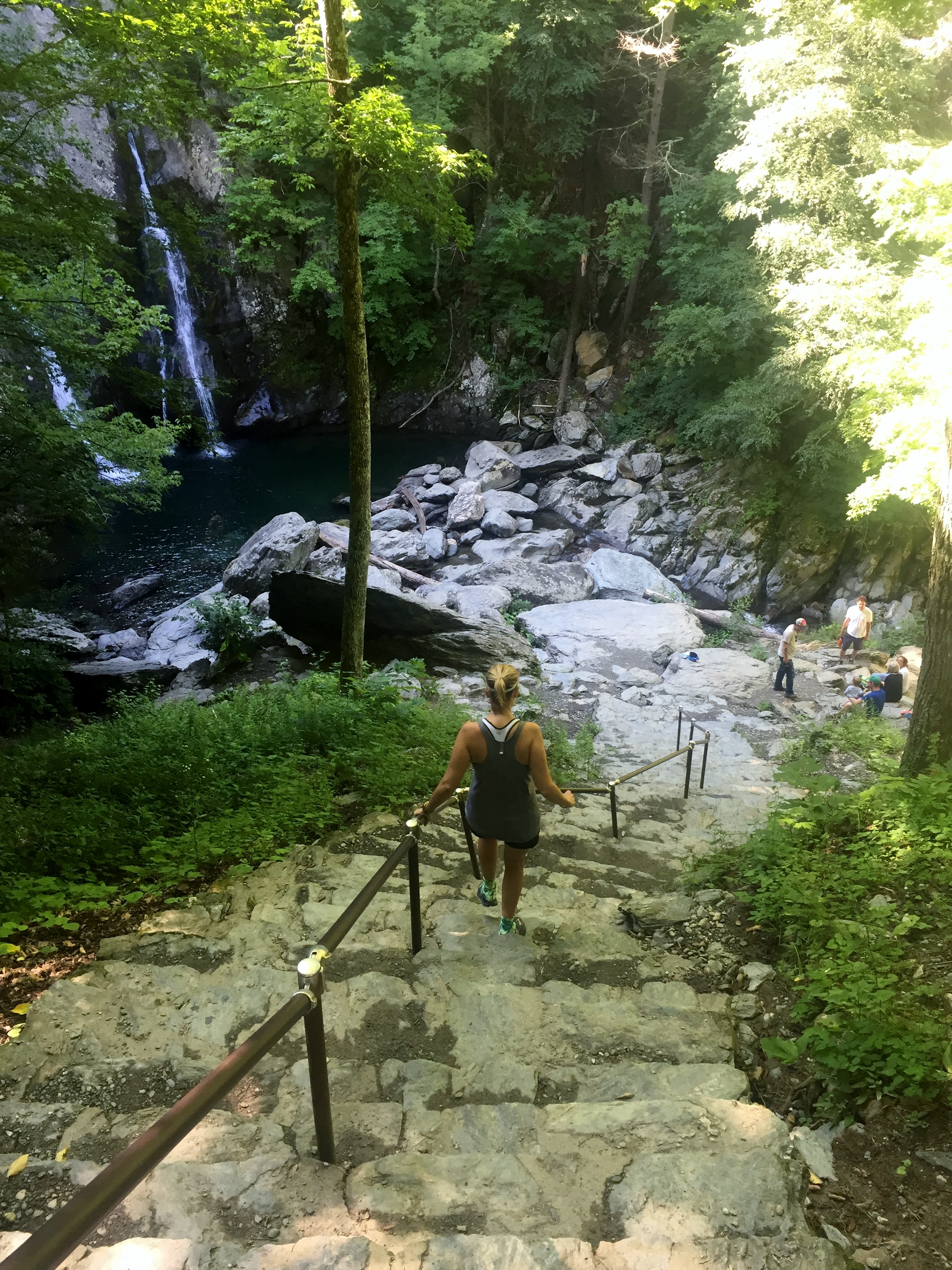
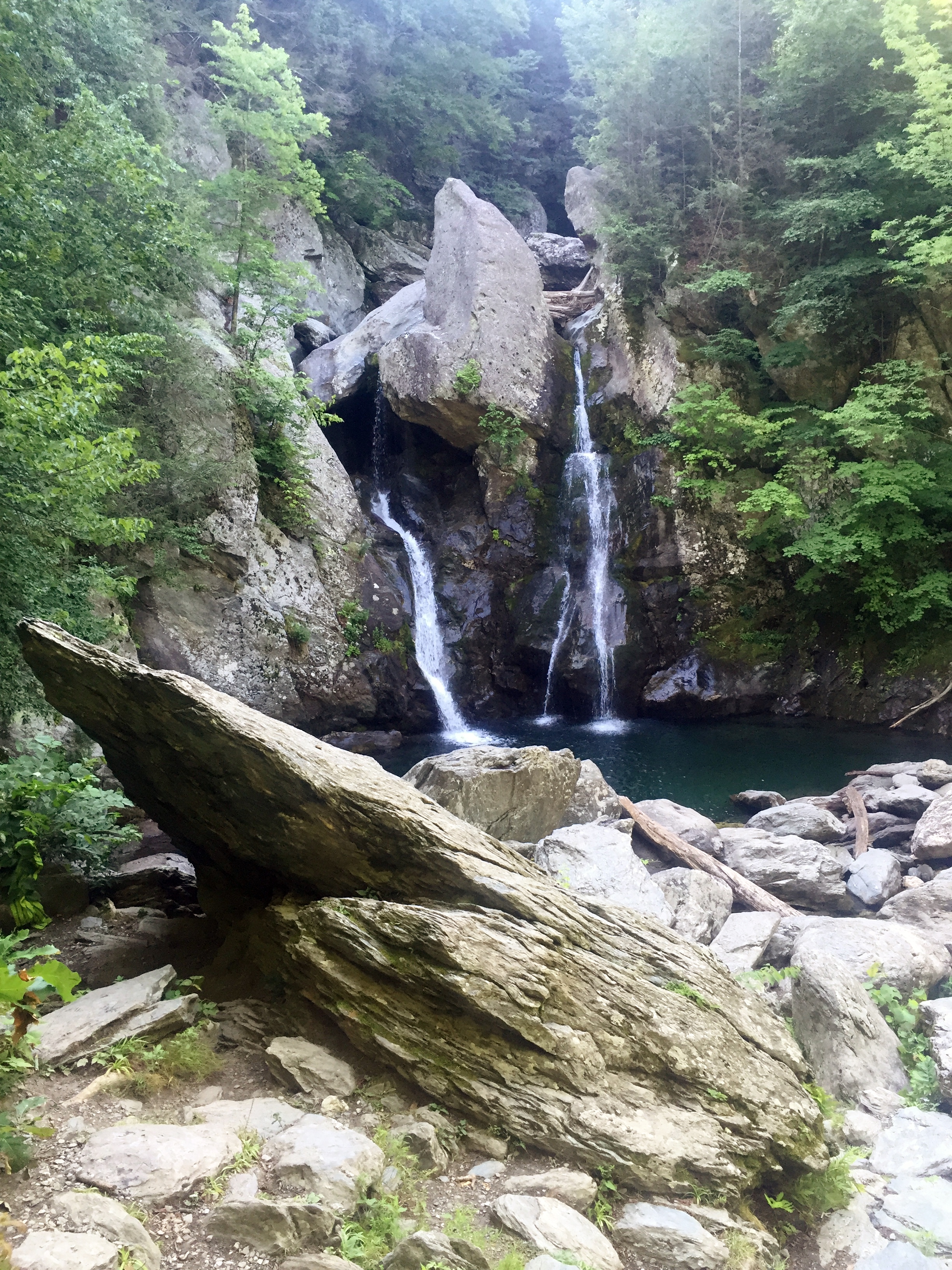
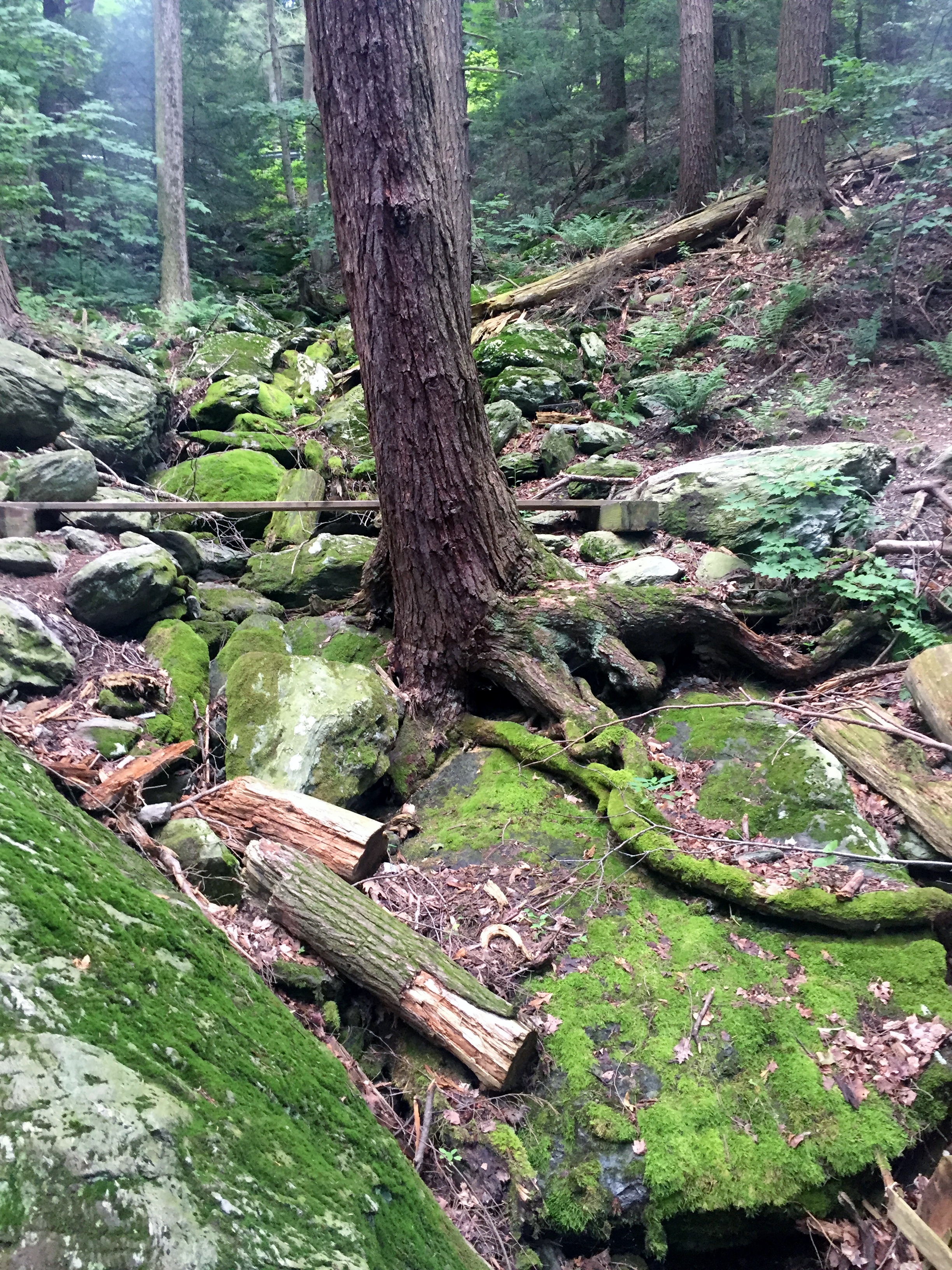
Bash Bish Falls, Mt. Washington, MA 7/26/16
Tuesday, July 26, 2016
Hike: Bash Bish Falls Trail, Mt. Washington, MA
Weather: calm, sunny, warm, low 80s
Hikers: Ian, Court, Jack, PJ, Doc, Susan
Length: 1.5 miles
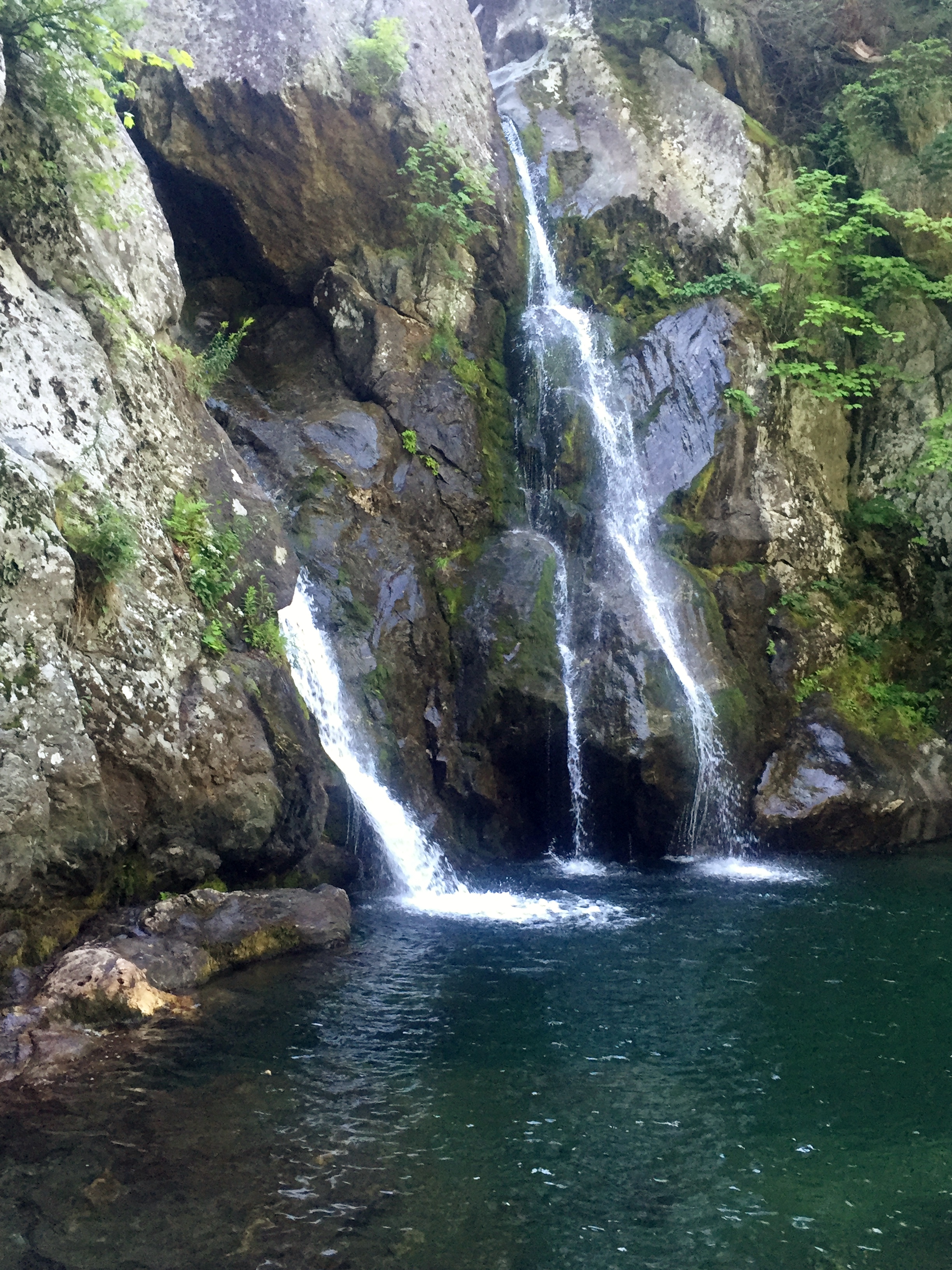
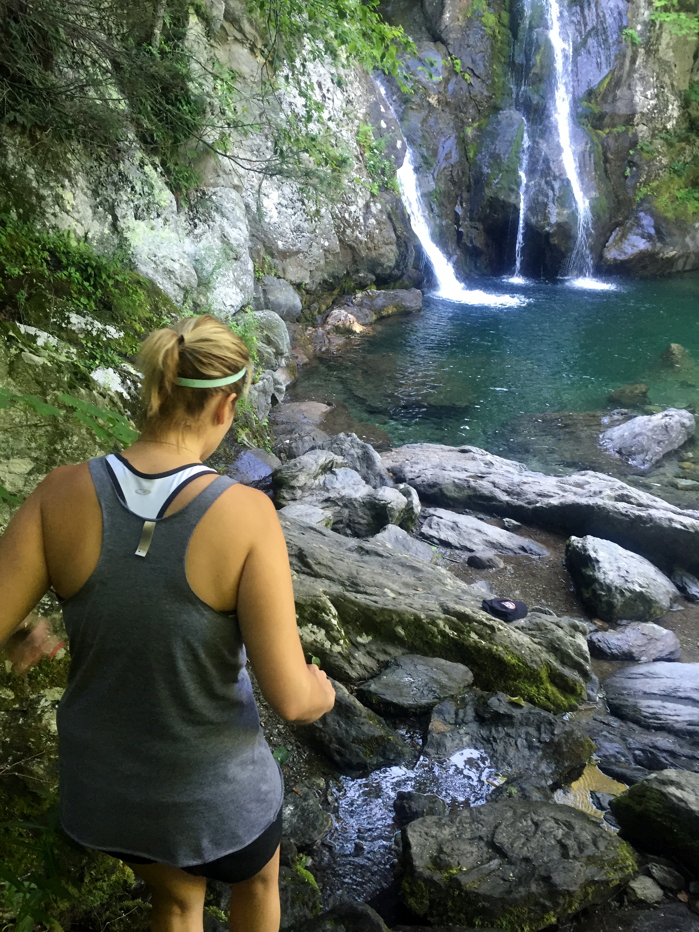
We hiked this short trail just about 15 minutes from where we stayed in an amazing cabin on Copake Lake, NY, just across the Massachusetts border. I gathered it is the highest waterfall in Western Massachusetts and it was a short hike that wouldn’t take much time, but would get everyone into the wilderness a little bit.
After some interesting driving to get to the trail head, there was only one other car there at about 9:30am. It was a Tuesday, which I guess contributed to the lack of hikers. We headed down the trail and immediately were in the deep woods and started losing elevation down to the falls. The terrain and landscape is so different from what we have been used to in Texas and it was great to see something different.
It just took about 20 minutes to get down to the falls and there were a few other people there who had taken a separate trail. It was gorgeous and I was able to crawl all around the rocks at the bottom to get different angles and explore the base of the falls.

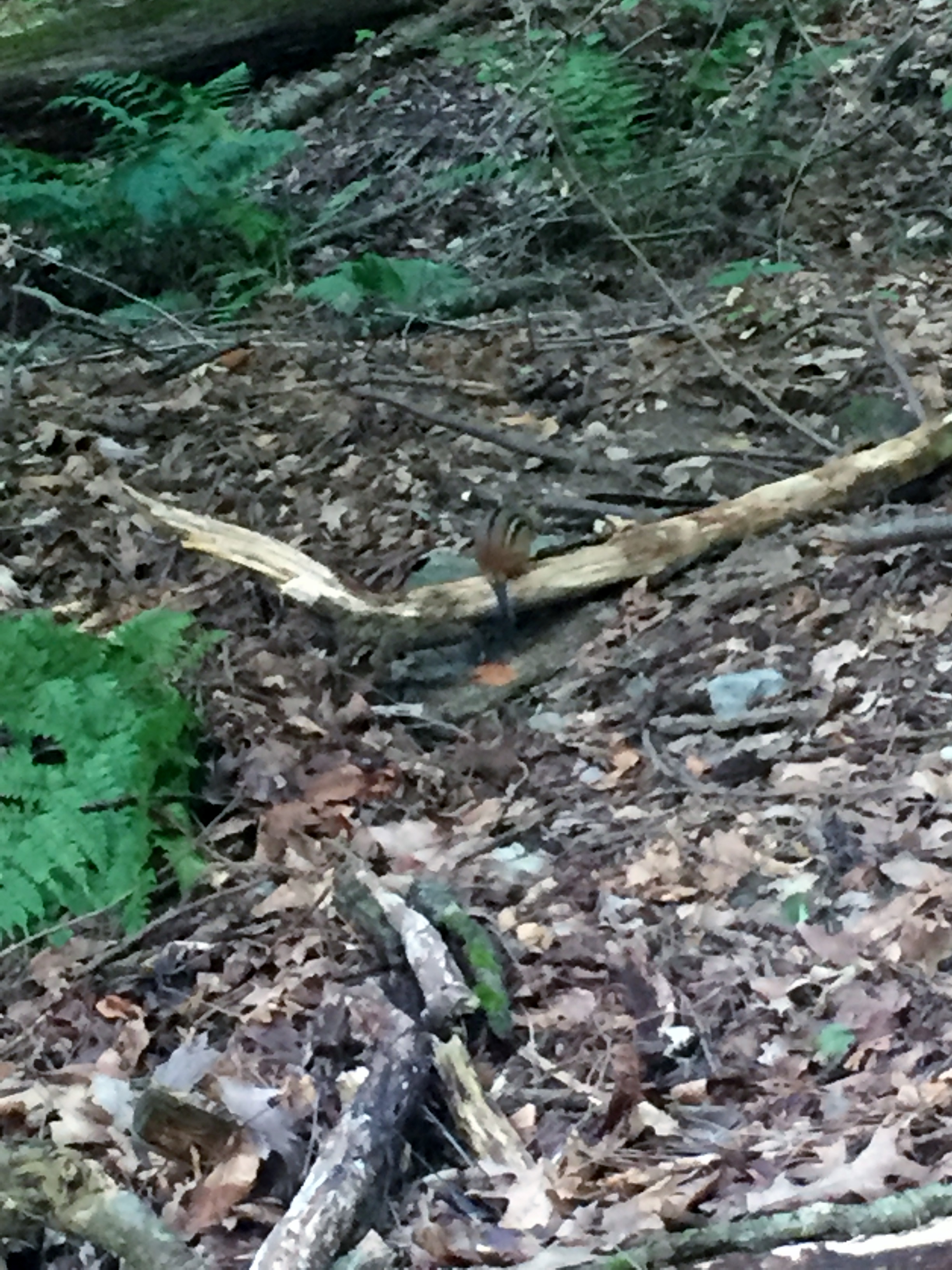
We hung out at the Falls for about a half hour and headed back up the trail, gaining all the elevation back that we had lost on the way down. We spotted a couple of chipmunks running around, which is normal up here, but they do not live in Texas, so we think it is great.

This is a great short hike that isn’t too hard and the Falls easily live up to their billing. This was a great way to start our time in the Berkshires.
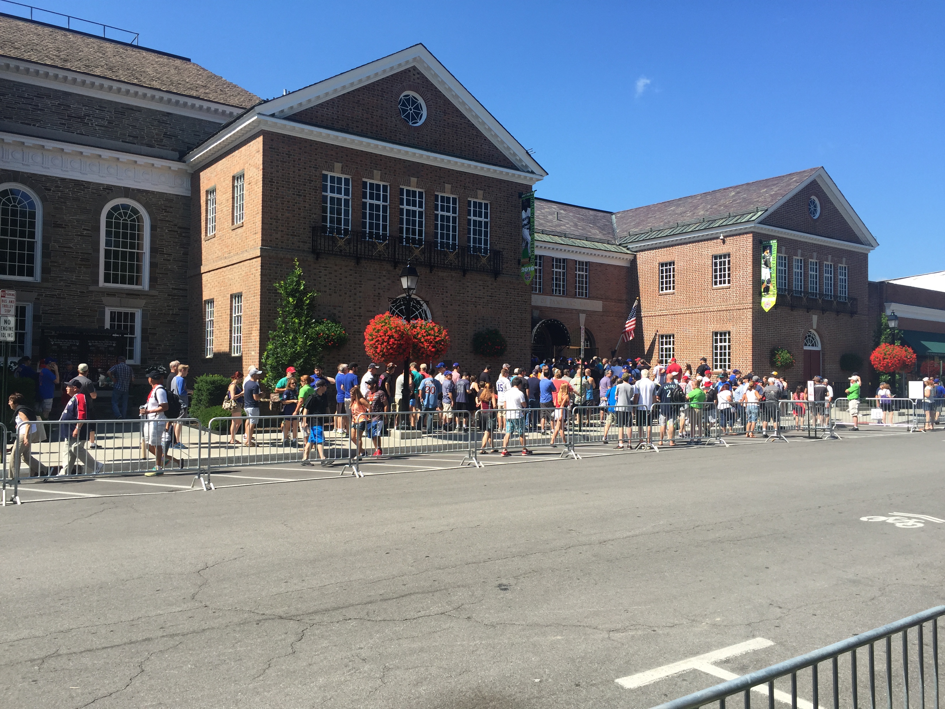
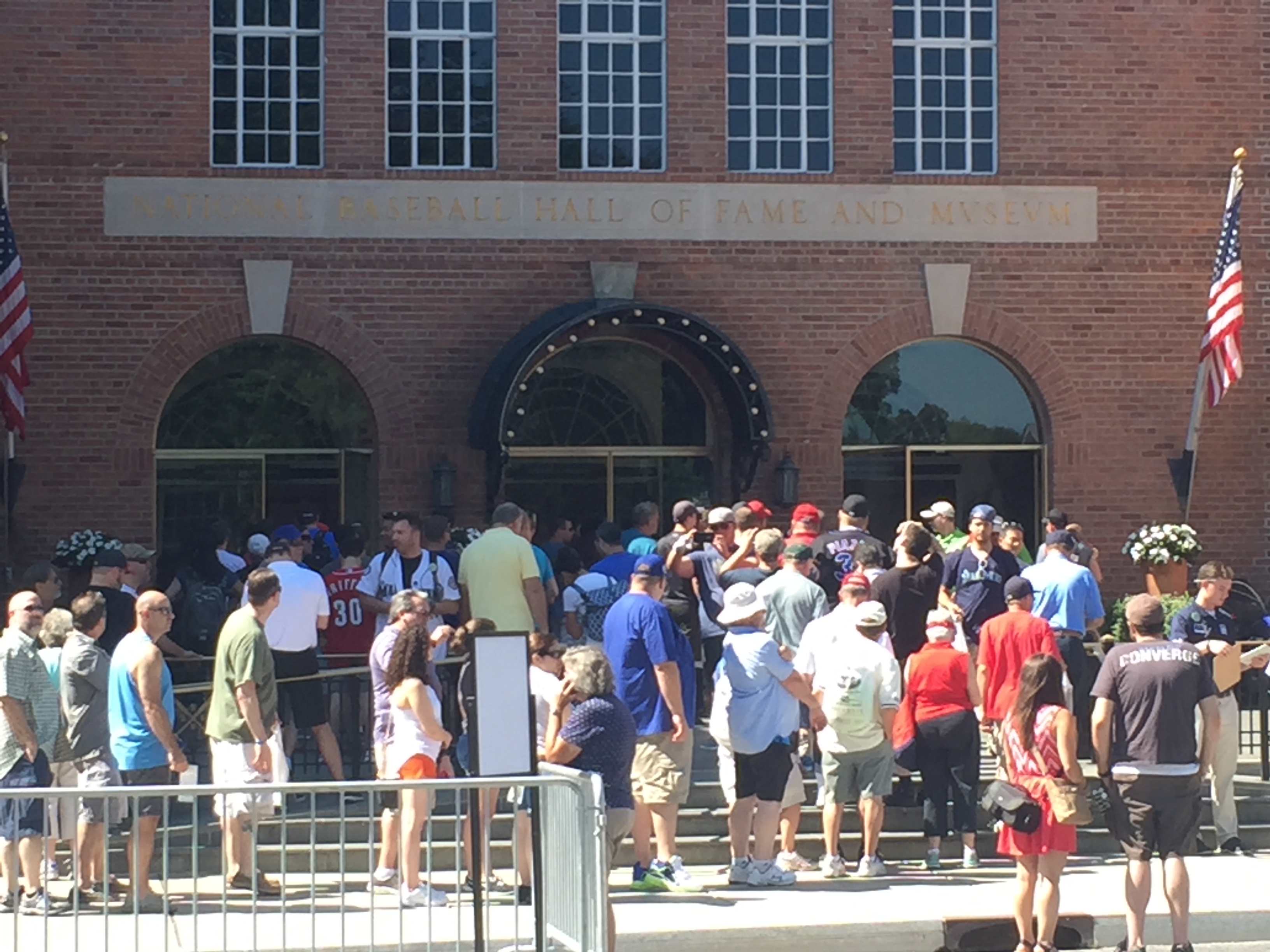
Ken Griffey Jr. Hall of Fame Induction – Cooperstown, NY 7/23/16 – 7/24/16
Saturday and Sunday, July 23 and 24, 2016
Cooperstown, NY
This isn’t the normal hiking blog entry, but it was part of our trip to New York and I’m including it because it was amazing. Ken Griffey, Jr. has always been my hero and favorite player and I planned a trip up to Cooperstown for his Hall of Fame Induction and then a couple of hikes over in the Berkshires of Massachusetts a few days later.
This is a really long post, so heads up.
I have been to the Hall of Fame once before when I was 14 years old. I remember a lot of it, but the chance to come see my favorite player ever get inducted into the HOF was the chance of a lifetime. Both sets of parents joined us on this trip as well.
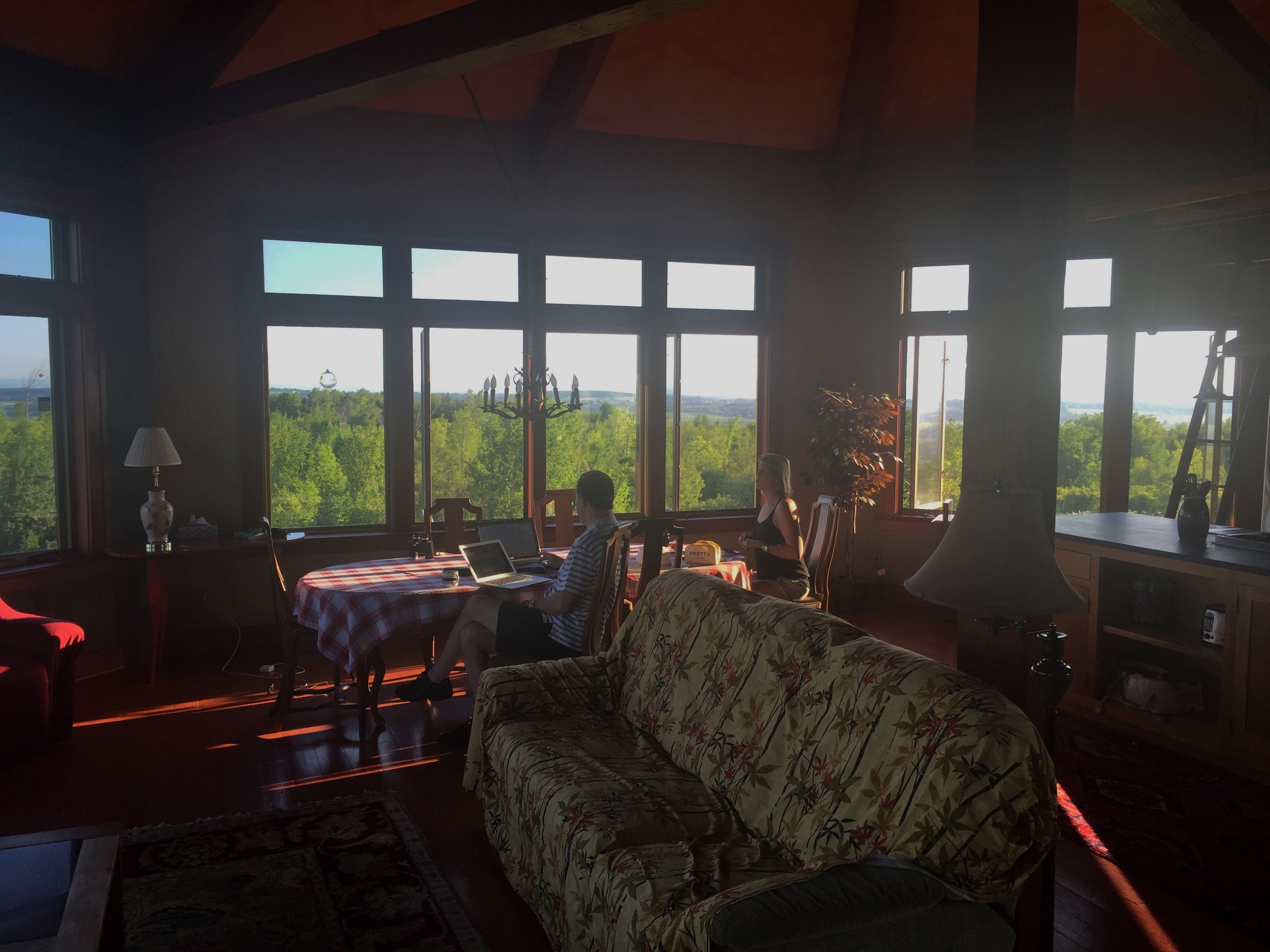
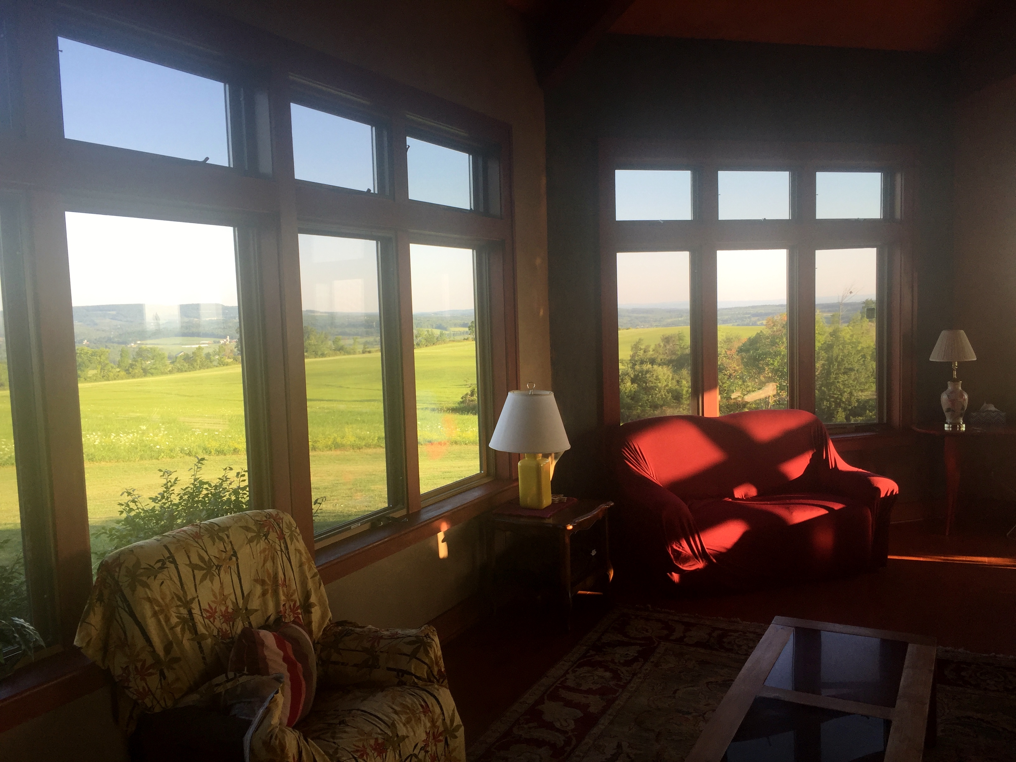
We stayed in a rented house about 30 minutes outside of Cooperstown on a hill overlooking the valleys. The sunrises and sunsets were stunning. The house was situated on 123 acres of land and had a very interesting, if somewhat odd, layout.

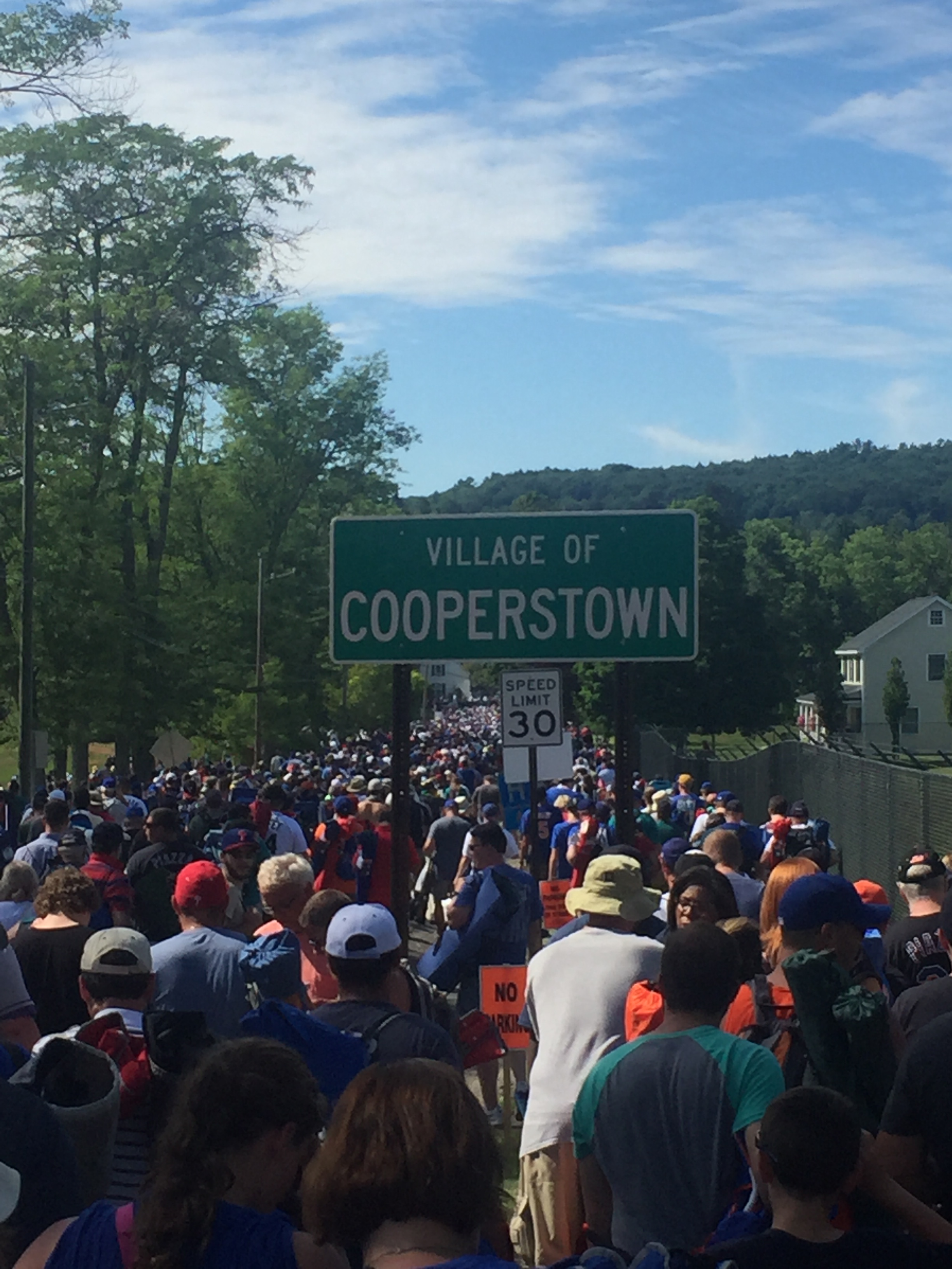
The first day we got up super early and went to the actual Hall of Fame Museum. We got to one of the free parking lots (Red, Yellow, and Blue) by about 8am and were able to park and then catch the trolley that runs to the Hall of Fame from the parking lots ($2 for an all day pass).

I was told that to beat the crowds we needed to arrive early and I’m so glad we did. We walked right in at around 8:30am and got done with the museum in about 3 hours and by the time we were leaving the line was way down the street and inside was elbow to elbow.


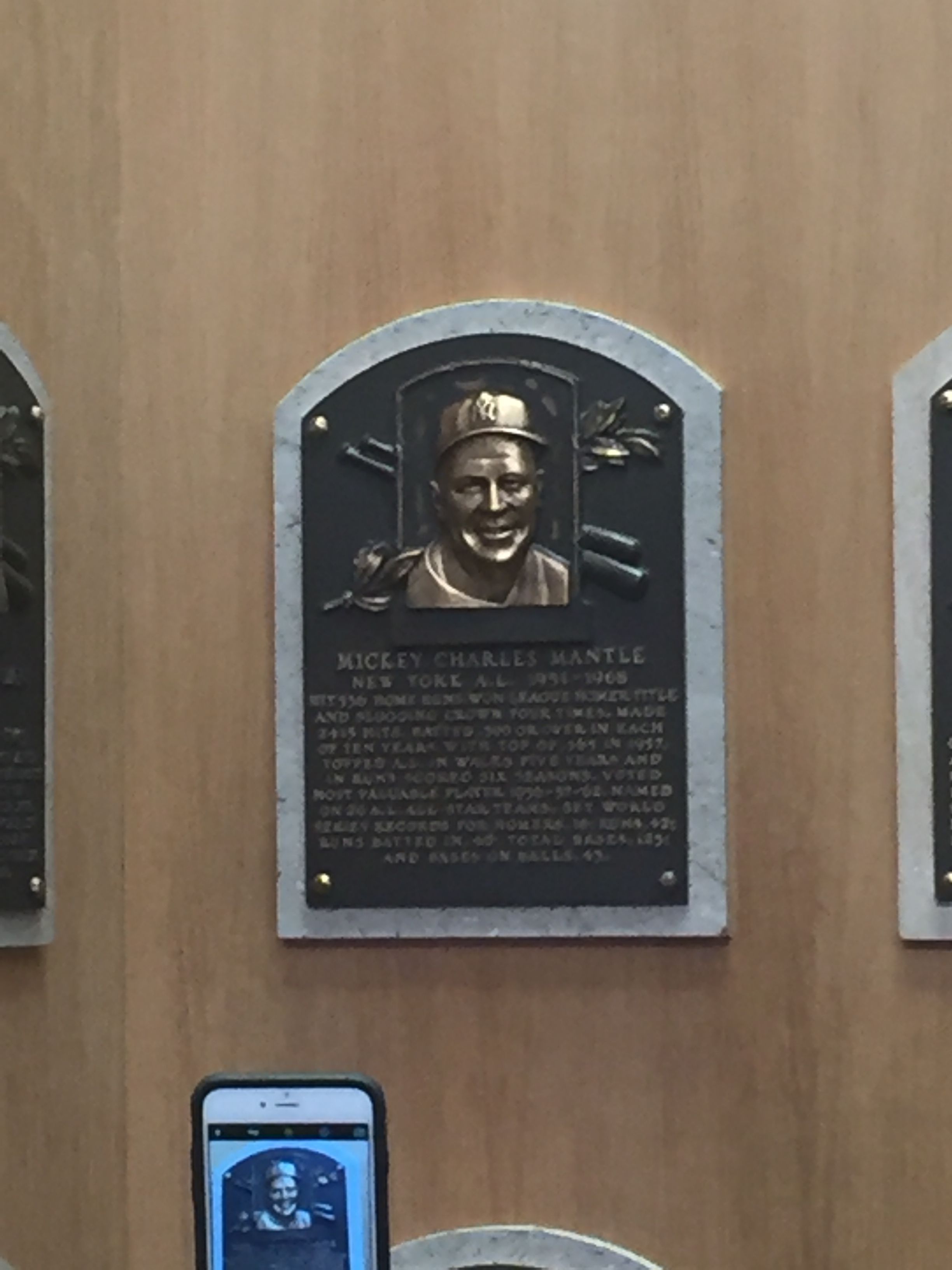
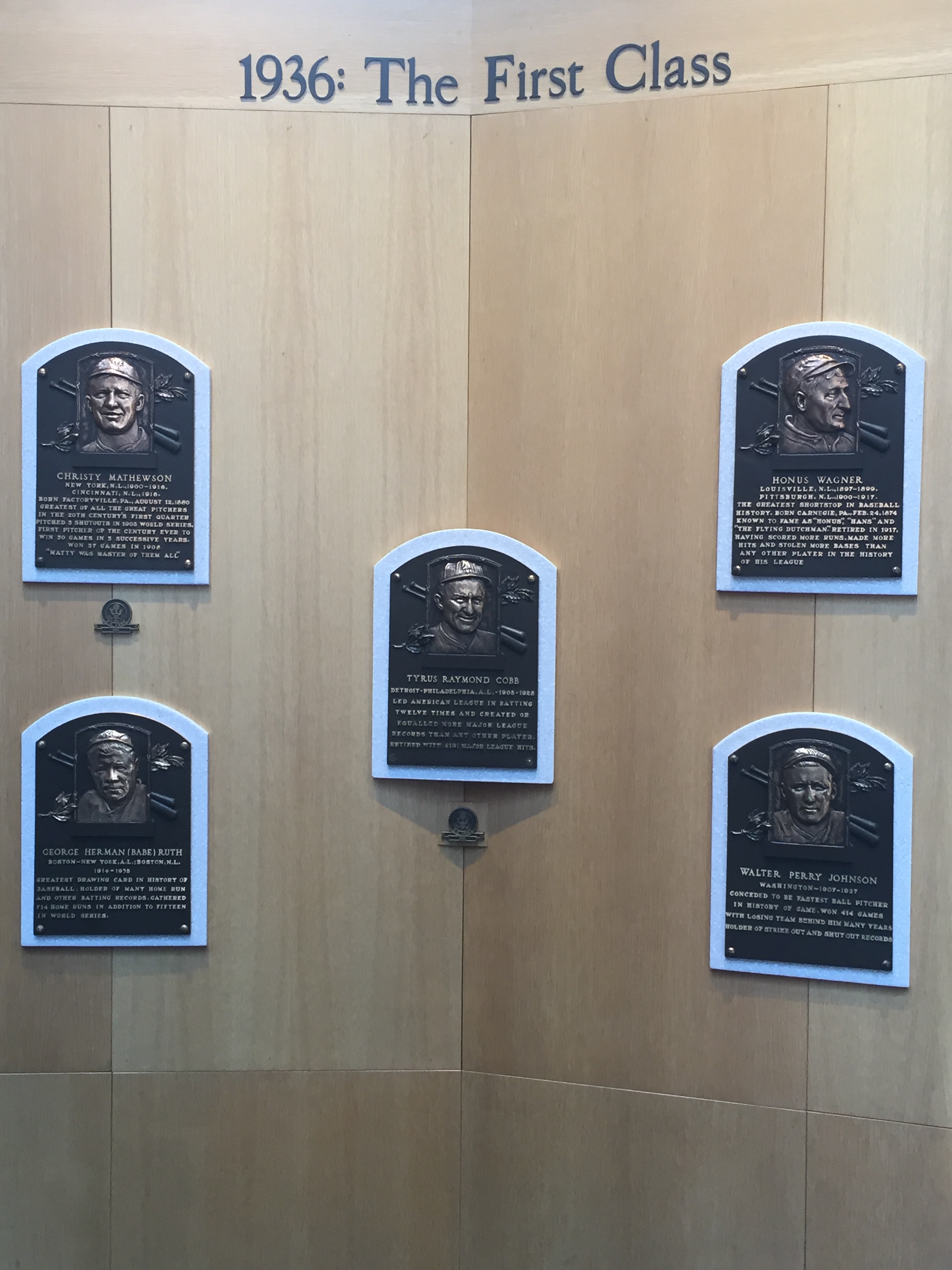
The displays upstairs are great, but I really love the actual hall with the plaques as well. Here are some of my favorite players.


We ate lunch at the Lake Front Restaurant on the marina at Lake Ostego (aka Glimmerglass Lake) and then explored Cooperstown for a few hours until the Hall of Famer Parade at 6pm.

We staked out a good spot near the start of the parade, which is only about a half mile long, if that. The plan was to run to the car as soon as the parade ended and drive to the Clark Sports Center where the induction takes place the next day so we could set out our lawn chairs and claim our spots.
The next morning we started out early again. In fact, very early. The sun rises around 5:30am in New York in the summer and we woke up to an amazing sunrise right outside our bedroom. The clouds were still in the valley and the crows were just waking up.
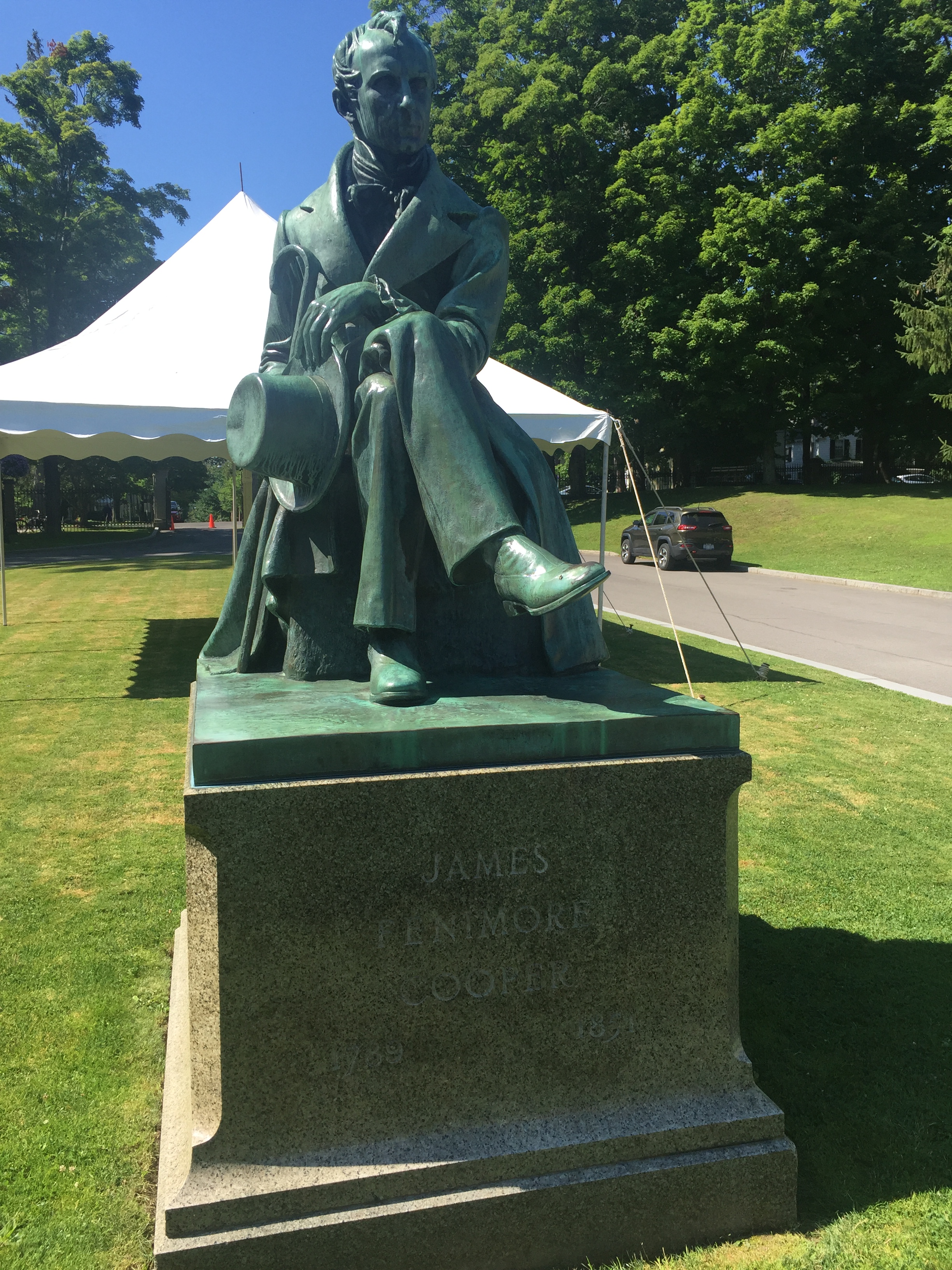
We left the house around 7:30am so we could get a spot in the parking lot for the trolleys back downtown. We went and ate breakfast at the Lake Front again and then went back to check out the Fenimore Museum. The museum is right by the golf course and several Hall of Famers were teeing off right across the street including Robin Yount, John Smoltz, Ozzie Smith and Rod Carew.


After the museum we took the trolley back downtown and the line for the buses to the Clark Sport Center was ridiculous, so we set off on foot. It’s only about a mile. Luckily we had set our chairs out on the edge of a pathway that security was keeping clear for emergencies, so it was really easy to find our seats and we didn’t have anyone in front of us for about 20 feet.


The sun was blazing and we sat in it for about an hour and a half before the ceremony started. Piazza was inducted first and he had an amazing speech. I wasn’t a huge Piazza fan coming in, but I definitely was coming out. Mets fans, on the other hand, decided after Piazza that they weren’t sticking around for Griffey and started walking out in the middle of his speech. Come on Mets fans. That’s just piss poor.
Griffey’s speech was also great, even if he couldn’t make it more than a couple of sentences without breaking down. I held it together really well, until he put his hat on backwards at the end. That got to me pretty good.
The lines on the video board weren’t there in real life.
It was literally a once in a lifetime experience and I am so glad my family was there to see it with me. We walked back with the huge crowd and stood in line for another hour in the hot street to get a trolley back to our cars. Court and I went to the grocery store and she cooked up a fantastic meal at the house where we ate and watched the sun go down.


The next morning we were headed to Copake Lake, NY near the border of Western Massachusetts.
Continued on next entry…
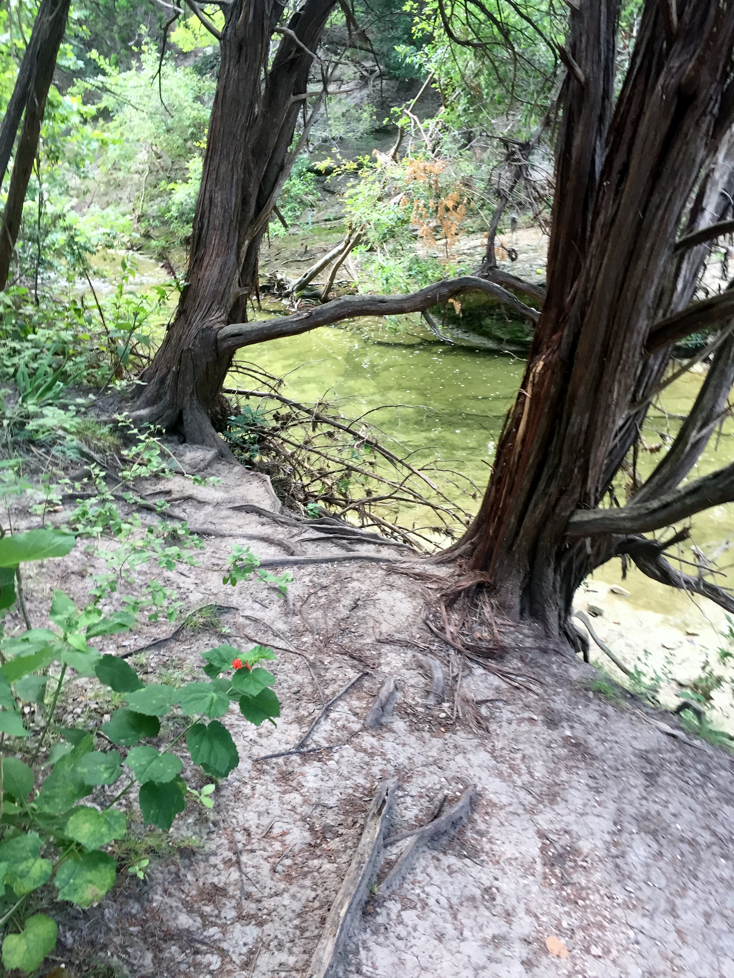
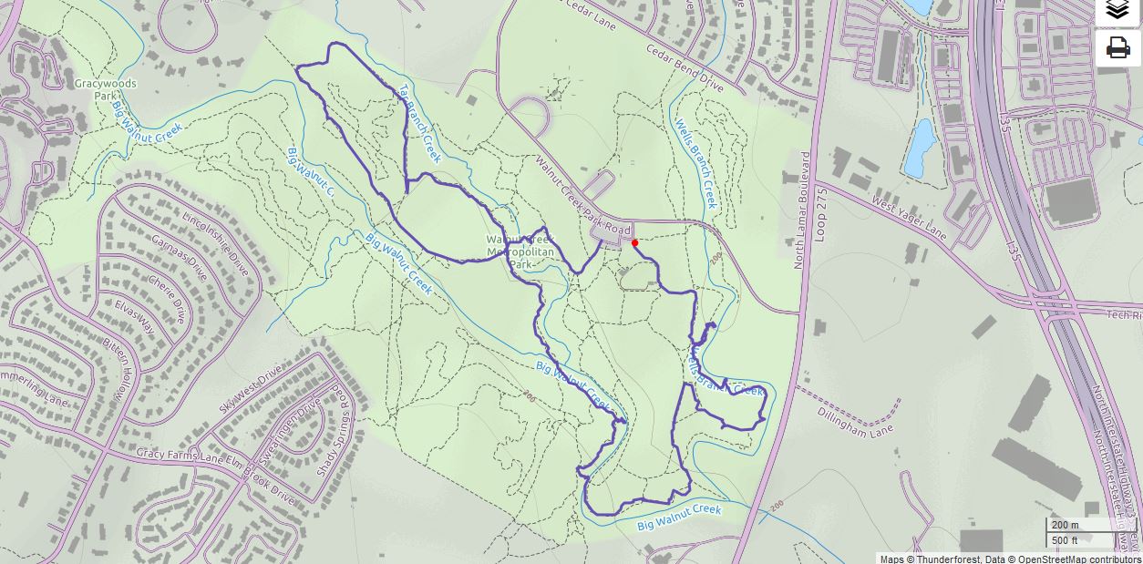
Walnut Creek Greenbelt 6/26/16
Sunday, June 26, 2016
Hike: Walnut Creek Greenbelt
Weather: Humid, hot, low 90s
Hikers: Ian, Court, Biff, Riley
Length: 2.9 miles
This is one of the few trails in Austin we haven’t done yet. It’s not really a trail, but a ton of intersecting loops. Lots of mountain bikers at high speed. Makes it interesting with off-leash dogs.
We got out somewhat early, about 9 or so and the heat was coming on, but luckily the trails are pretty shaded. It was very crowded, but the pups did well. Riley is my sister’s dog who we are dog-sitting while they are in Europe and she loves to hike and swim.
This park is right in the middle of north Austin and Walnut Creek runs through it. There are some nice creek crossings and deep, shaded woods. Aside from the traffic noise, you wouldn’t know you were in the middle of the city.

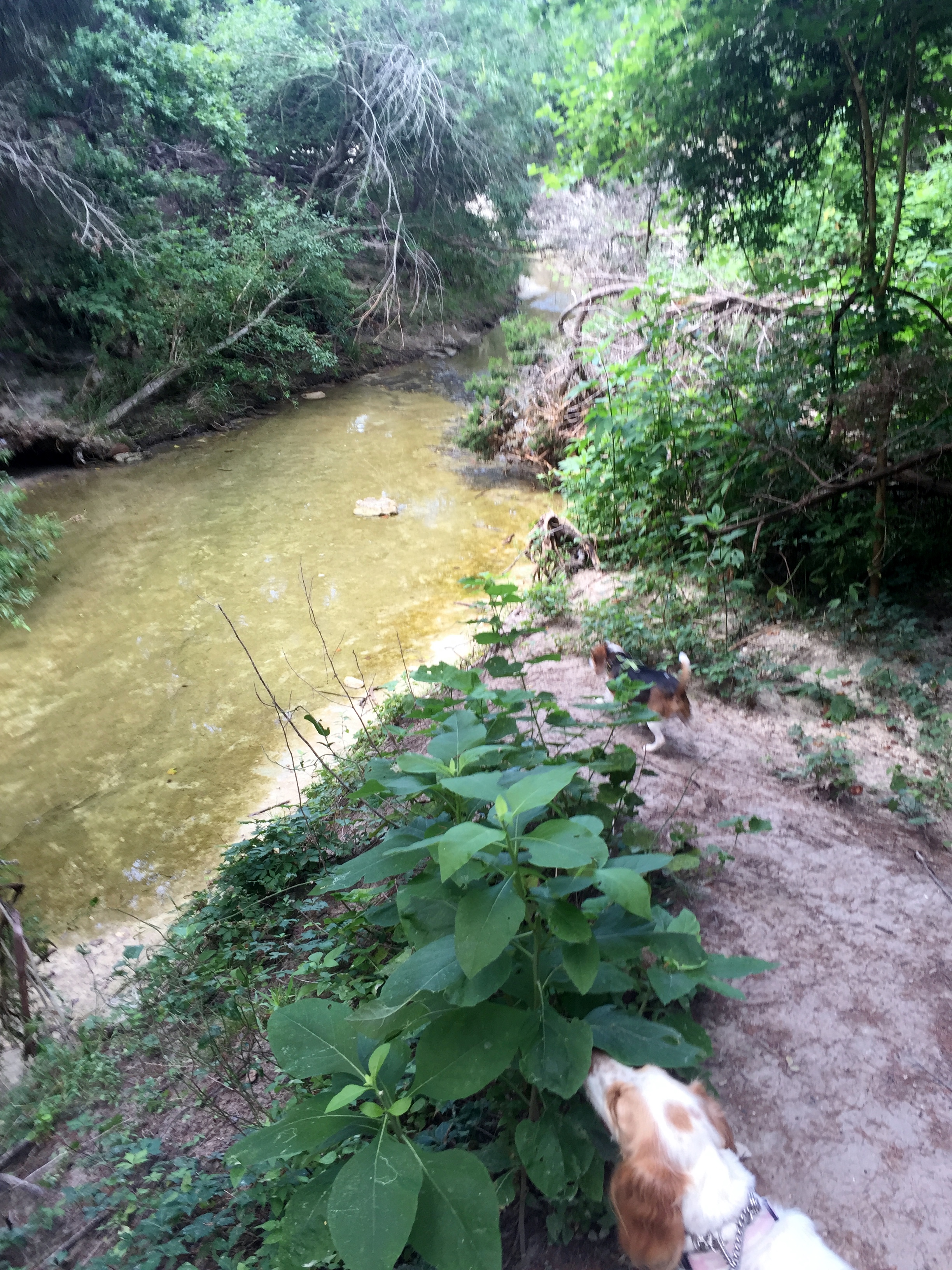

We wound around a few trails until the heat got to be too much and the dogs were ready to go. They played in the water, so at least they stayed cool.


Colorado Bend SP – Gorman Falls Trail 6/18/16
Saturday, June 18, 2016
Hike: Colorado Bend SP – Gorman Falls Trail, near San Saba, TX
Weather: HOT, humid, sunny, HOT
Hikers: Ian, Court, Greg, Cat, Sam
Length: 3.8 miles
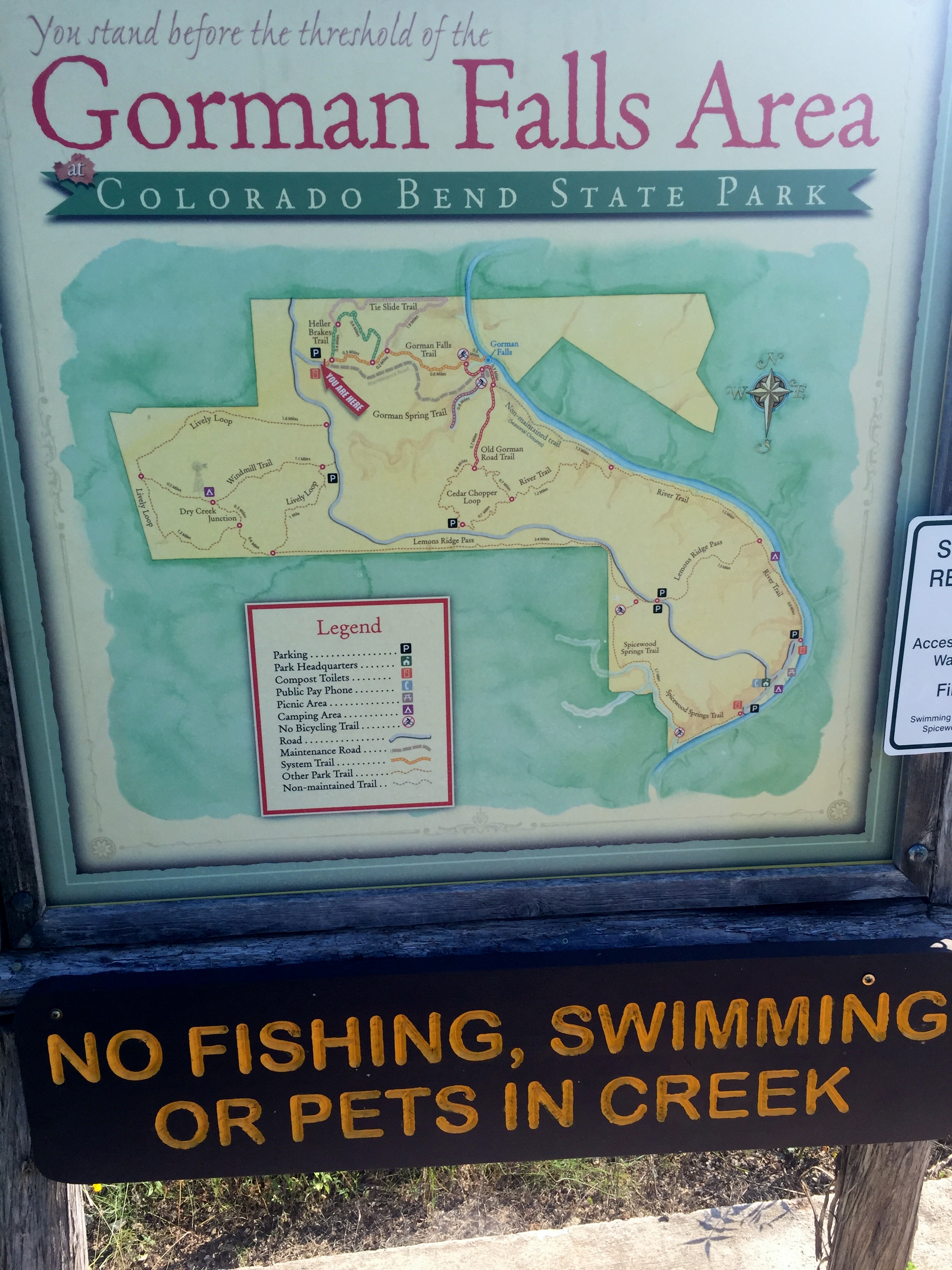
The four of us plus Sam got up early to beat the heat and drove out to Colorado Bend State Park to hike Gorman Falls and the Tenaja Trail. Greg and Cat had never been there. Court and I had planned to do the Tenaja when we backpacked here last time, but didn’t quite get to it. We got to the park and hit the trail at about 9am. We did not beat the heat.

Sam took off like he normally does, but within a quarter mile, he was huffing and puffing like we have never seen. We think he just went way too hard, way too fast, and didn’t realize how the heat would affect him. We rested in every shady spot we came to and gave him tons of water. The trail was your typical Texas rocky trail and the sun was beating down. We took Sam down and dunked him in the spring and cooled him off a bit, but it was clear this hike was going to be much shorter than anticipated.


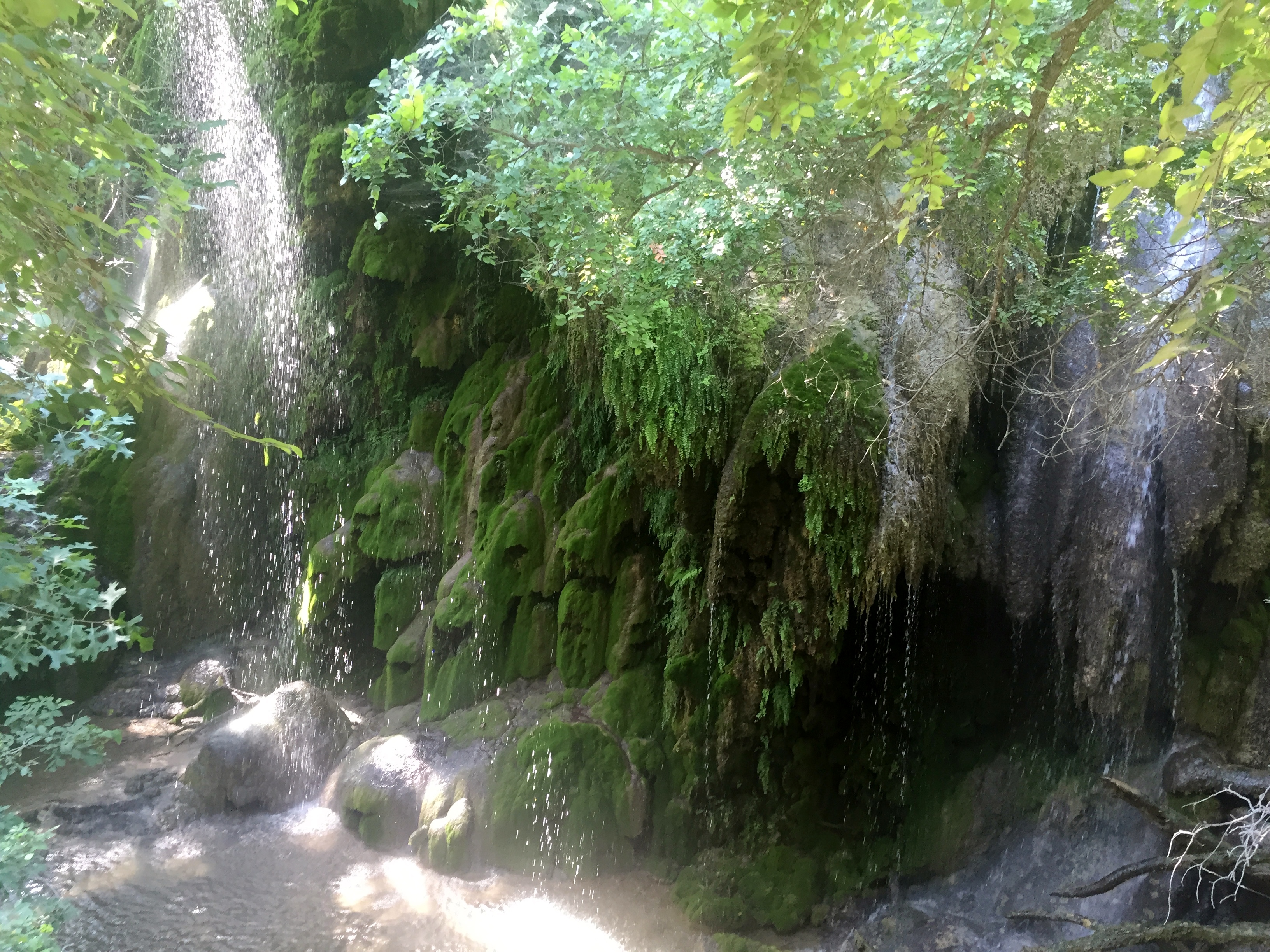
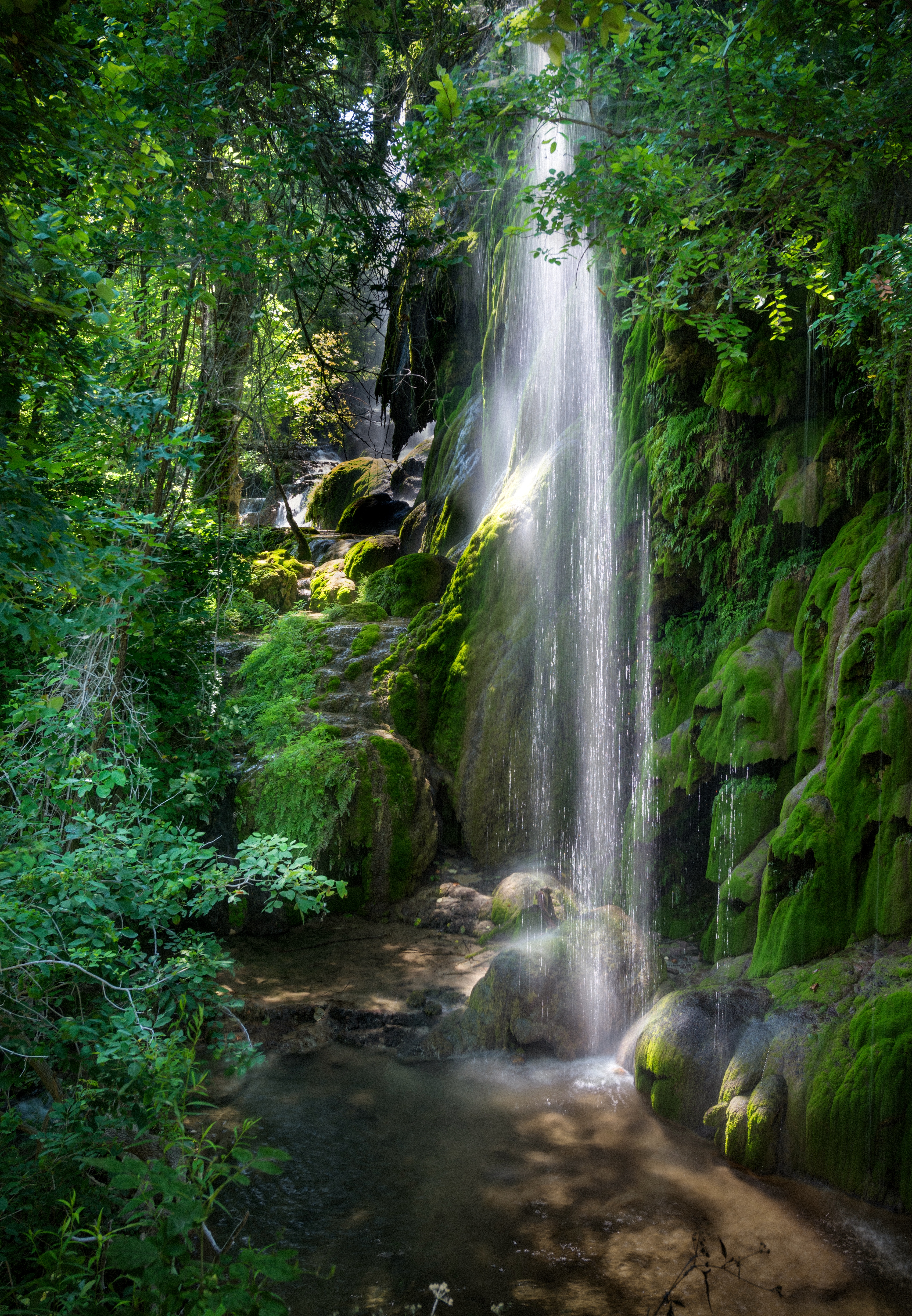
We decided to go on down to the falls though because it was only another .2 miles or so and Sam could maybe swim in the river. The falls were gorgeous as always and the temperature was noticeably cooler. The whole viewing area is shaded too. Sam was able to get down and swim in the river and he was back to his normal self shortly. We hung out in the shade for about a half hour or more while Greg continued his camera experiments.


We headed back up the steep trail and back to the car. Court checked the heat index and it came in at 113 degrees at around 11am. Texas hiking in the summer is no joke. It was very pretty, but I’m looking forward to getting up the the Catskills in July and Sequoia and Kings Canyon on Labor Day weekend for some non-Texas hiking. We got back to the car, cranked the AC, and headed home.


Recent Comments