Pierce Wanderings
Texas Hiking (and elsewhere)
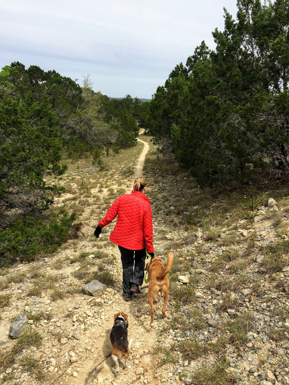
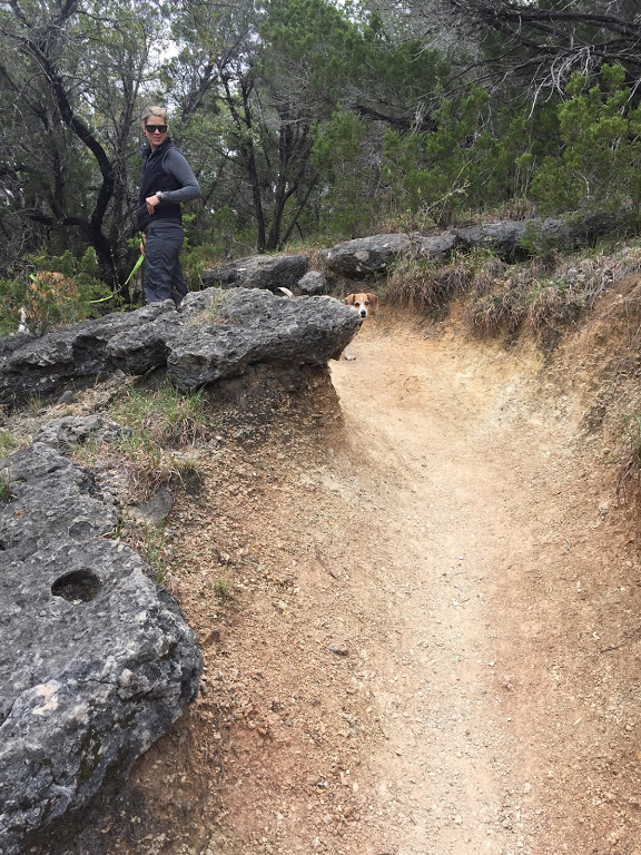
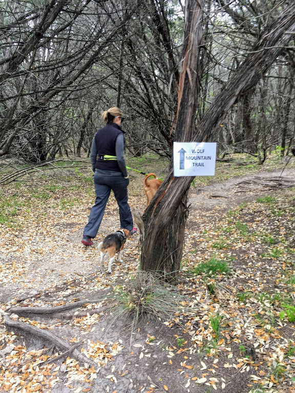
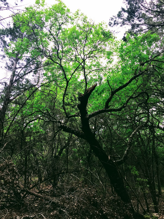
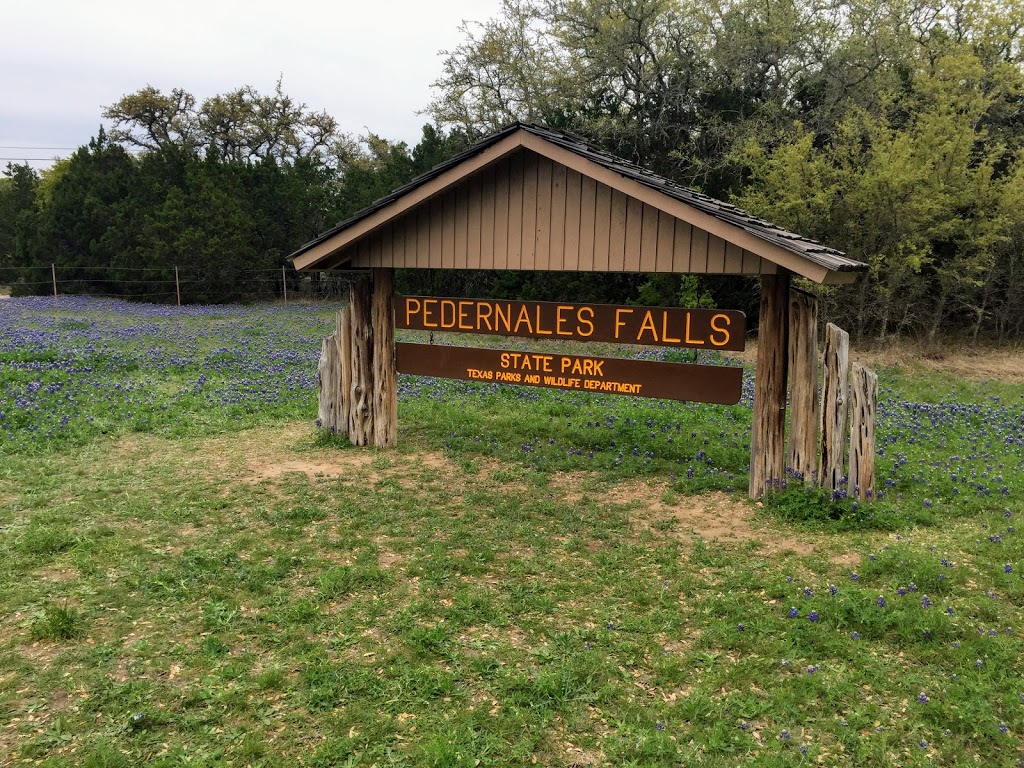
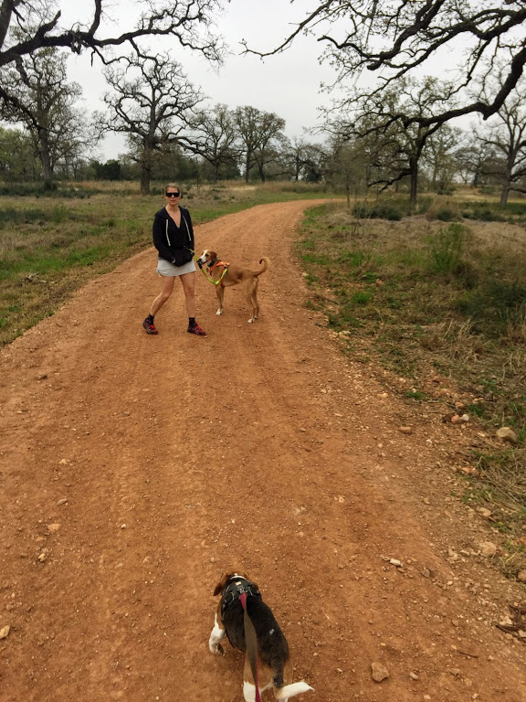
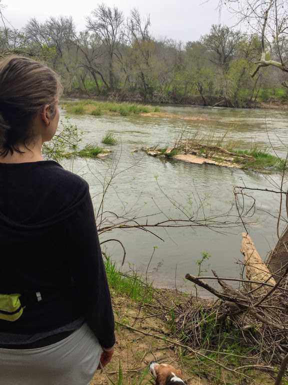
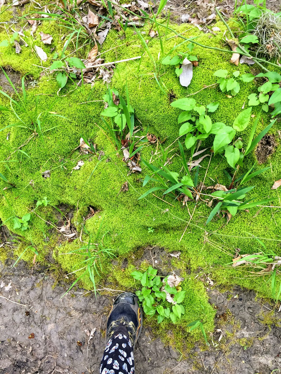
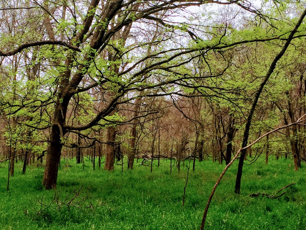
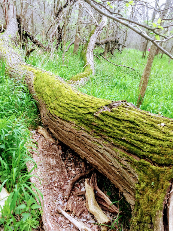
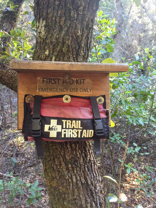
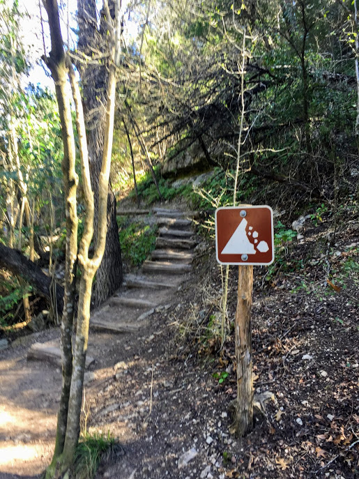
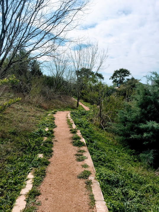
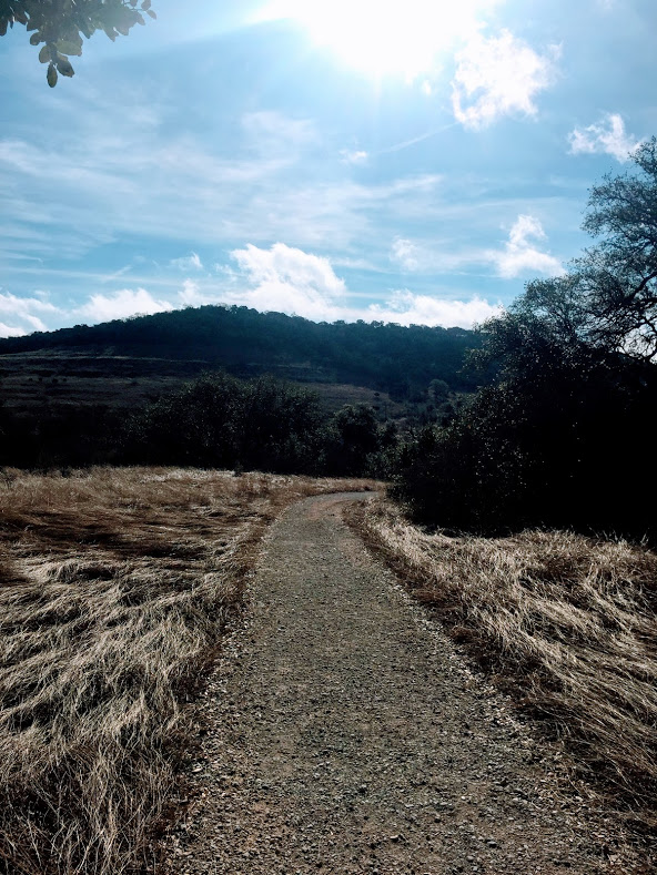
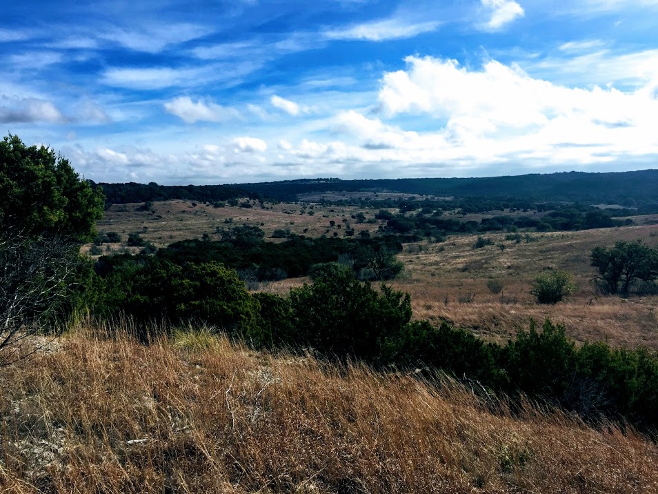
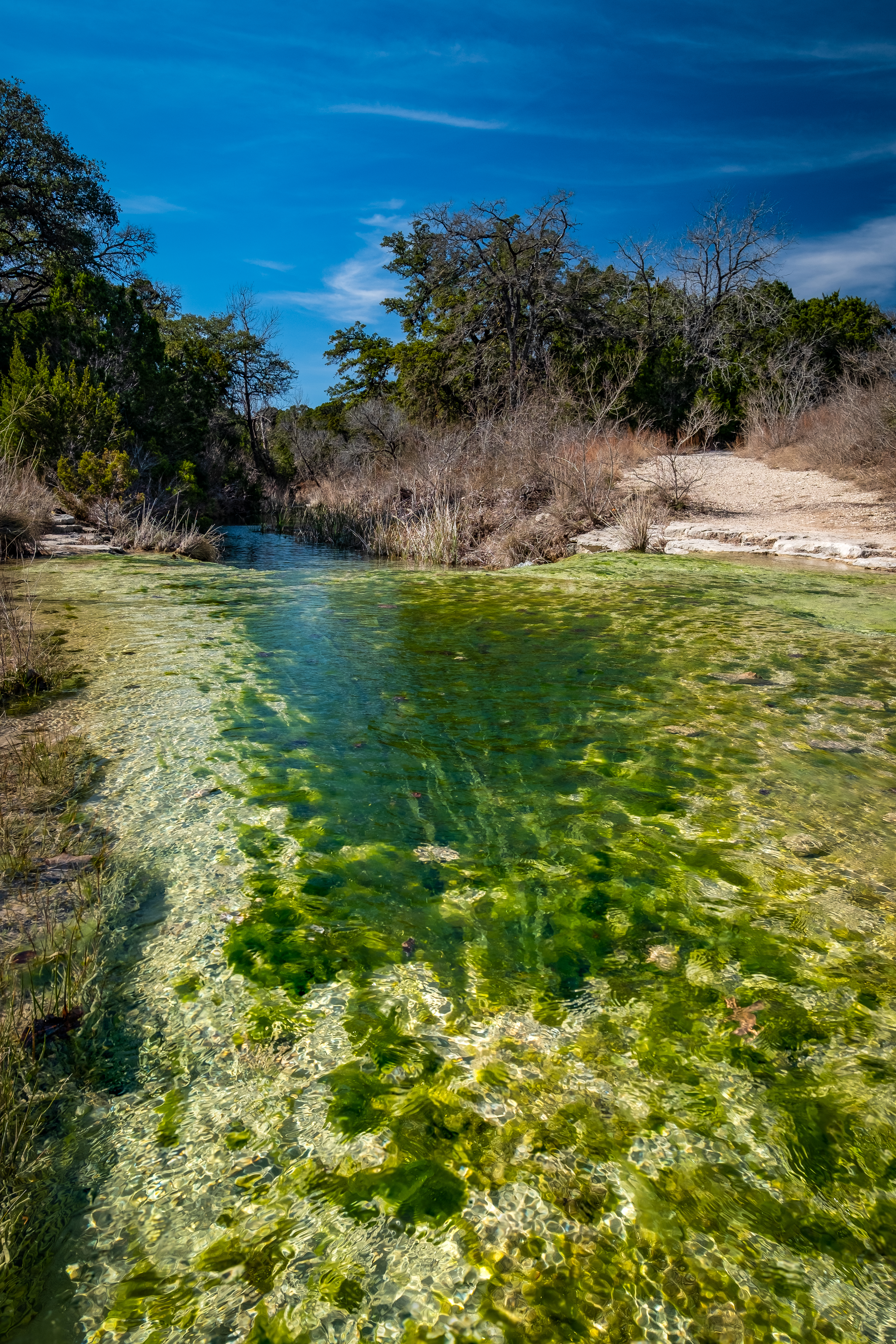
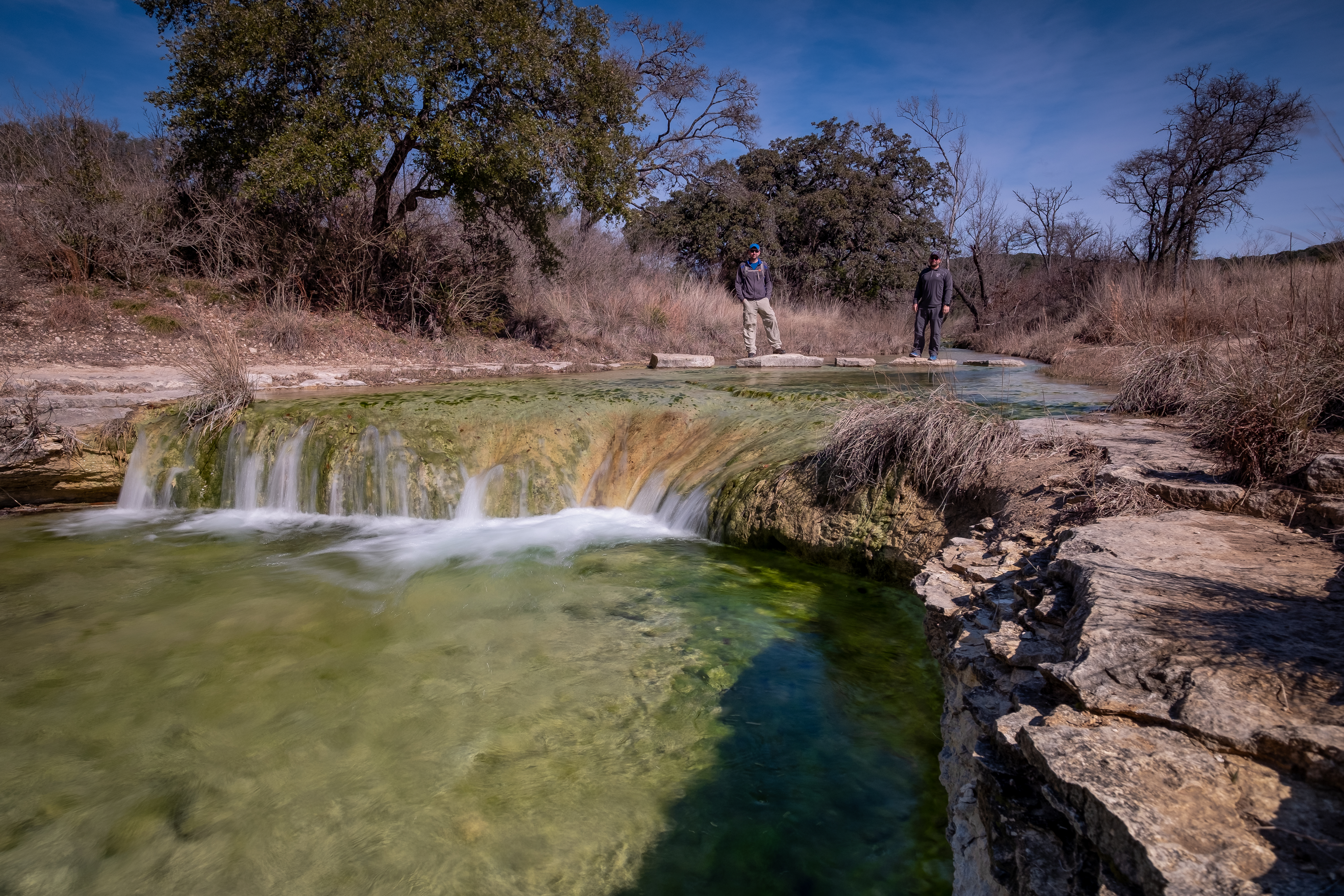
Pedernales Falls SP – Jones Spring 3/31/19

Sunday, March 31, 2019
Pedernales Falls SP – Jones Spring
Chilly, overcast, 40s-60s
Ian, Court, Biff, Finn
6.5 miles
We got out to Pedernales Falls and did some of the trails in the southern part of the park that are much less traveled than the trails up by the Falls. The winter weather (Texas winter, not actual winter) refuses to release us from its grip so we started the morning in our puffy jackets for the first hour or so before we worked up enough heat to shed the layers later in the hike.

We combined parts of the Madrone, Juniper Ridge, East Boundary, and Wolf Mountain trails to make a loop on the southeast corner of the park before coming back down the Windmill Road to get back to the car.

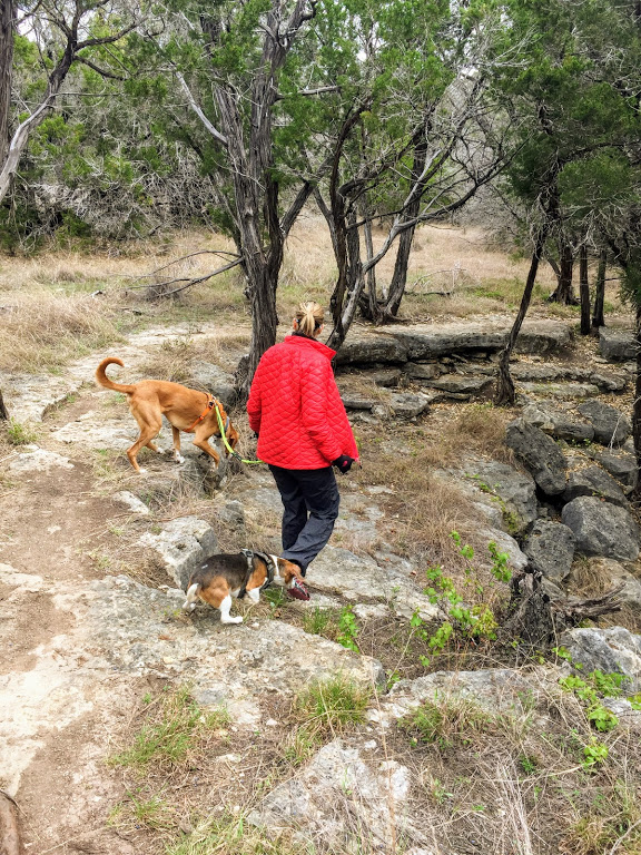
About halfway through we got to Jones Spring and the remains of an old homestead. This was a great place to stop for lunch.


After the spring we took the Wolf Mountain trail for a bit as it wound around through the woods and eventually took the Windmill Road for a straight shot back to the car.

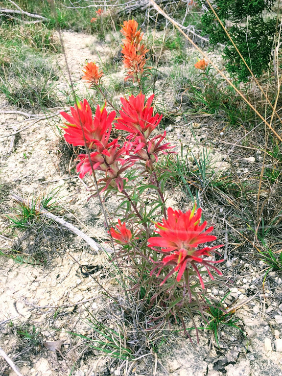
Strangely, there were very few wildflowers in the park, even though we are in the midst of the season right now. There was a large field of bluebonnets at the entrance to the park and some very nice people took some pics of us and the pups.


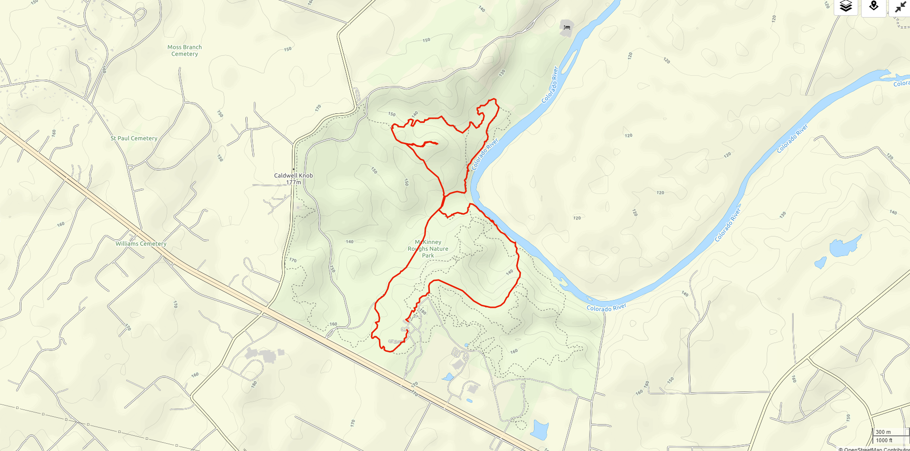
McKinney Roughs 3/10/19

March 10, 2019
Ian, Court, Biff, Finn
Overcast and cool
5.4 miles
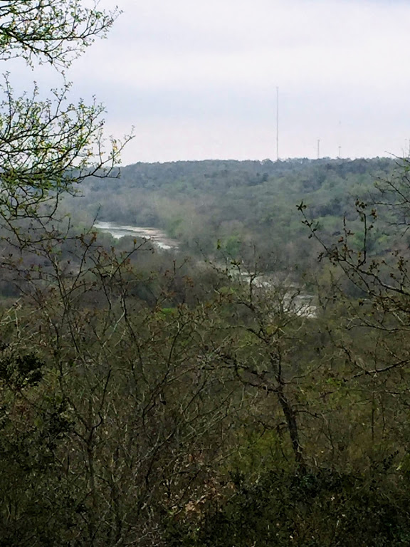
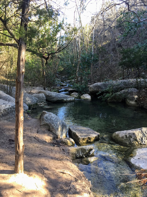
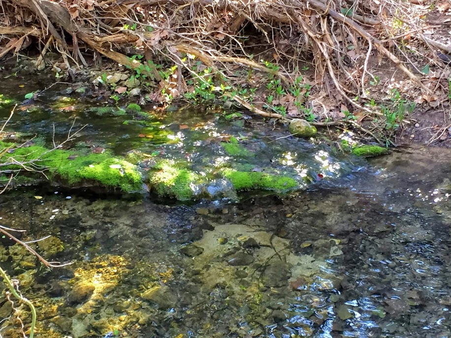
One of our favorite hikes near Austin is at McKinney Roughs Nature Preserve. It is run by the LCRA and has gotten a lot more maintenance lately because they opened a zip line course that brings in more money, so that’s fun. We haven’t done the zip line yet, but I’m sure we will at some point.

Spring in Texas is starting to come out after a long and wet winter. It is still chilly in the mornings (mid 40s or so), but getting up into the 70s regularly during the days now. 100s are just around the corner I’m sure.
We took the main path down to the river and then followed the river north towards the Hyatt Lost Pines Resort before winding through some thicker woods. The greens are coming out nicely.


Biff has started eating grass on hikes a lot. He doesn’t act any different or like he’s feeling bad, he just likes grass now. Thinks he’s a cow I guess.


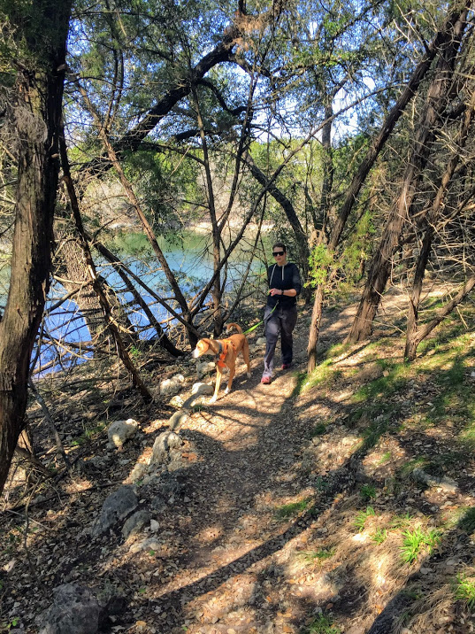
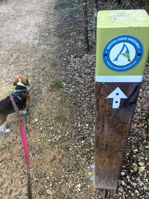
Riverplace Nature Trail 2/24/19

Went out with Greg to the Riverplace Nature Trail the week before they started charging $10/head/pet to hike there. I do understand the need to limit crowds, as it has gotten extremely popular, but $10/dog? That seems a bit overboard.
Anyway, we did the full trail, out and back, including the Little Fern side trail. Water was flowing pretty well. Lots of people. Very pretty. Tired at the end.
Greg and I are going to hike Half Dome in Yosemite in the fall, so it’s time to get in shape. This trail will probably be one of several that I use to train for that endeavor.


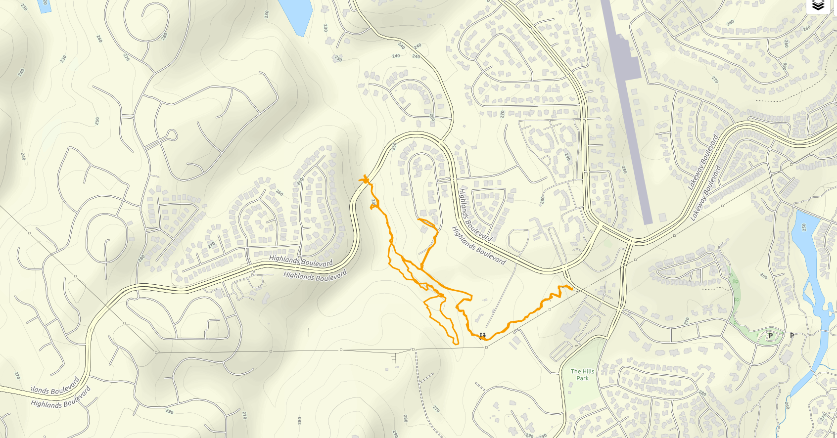
Rim Trail, Lakeway, TX 2/17/19

Hike: Rim Trail, Lakeway, TX
Weather: cool, sunny, mid 60s
Hikers: Ian, Court, Biff, Finn
Length: 3.14 miles
This was a nice short hike back out in Lakeway starting from the Mt. Lakeway trail head. Our goal was to take the trail all the way to the lake, but they are doing construction and the trail seems to have been cut off, unfortunately. We circled back and did a quick loop around the pond which is more full than we’ve ever seen, due to some consistent rain this winter.
It was still a nice day and the pups were happy to get out in the early spring weather. We still have a few random days of cold and cloudy, but spring is just around the corner. I’m planning to hike a lot this year in anticipation for a pretty big idea that I will share down the road.


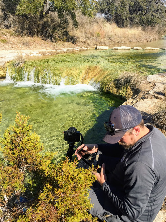
Balcones Canyonlands NWR – Doeskin Ranch 1/20/19

Sunday, January 20, 2019
Hike: Balcones Canyonlands NWR – Doeskin Ranch
Weather: cool, clear, mid 50s
Hikers: Ian and Greg
Length: 3.7 miles
This is one of my favorite hikes, though I don’t do it that often because there are no dogs allowed due to it being a National Wildlife Refuge.
Greg had never been and I figured it would be a good hike to start off the new year and a good MLK Day hike. We got out to the trail head around 11am and there were actually several other cars in the lot, which was a bit surprising. We didn’t see too many people on trail though, as I think there were some families with kids and they probably didn’t do the full length of the trail.
The day was pretty and quiet and we saw several small birds flitting around along with some vultures riding the updrafts. Greg brought his fancy-pants camera and got some shots of the waterfall near the end of the hike. I’ll let the photos do the rest of the talking.


Tyler State Park (belated) 7/14/18
Saturday, July 14, 2018
Hike: Tyler State Park – ‘A’ Loop Trail
Weather: warm, sunny, upper 80s?
Hikers: Ian, Biff, Finn
Length: 2.6 miles
I totally forgot to blog this when it happened back in July. I only remembered it because I was going back through all my 2018 photos, but hey, better late than never.
Court had a work function up in Tyler and I did a quick hike out at the state park. It was quite a nice hike through the piney woods of East Texas. We got out before it was too warm and the dogs had fun.
Here are the photos in no particular order.


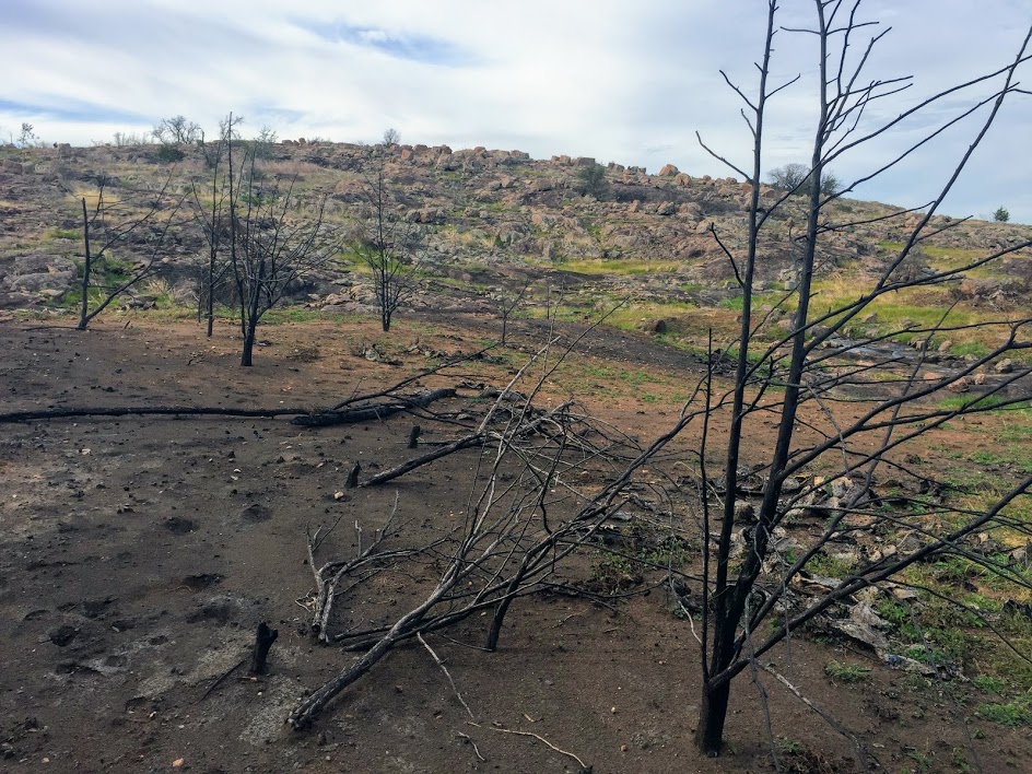
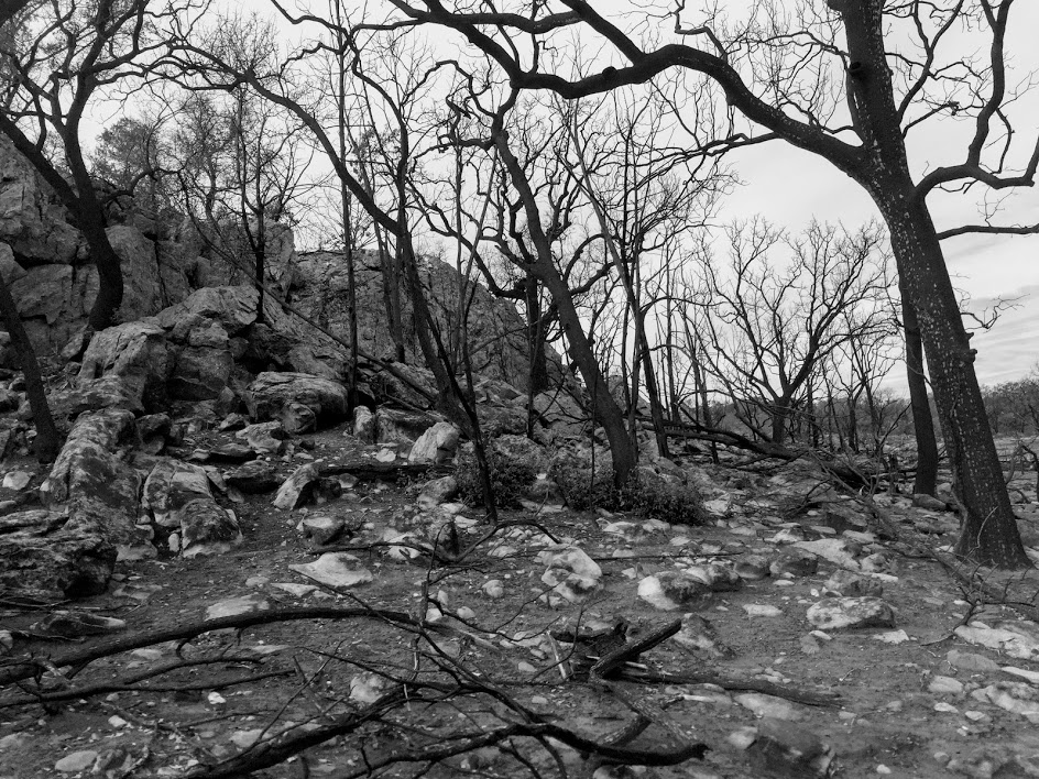
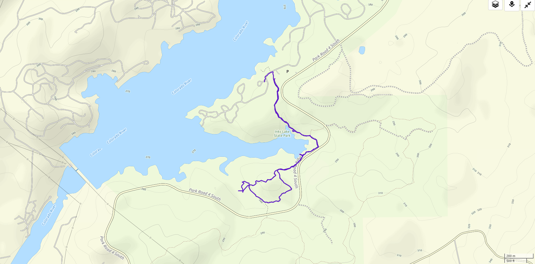
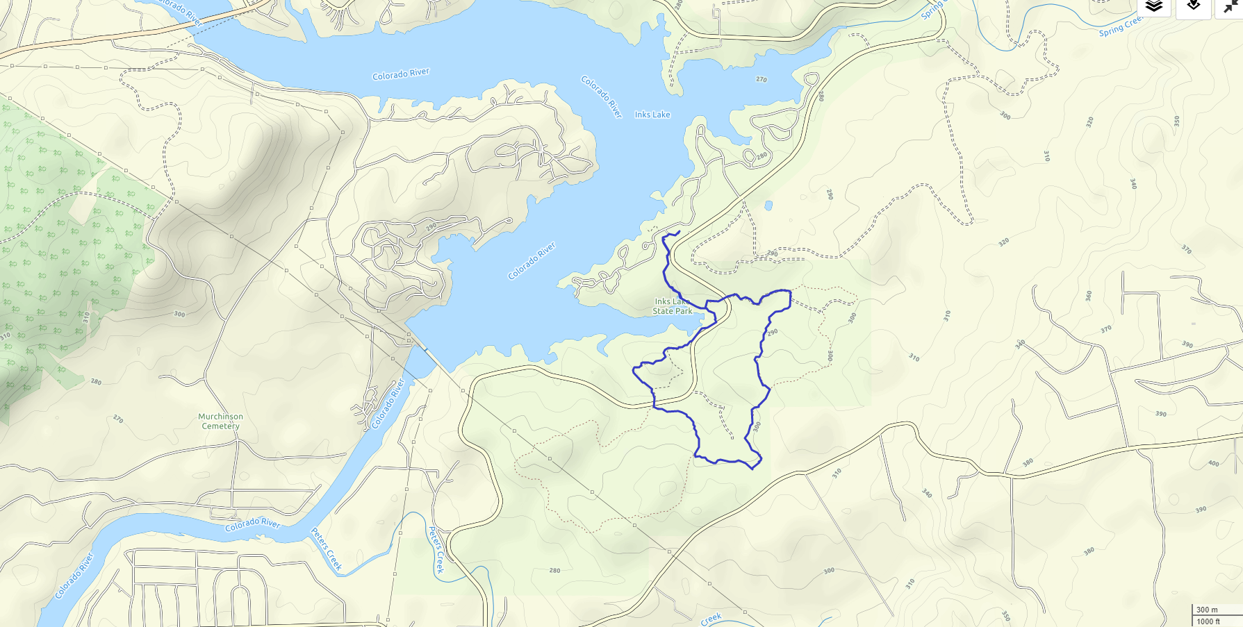
Inks Lake Overnight 11/24/18-11/25/18

Saturday and Sunday, November 24-25, 2018
Inks Lake State Park
Ian, Court, Biff, Finn
As is becoming tradition, we headed out to one of our favorite state parks for Thanksgiving weekend. This was originally slated to be a two night affair, but some exciting football scenarios played out and we wanted to make sure we were in a place to watch on Friday night.
Our regular site (#328) wasn’t available, so we took a chance on #304 which turned out to be awesome. It’s a huge site with private lake access. We could easily camp 3 separate tents here.
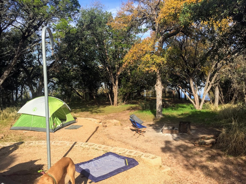

After a couple of hours in town watching football, we went for a quick evening hike before starting up a fire and making dinner.
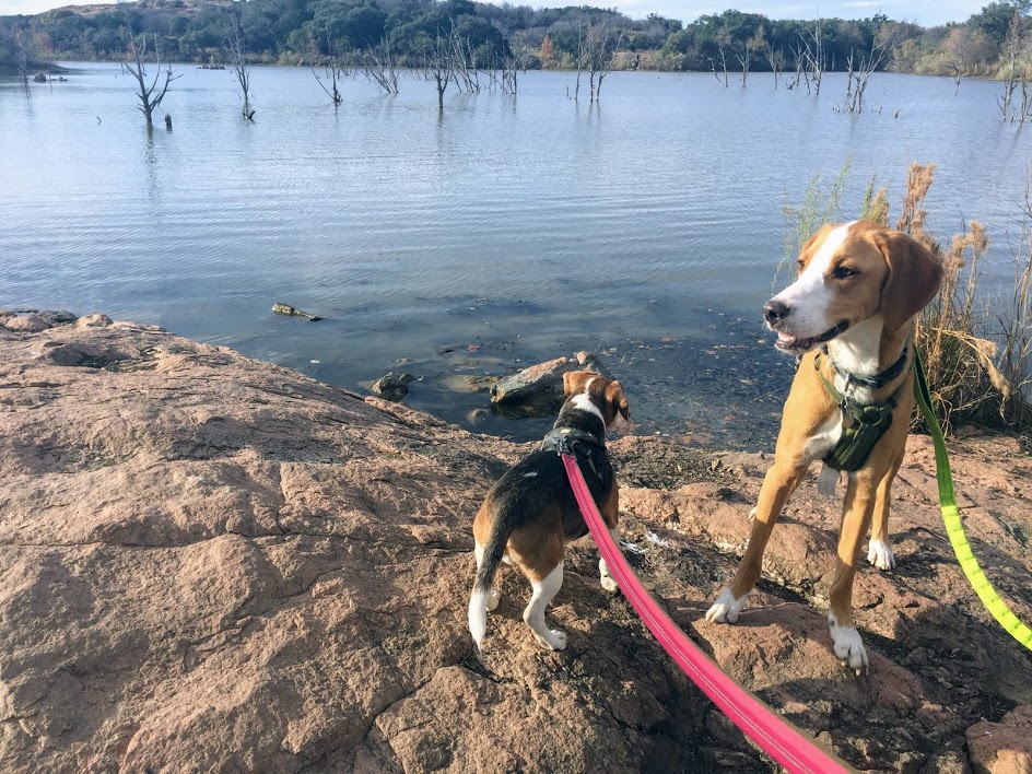


We woke up with the sun, packed up, and hit the trail for a longer hike to finish out the trip.

There was a fire out here this summer that consumed about 300 acres within the park and made for some really interesting burn zones on our hike. There were huge swaths of burned cactus that looked like corpses on a battlefield. Twas a bit eerie.


Barton Creek Upper 11/3/18
Trying out the new WordPress editor on this one so gonna be just some pics and whatever else I end up messing with.
Edit: Well the pics didn’t show up on the mobile version so I guess it’s back to the normal editor for now.
Hit up the Hill of Life after some heavy rains this fall in Austin.


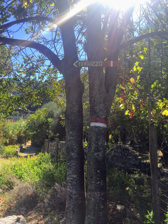
Palmaria Island – Portovenere, Italy 9/28/18
Friday, September 28, 2018
Palmaria Island – across from Portovenere
4 miles

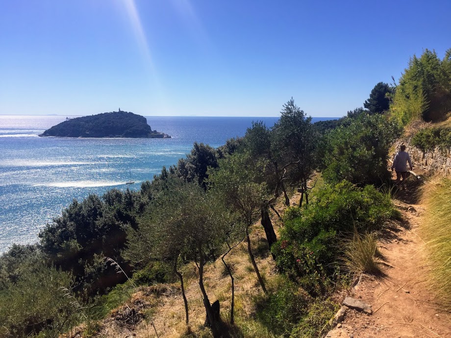
This hike was not really planned. The idea was to take the ferry across the bay to Palamaria Island and rent kayaks and explore the coast line. We had heard there was a place on the island to do just that. Instead we found a weird mix of dilapidated buildings, an odd beachfront “cafe” that looked like it might be haunted, wild goats, and questionably marked trails. On top of this, Court was wearing shoes much more suited to kayaking than hiking, so needless to say she was not ready to hike what ended up being just over four miles. She stuck it out though and the island gave us an interesting afternoon hike.
We started off on an old jeep trail that gradually climbed up and around the island, giving us some nice views looking back toward La Spezia and the mainland.


We climbed up into the woods for a bit and then back down to the shore, where we were greeted by the remains of an old military base of sorts. Most of the buildings had fallen down and it had a very eerie vibe.


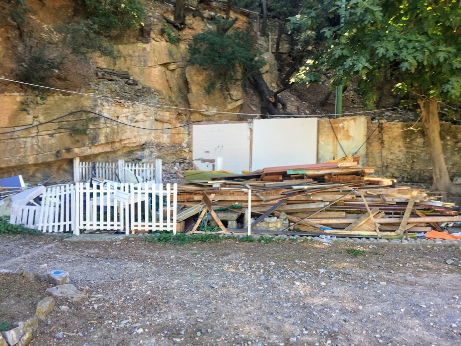
After this is where the “cafe” was, though it looked deserted as well. The pics of it on Google maps show it full of people and the food looks good, so maybe we were just here at a weird time of year or something.
We soaked our feet in the ocean for a bit and then headed back up hill where we were greeted by the islands wild goats that roam around and eat whatever they can.


We reached a few more military ruins at the top, enjoyed the views, and then cut back across the center of the island.

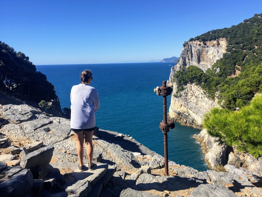
There was actually a large fort in the center that was completely overgrown and I believe dates back to WWI or WWII.
By this time our feet were hurting and we were a bit disappointed by the lack of kayaks we had anticipated, so we did our best to get back to the dock and catch the ferry back to Portovenere as soon as possible. I think if our expectations had been different, this would have been a much more enjoyable hike, but it was an experience nonetheless.

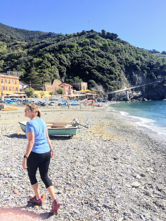
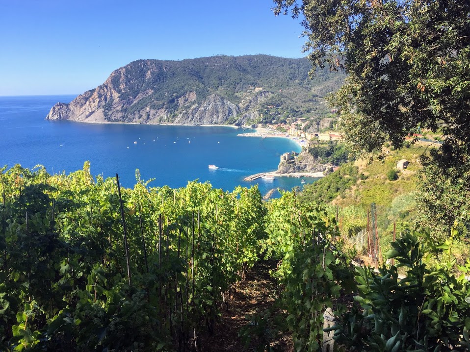
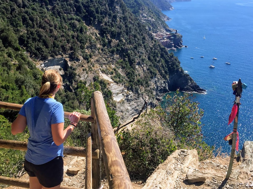
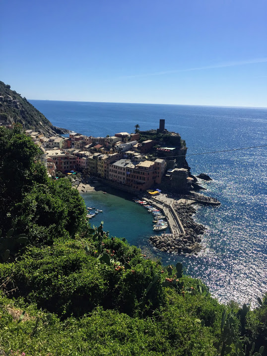
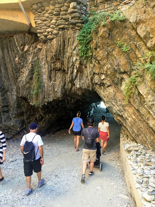
Cinque Terre – Monterosso to Vernazza 9/27/18
Thursday, September 27, 2018
Cinque Terre – Monterosso to Vernazza
About 3.5 miles
Cinque Terre is an interesting place. It is beautiful, but I will say it is a bit over hyped. Don’t get me wrong, it is unique, but it feels like the towns are still trying to figure out how best to deal with the hordes of tourists that have started to come in the past few years. That said, still a good day.
We took the first ferry in the morning out of Portovenere where we were staying to Riomaggiore, the southernmost town of the Cinque Terre. There is supposed to be a system of trails that connects all five towns, but the first two (Riomaggiore to Manarola and Manarola to Corniglia) were closed, which is apparently a semi-permanent status. After realizing this, we took the ferry up to Monterosso on the north end and made the trek over to Vernazza.


This was a pretty difficult hike in terms of elevation, as you basically go from the beach straight up through the vineyards to the top of the hills and then back down. There were a lot of people to contend with, but the views were pretty spectacular.

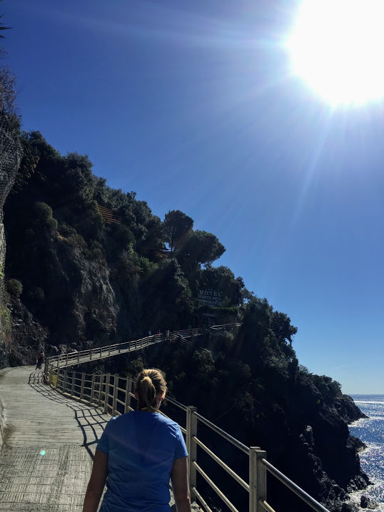


There is a wine train track that is elevated along some of the trail, which as far as I can tell is like a tiny rollercoaster that takes you among the vineyards, but it wasn’t running today apparently.


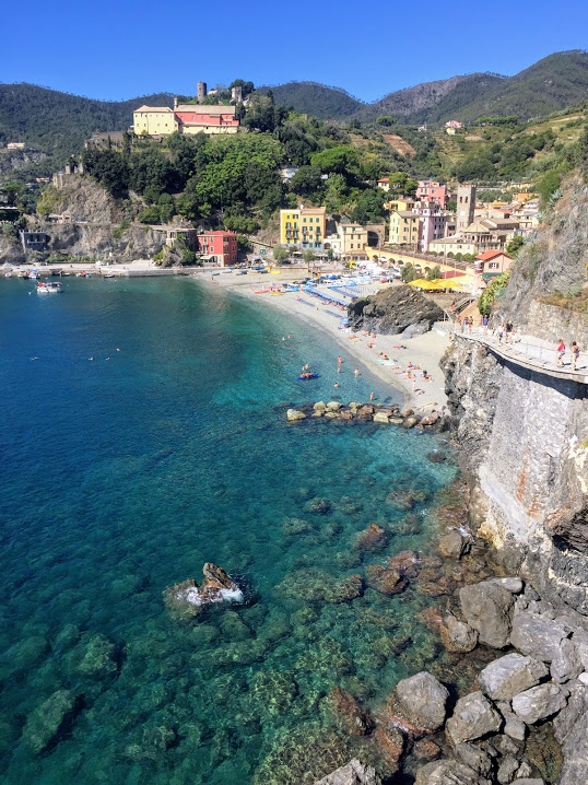
Vernazza seems to be the most popular of the towns and it has the most unique layout with an enclosed harbor and a watchtower that was used to look out for invading pirates back in the day.


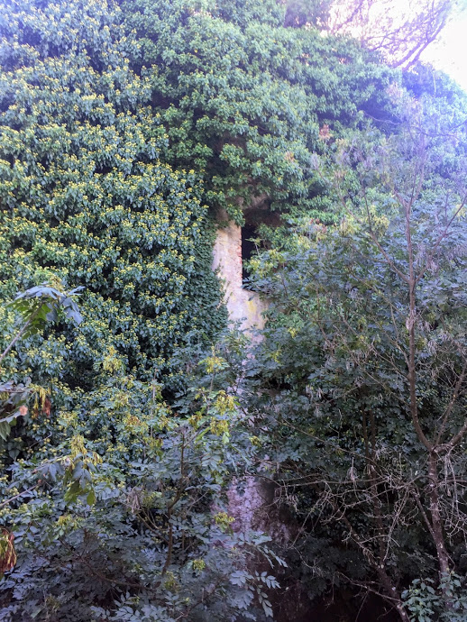
There is also cave under the massive natural rock wall that leads to the beach. This was really really cool, though it seems like easy access for the aforementioned pirates.

After a quick lunch and some views from the watchtower we took the ferry over to Manarola, which ended up being my favorite town. Here you could cliff jump into the harbor and it just had the most chill vibe of all the towns.

Cinque Terre was definitely an experience, but just be prepared for huge crowds in both the towns and the trails in between.

Recent Comments