Pierce Wanderings
Texas Hiking (and elsewhere)
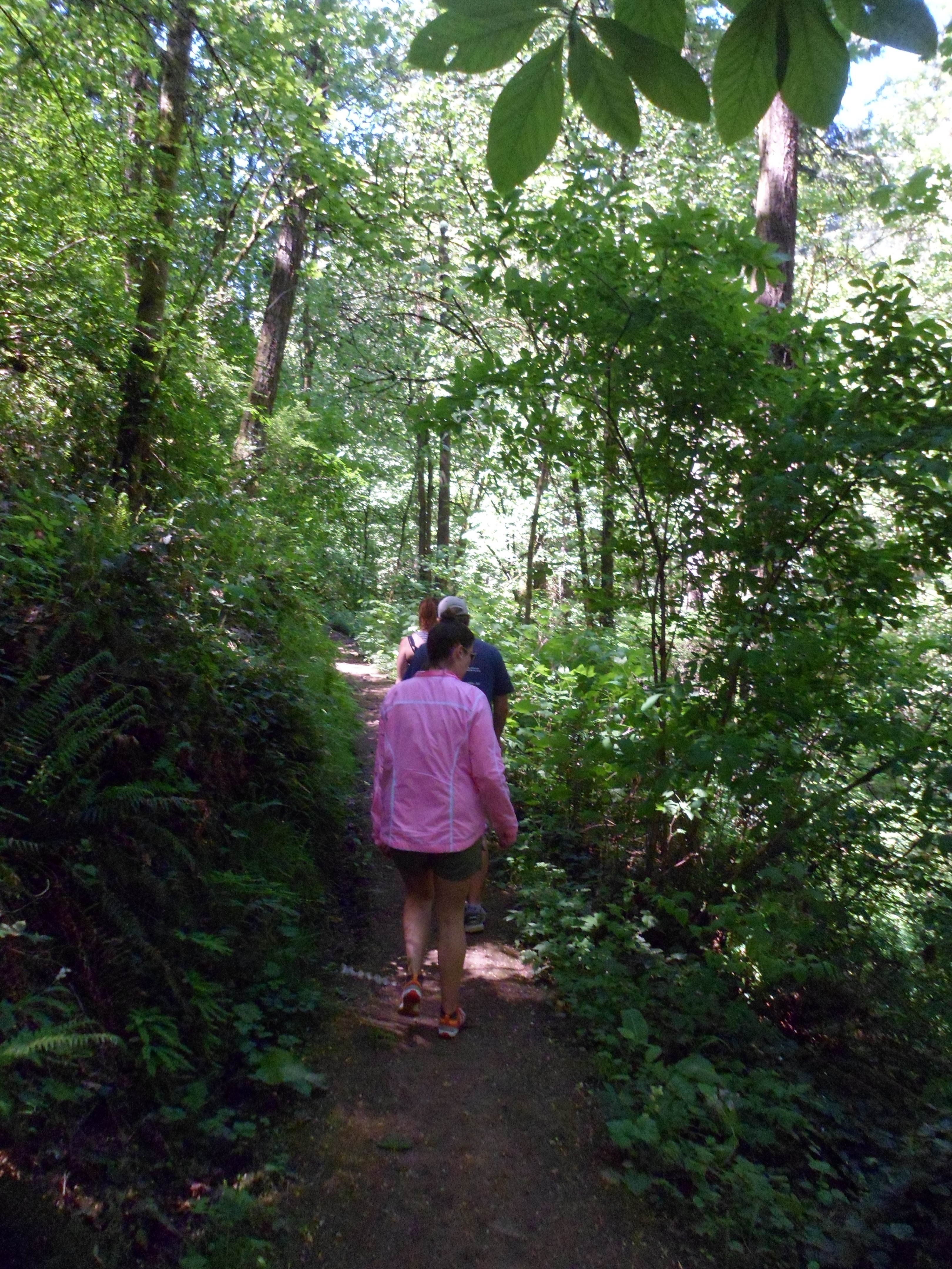
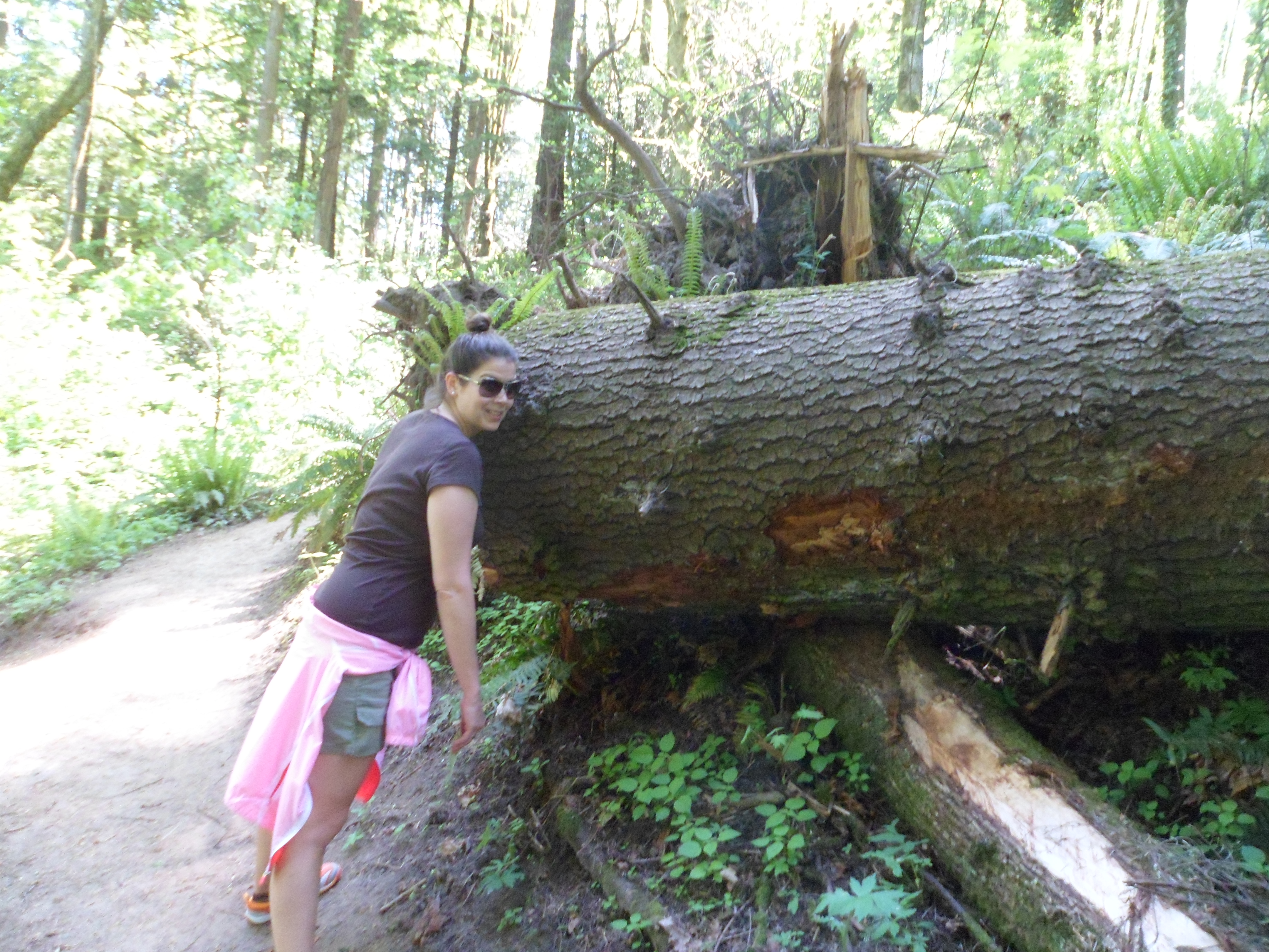
Council Crest 5/4/13
May 4th, 2013
Hike: Marquam Trail to Council Crest, Portland, OR
Weather: Low 80s, sunny, breezy
Hikers: Ian, Court, Greg, Cat
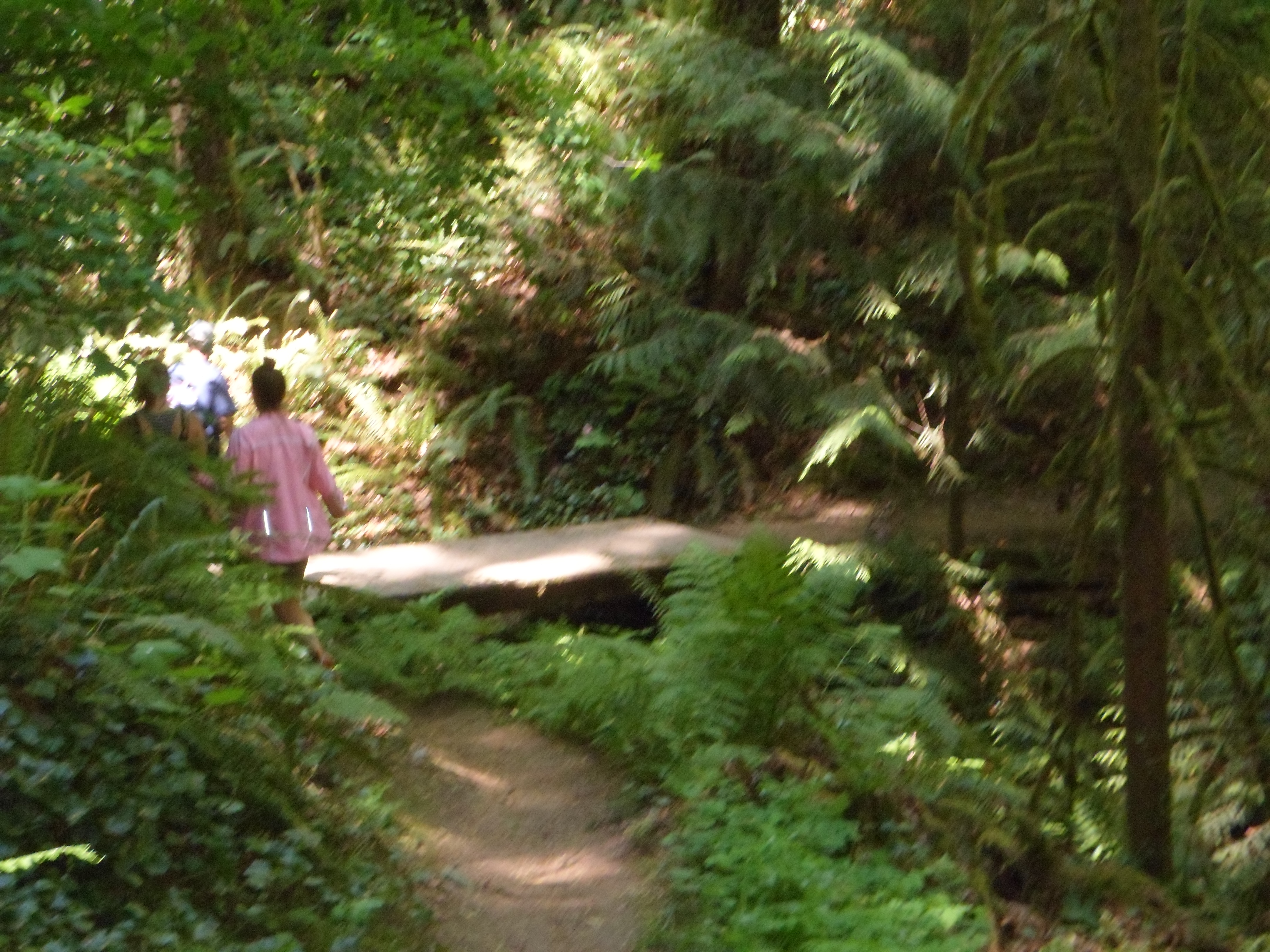
This was Ian and Court’s second trip to Marquam, Greg and Cat’s first. Trail wasn’t too crowded and a bit drier than the first time. Breeze felt great under the shade of the trees. We made the roughly 3.2 mile loop in about 2 hours.
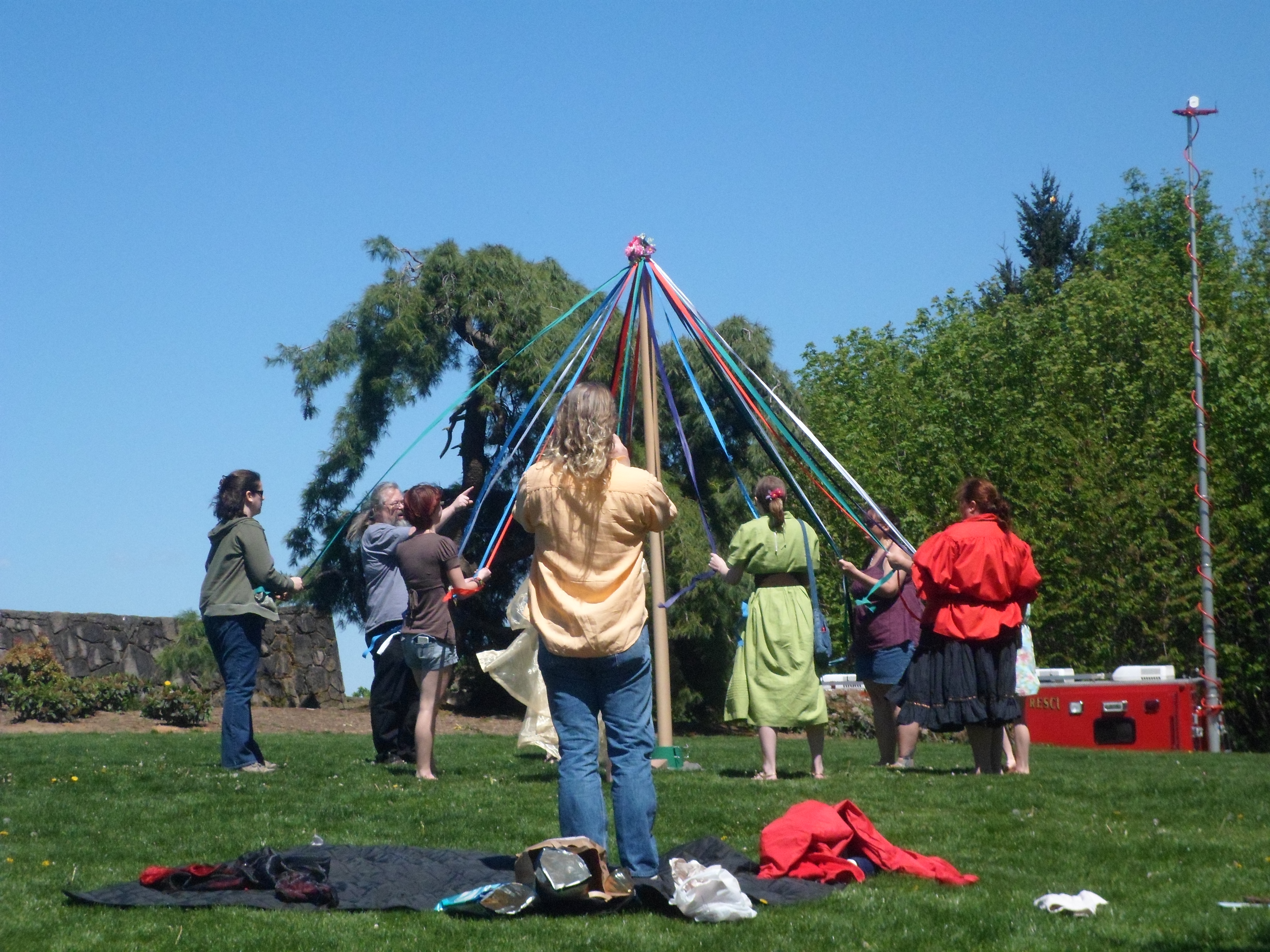
The summit was gorgeous. There was a group of people wrapping a Maypole at the top. We had clear views of Mt. Hood and Mt. Adams (St. Helens too, I think). On the way back down we saw a black snake on the trail, but it got away before we could identify it. Ian also broke in his new hiking shoes on this trail.


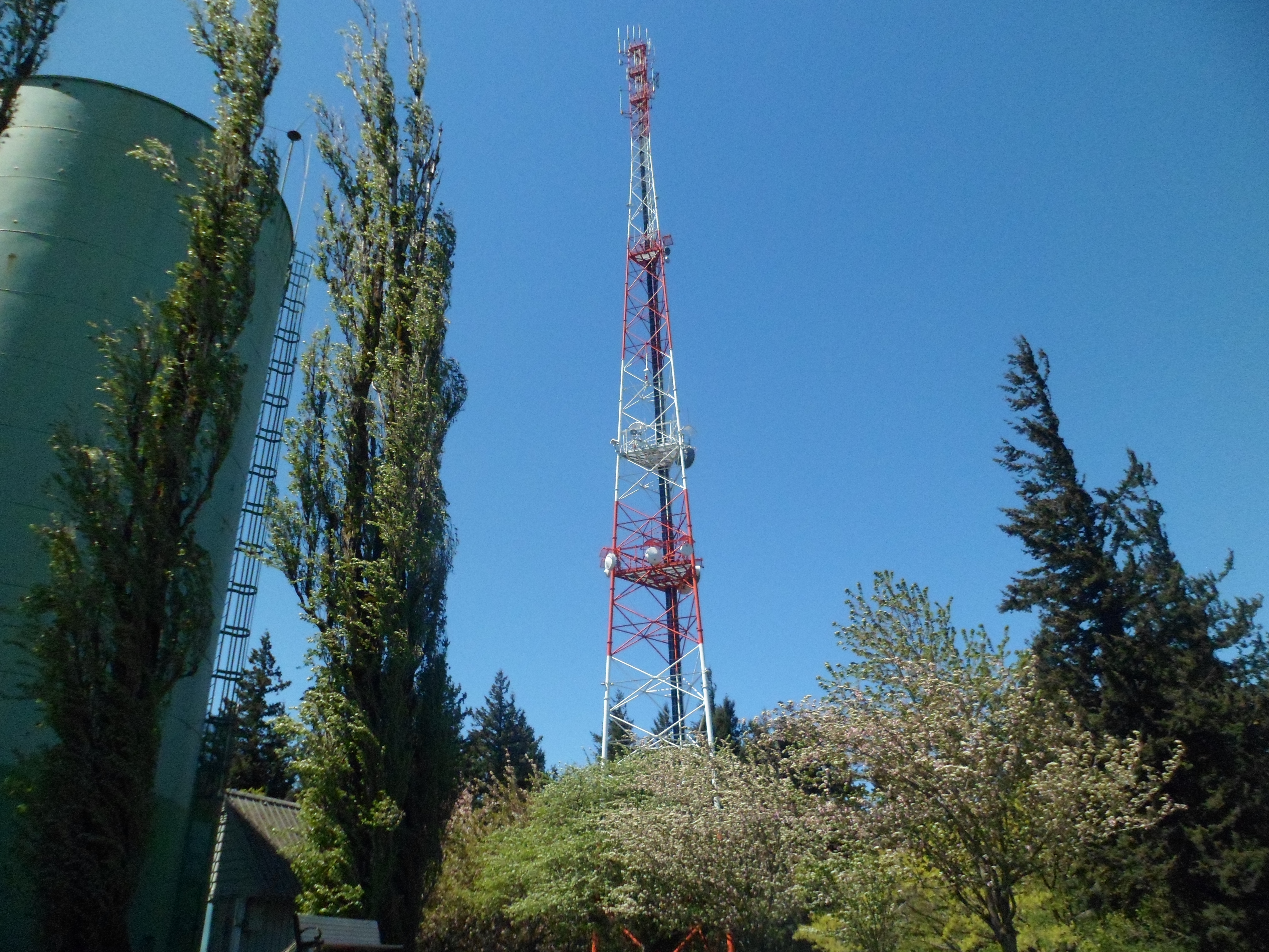
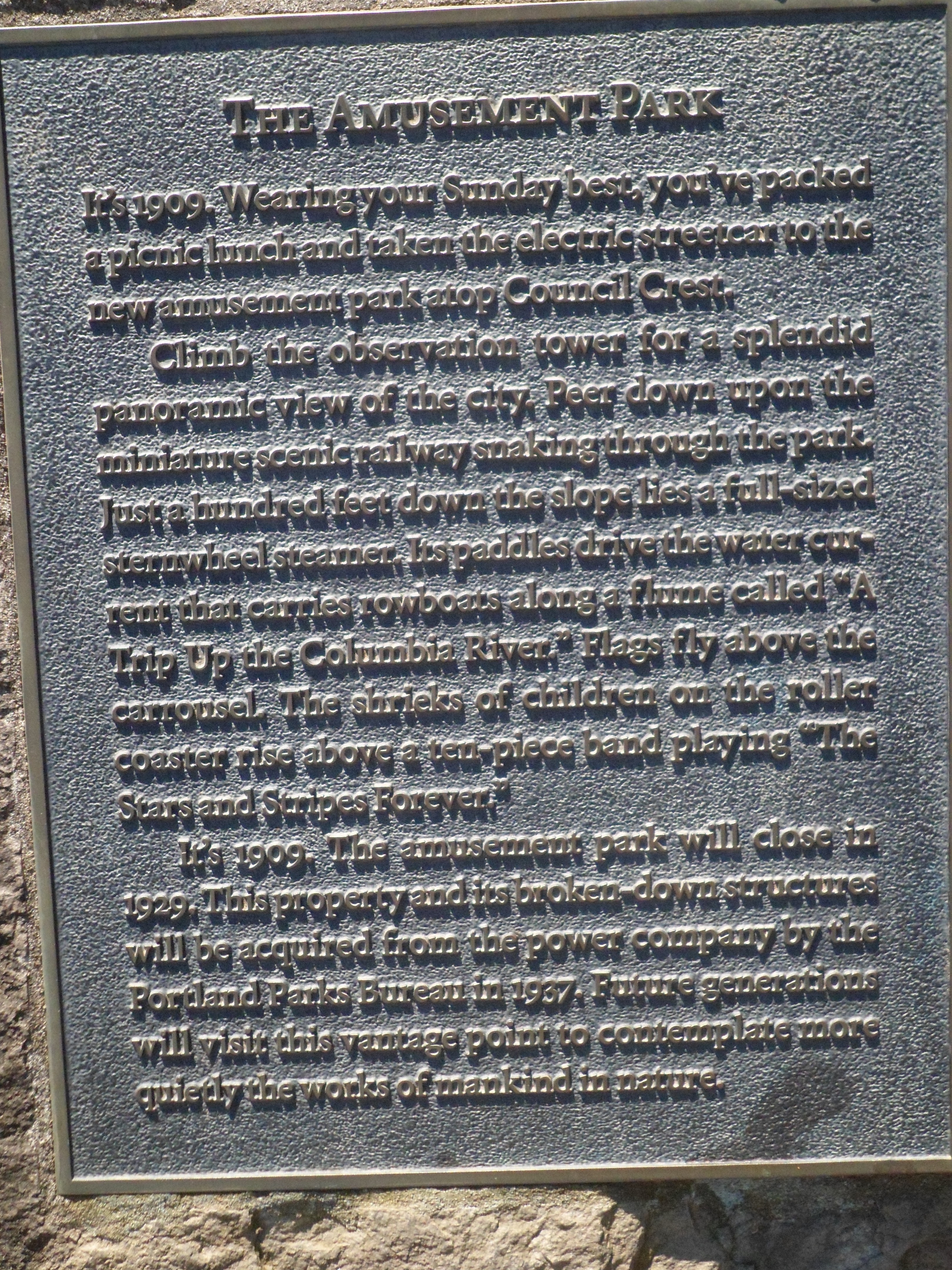
“At 1,071 ft above sea level, Council Crest is the highest point in the Tualatin Mountains (West Hills) that run parallel to the Willamette River in Portland.” – Wikipedia
Enchanted Rock 2/23/13
February 23rd, 2013
Hike: Enchanted Rock, Fredericksburg, TX
Weather: clear blue skies, sunny, low-mid 70s
Hikers: Ian, Courtney
Got to the park around 10:15am. Had to wait in line, as cars were backed up onto the main road to get in. Made our own trail up to summit of Little Rock. Steep ascent at the beginning. Main rock too crowded. Court saw a squirrel and we came across a lizard on the way down that blended in perfectly with the granite. Court also got scratched by a cactus spine at some point.
“Enchanted Rock is an enormous pink granite pluton rock formation located in the Llano Uplift approximately 15 miles north of Fredericksburg. The rock rises 425 feet above the surrounding terrain to an elevation of 1,825 feet above sea level. It is the largest such granite formation in the US and was designated a Texas Historic Landmark in 1936. The rock is roughly 1 billion years old, with evidence of human visitation going back at least 11,000 years.” – Wikipedia
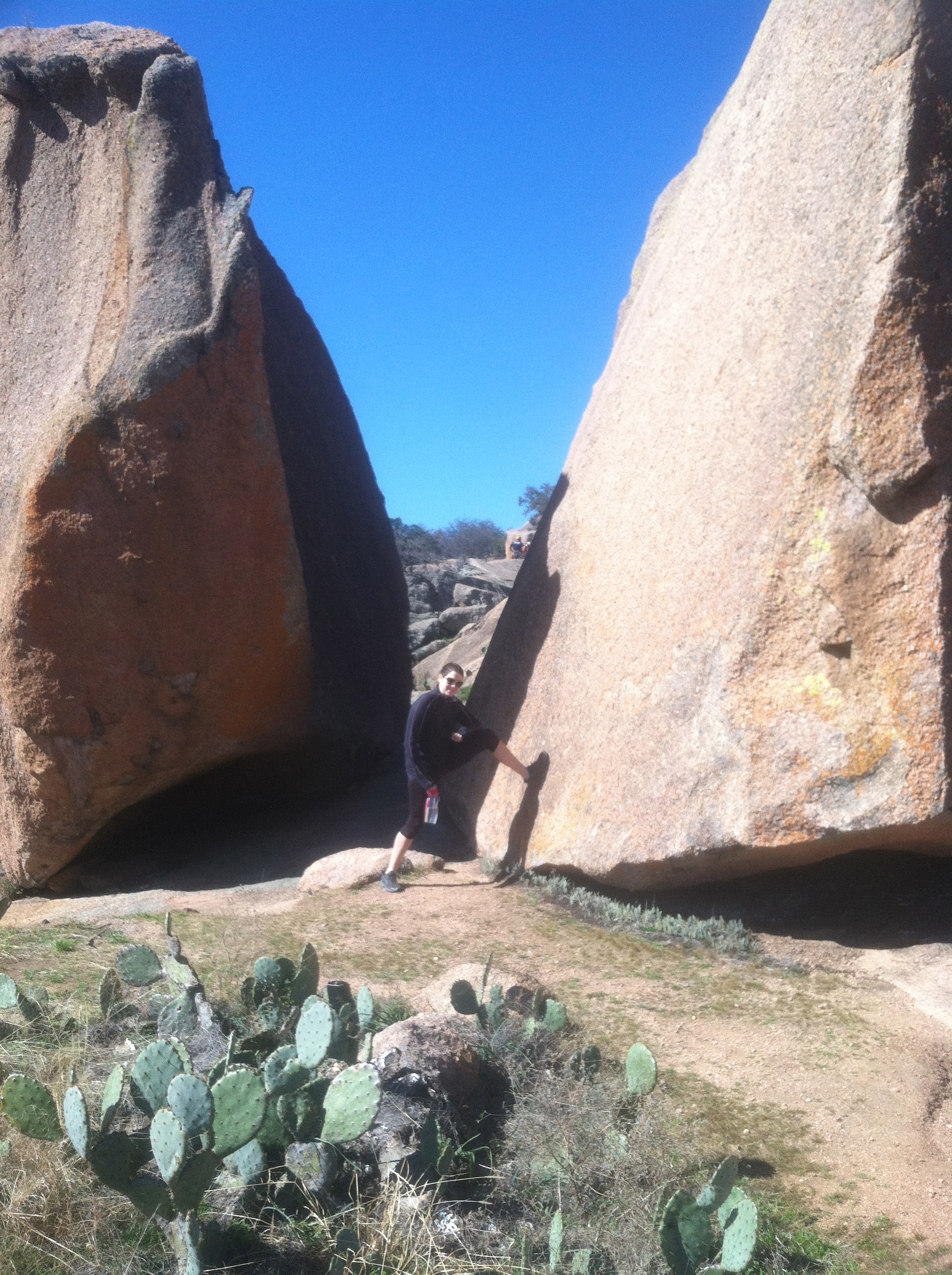


Vegetation on the rock includes lots of grasses, prickly pear cactus and other small shrubs. Lots of lichens as well. We could see for miles around from the top. I forgot my hat, so the sun was a little harsh. Overall, a pretty short hike, but good exercise and Courtney’s first time to the rock.
See map: http://www.tpwd.state.tx.us/publications/pwdpubs/media/park_maps/pwd_mp_p4507_119c.pdf
Blast Off
So I’ve decided to start a blog to get a digital record of our hiking adventures. I’ve been keeping my hiking log on paper, but will now transcribe them here, along with pictures. I’m not looking for followers necessarily, but really I just want a place to store our adventures. Plus, my handwriting is getting continually worse as time progresses.
I’ll see how this goes and maybe eventually I’ll get deeper into it and post some videos, gear lists, and other stories from the trail.
Ian

Recent Comments